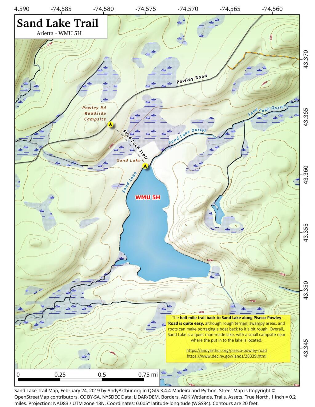
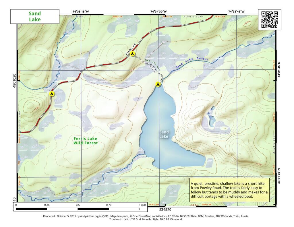
The Sand Lake Trail is about a half mile long but can be a somewhat difficult portage at the end due to the swampy, narrow trail. But it's a nice little wilderness lake, with a campsite, not too remote off of Piseco-Powley Road. There also is a designated roadside campsite at the trailhead.
Sand Lake is a 1/3rd of a mile away from Piseco Powley Road. The trail is somewhat overgrown and marshy, so a paddle cart won't work for well for carrying a boat back here, but with another person you should be able to get back here.
I was looking east from Wolf Hill noticing a bunch of denuded land. I thought it was a farm field but I think it's the West Sand Lake Gravel Mine.
If you want to do something fun, you can trace how the Alder Pond Dam diverts water from the upper Black River lakes (such as North Lake, Woodhull Lake, South Lake, Sand Lake) into the Black River Canal, the upper part which is still used for moving water to the Lansing Kill which dumps into the Mohawk River and Delta Reservoir in Westernville.
As you head north and west of Cross Lake in Cayuga County, drumlins made from centuries of wind blowing on sand dominate the landscape which is covered by farms and apple orchards.
Situated in northern Ohio on the shores of Lake Erie, Sandusky is located roughly midway between Toledo (45 miles (72 km) west) and Cleveland (50 miles (80 km) east). https://en.wikipedia.org/wiki/Sandusky,_Ohio