Search Results for: "Map:" Rock Lake
Rockwood Lake
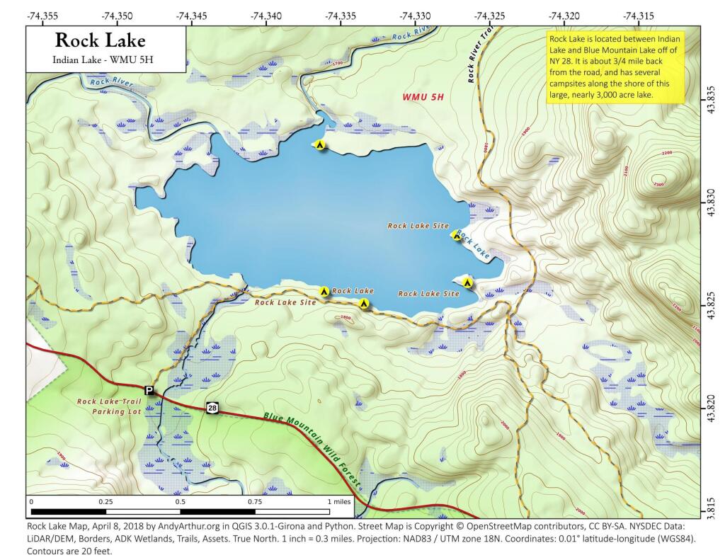
Rock Lake
Pulpit Rock
This 1,603-acre state reforestation area consists mostly of a granite plateau ranging in character from bare rock outcrops to relatively fertile valleys. A sheer stone cliff over 100 feet high rises from Payne Lake to overlook the Payne Lake Public Fishing Access Site to the east. This state forest was named for a unique nearby rock formation that once served as an outdoor podium from which traveling clergy preached to the local pioneers.
https://www.dec.ny.gov/lands/8013.html
http://lion-tales.blogspot.com/2012/07/northern-new-york-pulpit-rock.html
2016 Land Use in the Finger Lakes
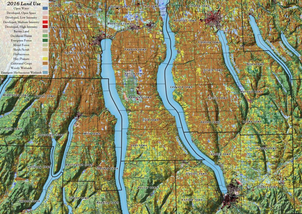
Yesterday, I downloaded the National Land Cover Data for 2016. I had some older data but I hadn't updated it in years, but soon realized I could make some very interesting maps and graphics with this data. The Finger Lakes are kind of interesting to look at in particular as you can see the Northern Finger Lakes have a lot of cultivated lands -- mostly corn and soybeans -- for feeding dairy cattle, while the more upland and rocky lands in the Southern Finger Lakes are either wooded or pasture.
Dexter Lake – Spectacle Lake – Waters Millpond
Yesterday, I hiked back to Dexter Lake, Spectacle Lake and Water Millspond in Ferris Lake Wild Forest, off of Hall Road and Seeley Road (which is off of Piseco-Powley Road). I could have driven Hall Road, it's not rough and there was plenty of parking as I was the only one there, but I often prefer to walk remote mountain roads to look at wildlife without having to worry about tripping on rocks.
It was about 15 miles round trip, via Hall Road - Dexter Lake Trail - Burnt Vly Trail - Water Millpond Loop, but it was well worth it as it was remote wilderness with many scenic views, including North Creek Falls which is rarely visited. I didn't see a single other person hiking for 5 hours.
Valcour Island
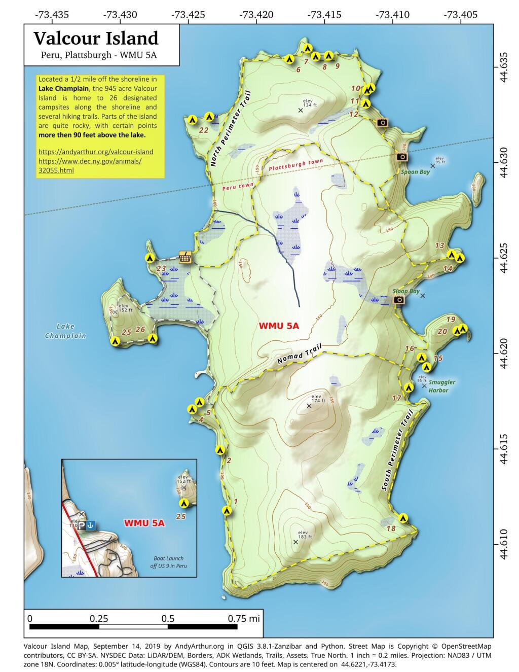
Located a 1/2 mile off the shoreline in Lake Champlain, the 945 acre Valcour Island is home to 26 designated campsites along the shoreline and several hiking trails. Parts of the island are quite rocky, with certain points more then 90 feet above the lake.
For more about Valcour Island, see the DEC website: https://www.dec.ny.gov/animals/32055.html