Search Results for: "Map:" Lake Placid
Moose Island in Lake Placid
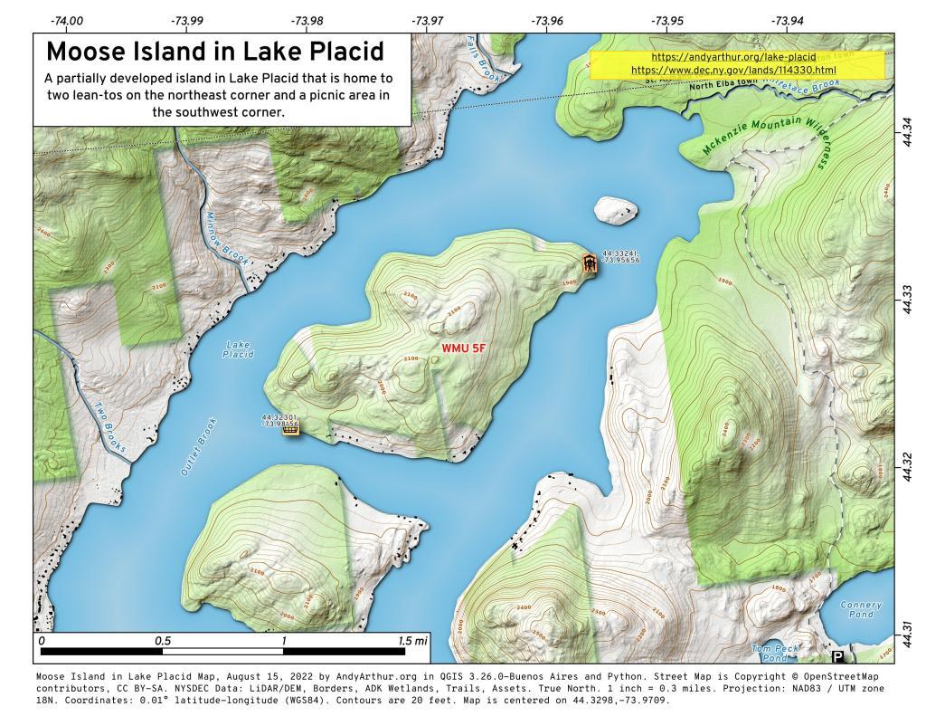
Moose Island in Lake Placid
This interactive map shows Moose Island in Lake Placid along with Lean-Tos and Picnic Area.
Moose Island Lean-Tos (northeast): 44.33241, -73.95656
Moose Island Picnic Area (southwest): 44.32301, -73.98156
Note: Most of the southern shore of this island is developed, private cabins and properties.
Northville To West Stoney Creek – NPT
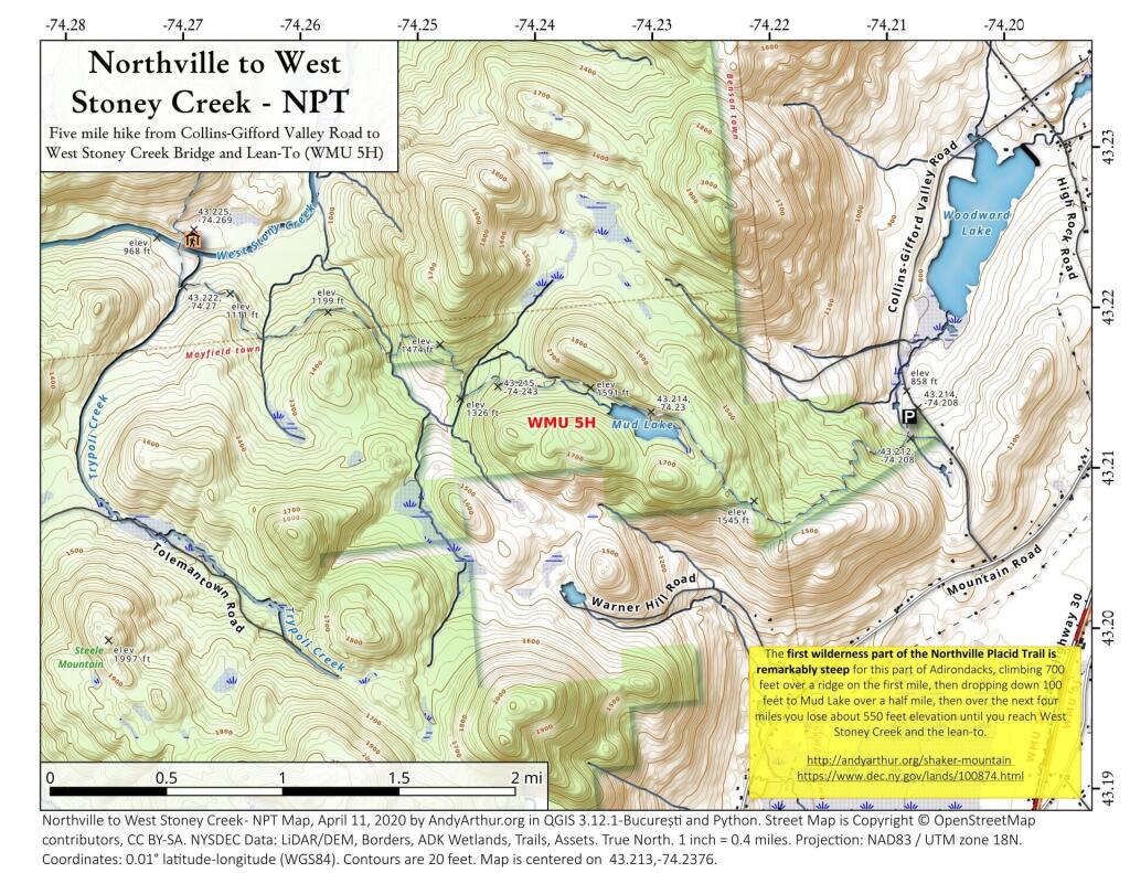
The first wilderness part of the Northville Placid Trail is remarkably steep for this part of Adirondacks, climbing 700 feet over a ridge on the first mile, then dropping down 100 feet to Mud Lake over a half mile, then over the next four miles you lose about 550 feet elevation until you reach West Stoney Creek and the lean-to.
https://andyarthur.org/shaker-mountain
https://www.dec.ny.gov/lands/100874.html
Big Eddy Trail
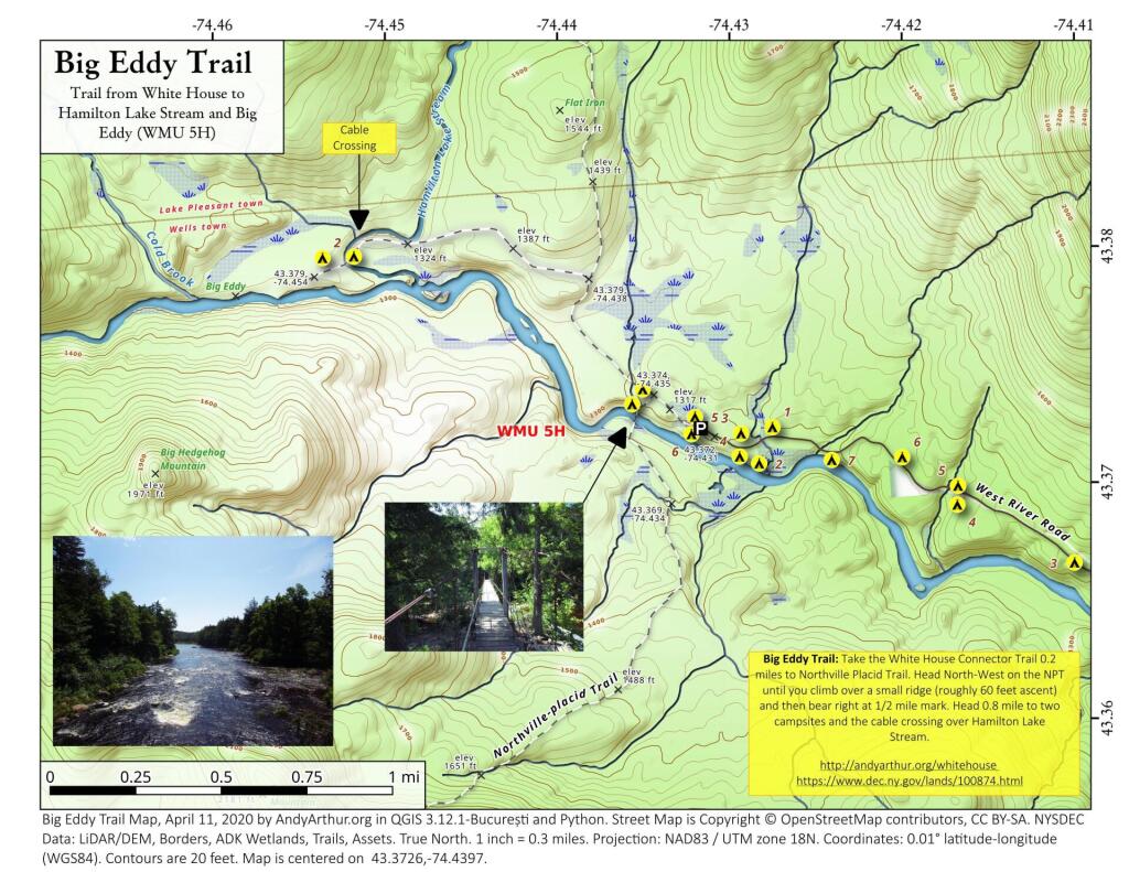
Big Eddy Trail: Take the White House Connector Trail 0.2 miles to Northville Placid Trail. Head North-West on the NPT until you climb over a small ridge (roughly 60 feet ascent) and then bear right at 1/2 mile mark. Head 0.8 mile to two campsites and the cable crossing over Hamilton Lake Stream.
https://andyarthur.org/whitehouse
https://www.dec.ny.gov/lands/100874.html
Long Lake – NPT
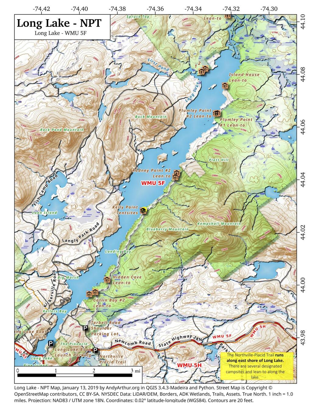
This map shows the North County - Lake Placid Trail along the shores of the northern section of Long Lake, including the lean-tos and designated campsites along the shorelines.
Traffic Counts – Saranac Lake
Traffic is heaviest going between Saranac Lake and Lake Placid, along with heading up to the hospital in Lake Colby. While traffic is delayed with the lights downtown, there is actually less volume downtown as people often take side streets.