Search Results for: "Map:" Black Mountain
Black Mountain
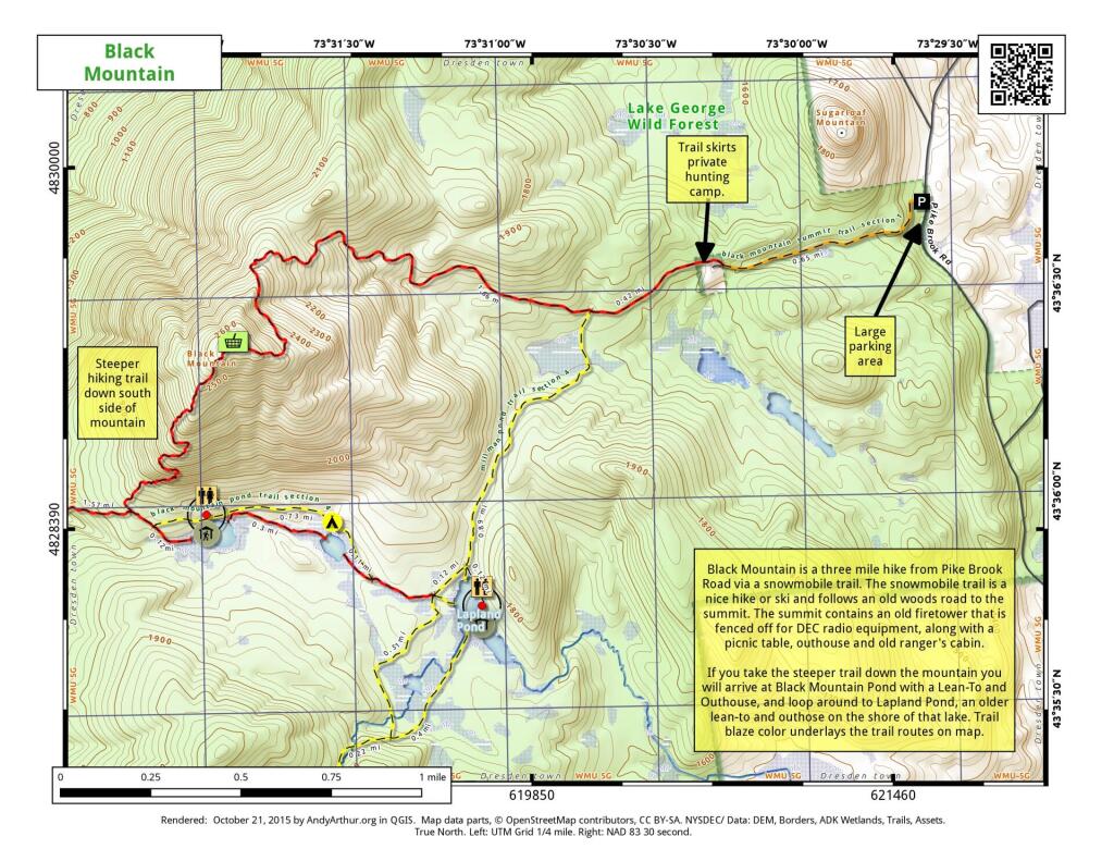
Black Mountain is a three mile hike from Pike Brook Road via a snowmobile trail. The snowmobile trail is a nice hike or ski and follows an old woods road to the summit. The summit contains an old firetower this is fenced off for DEC radio equipment, along with a picnic table, outhouse, and old ranger's cabin.
If you take the steeper trail down the mountain you will arrive at Black Mountain Pond with a Lean-To and Outhouse, and loop around to Lapland Pond, an older lean-to and outhouse on the shore of the lake. Trail blaze color underlays the trail routes on the map.
Black Mountain Trail
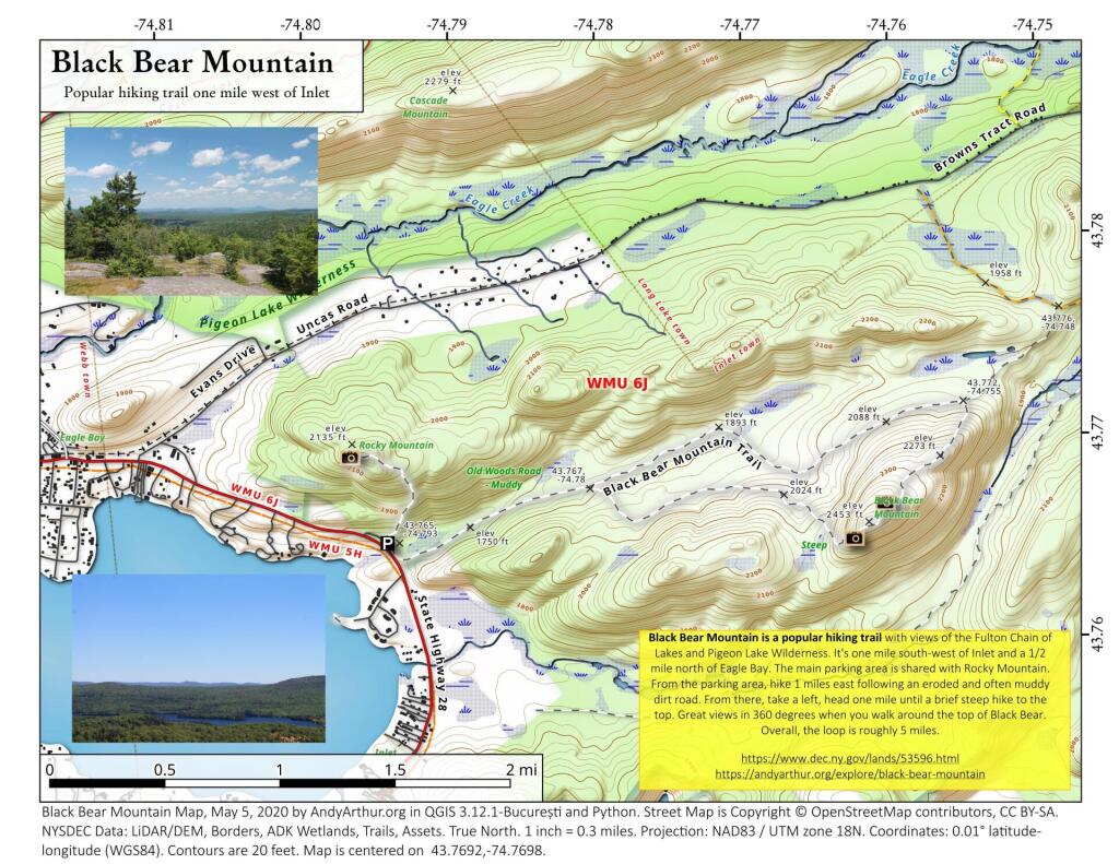
Black Bear Mountain
43.76917976445229,-74.7697504393449
Black Bear Mountain is a popular hiking trail with views of the Fulton Chain of Lakes and Pigeon Lake Wilderness. It's one mile south-west of Inlet and a 1/2 mile north of Eagle Bay. The main parking area is shared with Rocky Mountain. From the parking area, hike 1 miles east following an eroded and often muddy dirt road. From there, take a left, head one mile until a brief steep hike to the top. Great views in 360 degrees when you walk around the top of Black Bear. Overall, the loop is roughly 5 miles.
https://www.dec.ny.gov/lands/53596.html
https://andyarthur.org/explore/black-bear-mountain
Black Mountain
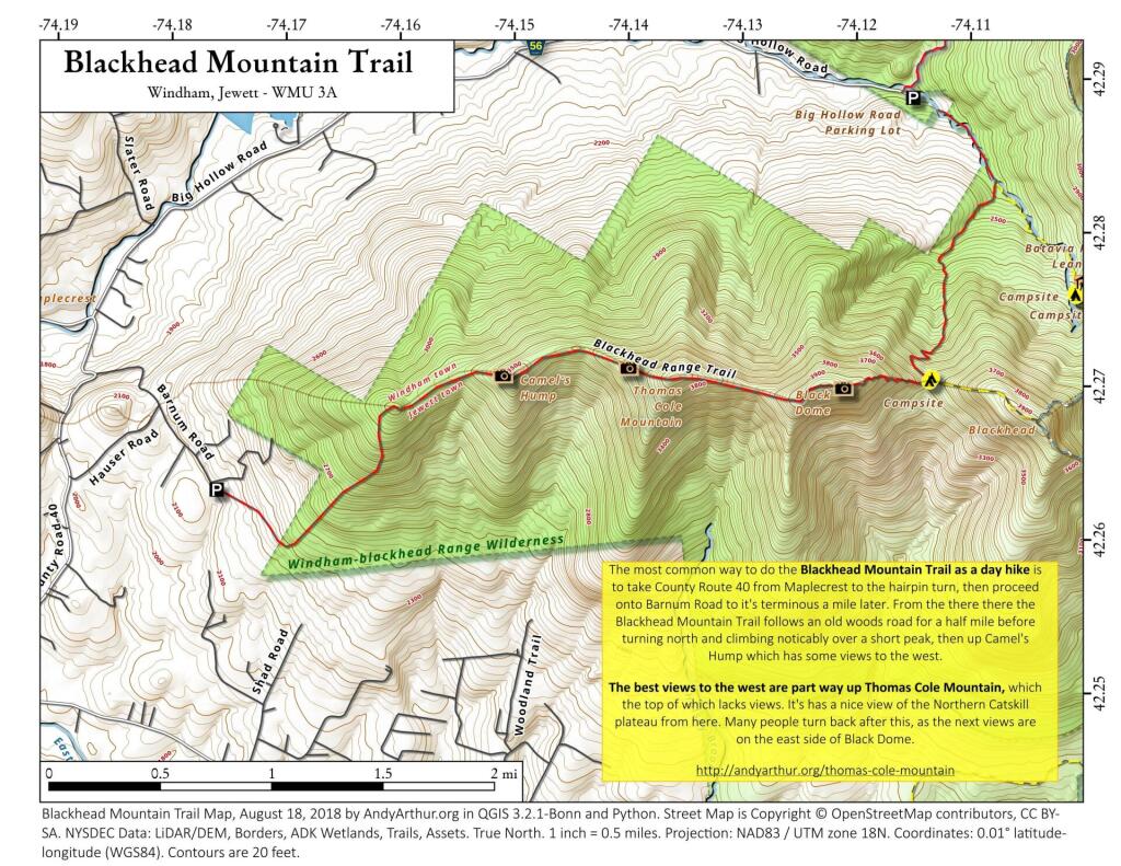
Blackhead Mountain Trail
Black Mountain Loop
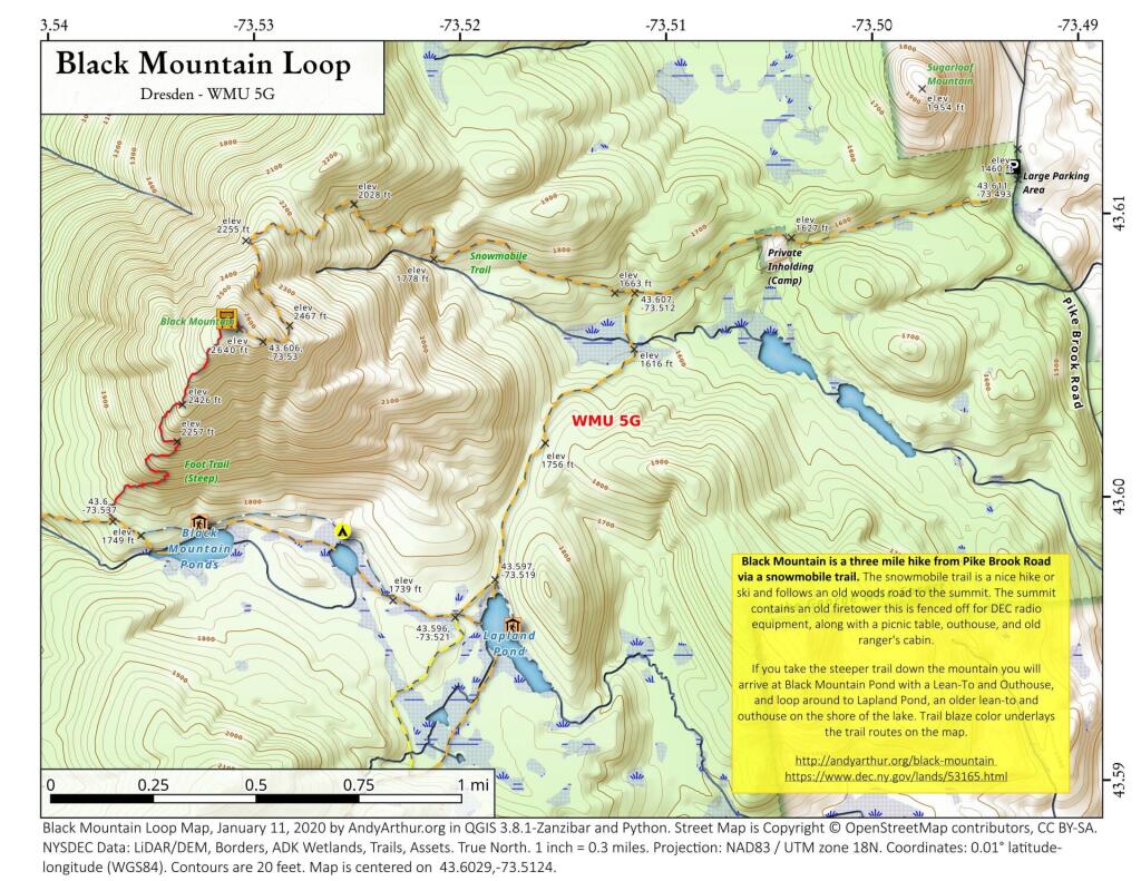
Black Mountain is a three mile hike from Pike Brook Road via a snowmobile trail. The snowmobile trail is a nice hike or ski and follows an old woods road to the summit. The summit contains an old firetower this is fenced off for DEC radio equipment, along with a picnic table, outhouse, and old ranger's cabin.
If you take the steeper trail down the mountain you will arrive at Black Mountain Pond with a Lean-To and Outhouse, and loop around to Lapland Pond, an older lean-to and outhouse on the shore of the lake. Trail blaze color underlays the trail routes on the map.