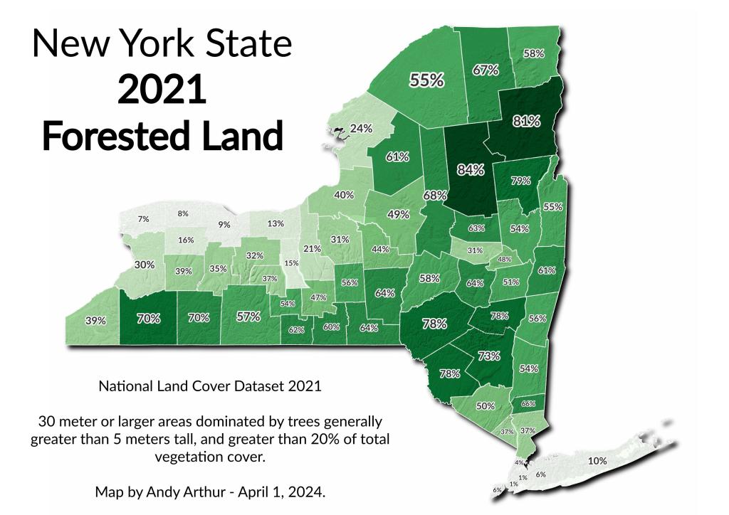
Percent of Land Forested – New York State Counties in 2021
A New York State take on a popular map that has been found on the inter-webs lately.
A New York State take on a popular map that has been found on the inter-webs lately.
Montgomery County is a classic example of an MAUP ... it's almost drawn to capture all of the agricultural areas along the Mohawk Valley without the hills and poorer soils of surrounding counties. Probably this was done historically not by accident.
The Iroquois National Wildlife Refuge is a wildlife refuge in Genesee and Orleans counties in western New York. The refuge is located between the cities of Buffalo and Rochester and is operated by the United States Fish and Wildlife Service.
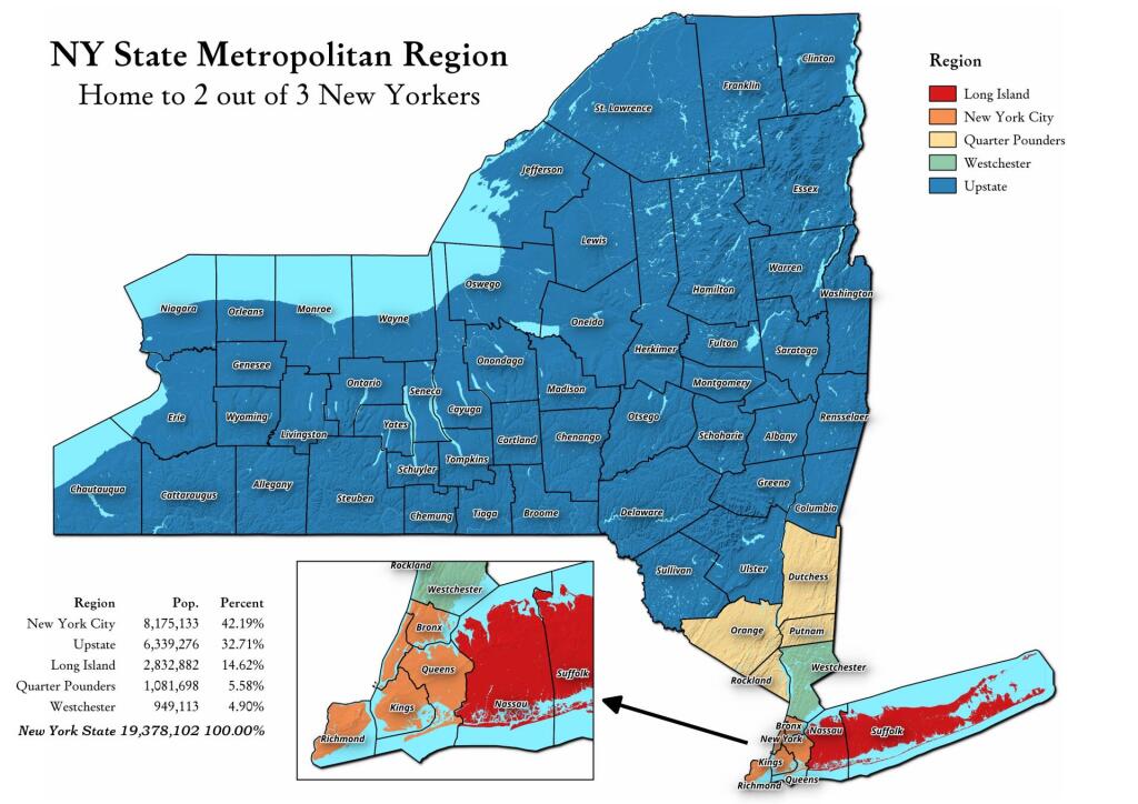
Somebody was asking about a map of the Quarter Pounders, along with Long Island, Westchester, and New York City -- versus Upstate map. This map shows this regions, along with the respective population in each region. The Quarter Pounders -- Dutchess, Orange, Putnam and Rockland Counties have this name, as they each have a quarter weighted vote on the MTA Board.
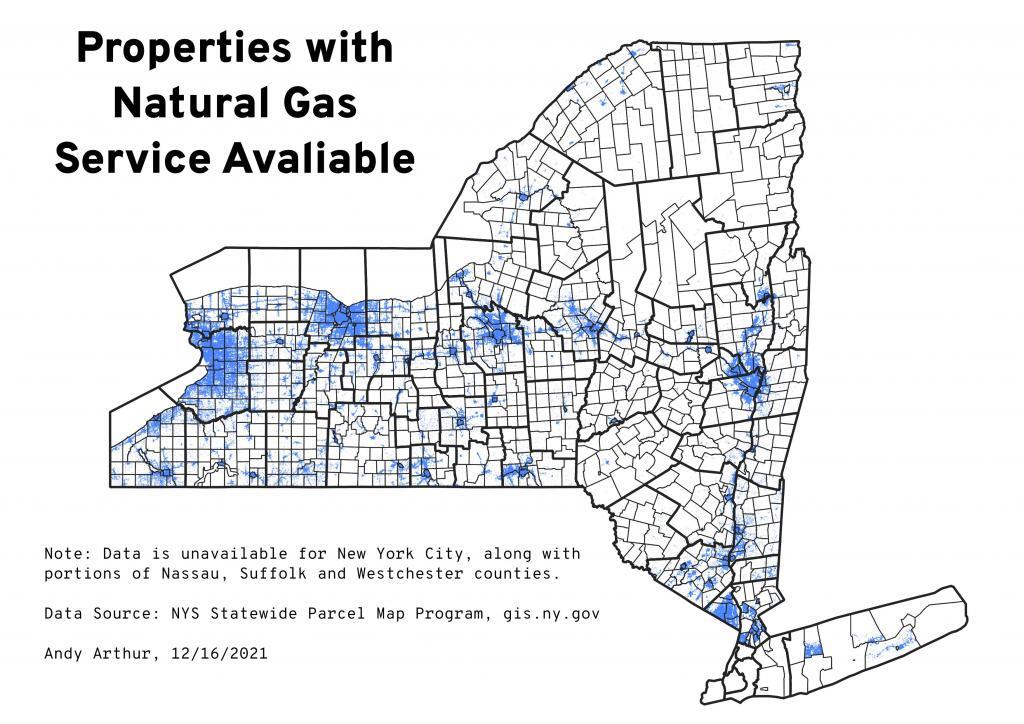
Note: Data is unavailable for New York City, along with portions of Nassau, Suffolk and Westchester counties.
Data Source: NYS Statewide Parcel Map Program, gis.ny.gov
A lot of people think cows when they think of the Green Mountain State. Vermont often celebrates it's rural heritage and agricultural is a big part of land use along Lake Champlain but the same can't be said about the Northeast Kingdom of Vermont. While there are certainly farms up that way, there is a lot less crop growing then some of the real agricultural areas of New York.