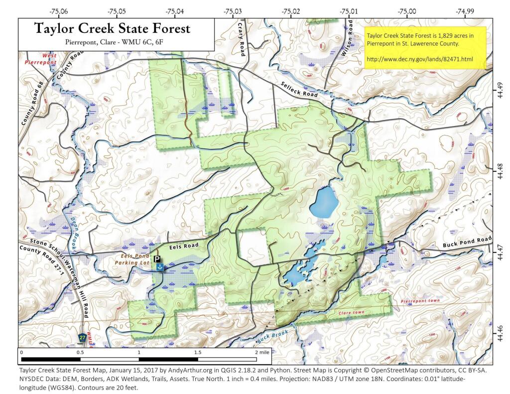
Map: Taylor Creek State Forest
Download a High Resolution JPEG Image of the Taylor Creek State Forest or an Adobe Acrobat Printable PDF of the Taylor Creek State Forest.

Bookmark my free Interactive GPS Map for your phone:
https://andyarthur.org/ny
... shows your location as a blue dot in relationship to campsites, trails, state land. This online map requires cell service, won't work in remote country, so also bring a paper map.
Free Download of New & Historical USGS 1:24k Topograpic Maps
Interactive maps with backcountry and roadside camping: New York, Pennsylvania, West Virginia & Vermont. List of NYS DEC Lean-Tos and Firetowers.
Google Spreadsheet with Roadside, Primitive and Pay Campsites
More about Taylor Creek State Forest...
Taylor Creek State Forest is composed of 1,860 acres located in the town of Pierrepont in central St. Lawrence County.
There are currently no developed trails on this state forest.
Camping - There are no designated camp sites on this property. Back Country Camping is allowed. Camping for more than three nights in a group of ten or more requires a permit from a Forest Ranger. Camping is prohibited within 150 feet of water, roads or trail.
Hunting and trapping are permitted on the property in accordance with all game regulations, unless otherwise posted. Fishing is available on Eels Pond, which is a short walk south from Eels Road.
This property provides large undeveloped areas suited for hunting, hiking and nature viewing.
Topography varies with upland areas supporting a mixture of northern hardwood, hemlock, and white pine forests. Pine and spruce plantations were established on what were formerly farm fields and pastures. Flatter ground supports open wetlands and shrub swamps, which gradually transition to swamp hardwoods and white cedar in seasonal flooded areas.
http://www.dec.ny.gov/lands/82471.html
... photos, maps and other content from from St. Lawrence County.