Search Results for: photo campsite 80

Below is a list of lean-tos, campsites, parking areas, and other assets along the Northville – Placid Trail πŸ•οΈ

Link to anΒ  Interactive Map of the Northville Placid Trail.

Type Name Description Coordinates
Hand Launch Ceder River Flow Boat Ramp Hand Carry Launch, Ramp 43.725826369700904, -74.47289916126694
Lean-To Beaver Pond (Aka Cedar Lakes Lean-To #2) Β  43.625969396804386, -74.54927150370021
Lean-To Carry Lean-To Β  43.67874488347091, -74.49549821879448
Lean-To Catlin Bay #1 Lean-To Β  43.99801269269887, -74.39278456108421
Lean-To Cedar Lakes #1 Lean-To Β  43.628125665037935, -74.54047323992656
Lean-To Cold River #2 Lean-To Β  44.14251664317184, -74.13035824291548
Lean-To Cold River #3 Lean-To Β  44.091459278051204, -74.25764175084498
Lean-To Cold River #4 Lean-To Β  44.09139025333258, -74.25573480252505
Lean-To Cold River Lean-To #1 Lean-To Β  44.14272737628489, -74.12984021065587
Lean-To Duck Hole #1 Lean-To Β  44.14162687400988, -74.10693734676616
Lean-To Duck Hole #2 Lean-To Β  44.14167686466829, -74.10654354672256
Lean-To Hamilton Lake Stream #1 Lean-To Β  43.39741359517532, -74.45529759002217
Lean-To Hidden Cove Lean-To Β  44.00265528819394, -74.38648026325164
Lean-To Kelly Point #1 Lean-To Β  44.02880023617087, -74.36730798599064
Lean-To Kelly Point #2 Lean-To Β  44.02870256717196, -74.36713034867948
Lean-To Moose Pond Lean-To Β  44.182843382402666, -74.07364102375995
Lean-To Mud Lake Lean-To Β  43.342671073157994, -74.45629078563864
Lean-To O’neill Flow Lean-To Β  43.875596840936154, -74.36642623697053
Lean-To Ouluska Pass Brook Lean-To Β  44.120221281603584, -74.18744717390932
Lean-To Plumley Point #2 Lean-To Β  44.06559891610762, -74.32761224546002
Lean-To Rodney Point #1 Lean-To Β  44.04140938489936, -74.35014909639557
Lean-To Rodney Point #2 Lean-To Β  44.042976745412616, -74.34933464753136
Lean-To Seward Lean-To Β  44.106244137686204, -74.2091536427719
Lean-To Silver Lake Lean-To Β  43.29193545679836, -74.4237351676776
Lean-To South Lake Lean-To Β  43.58724480971, -74.62157883837274
Lean-To Spruce Lake #1 Lean-To Β  43.52728411257782, -74.6099246975027
Lean-To Spruce Lake #2 Lean-To Β  43.53463062983387, -74.60808580306896
Lean-To Spruce Lake #3 Lean-To Β  43.53712972792447, -74.60820962802477
Lean-To Stephens Pond Lean-To Β  43.818673668554965, -74.42052487172707
Lean-To Tirrel Pond North Lean-To Β  43.887344477557306, -74.37880062606054
Lean-To West Canada Creek Lean-To Β  43.58698761405157, -74.61399797100106
Lean-To West Lake #1 Lean-To Β  43.59316222884976, -74.62688668431306
Lean-To West Stony Creek Lean-To Β  43.22474428954461, -74.26933345717664
Paved Parking Lot Lake Durant Northville Placid Trail Parking Lot Paved, 12 Vehicle Capacity 43.84219550506574, -74.3862742856788
Paved Parking Lot Northville Lake Placid Trail Parking Lot Paved, Good Condition 43.84213270187873, -74.38656792328511
Primitive Tent Site Canary Pond Campsite Β  43.30513256312245, -74.4472062440692
Primitive Tent Site Cedar Lake Dam 1 Β  43.62894580965635, -74.53639939387939
Primitive Tent Site Cedar Lake Dam Tentsite Β  43.62937624507422, -74.53679785644344
Primitive Tent Site Cedar River Flow Tentsite Β  43.70292480315104, -74.48713041165333
Primitive Tent Site Fall Stream Tentsites Β  43.49661052800474, -74.53713112743992
Primitive Tent Site Jessup River Tentsites Β  43.51246207852797, -74.57229710138834
Primitive Tent Site Kelly Point Tentsites Β  44.02910364406153, -74.36670207204214
Primitive Tent Site Moose Pond Tentsites Β  44.18274441156179, -74.07408240028583
Primitive Tent Site Moose River Plains Campsite 01 Live 43.72667672123972, -74.47410026642402
Primitive Tent Site Moose River Plains Campsite 02 Live 43.72665150100841, -74.47331107300782
Primitive Tent Site Moose River Plains Campsite 03 Live 43.725959512295866, -74.47389996564202
Primitive Tent Site Moose River Plains Campsite 04 Live 43.726067692208126, -74.47423264719026
Primitive Tent Site Moose River Plains Campsite 05 Live 43.725563790898704, -74.47417512282912
Primitive Tent Site Moose River Plains Campsite 06 Live 43.72522313374867, -74.47458303719159
Primitive Tent Site Mud Lake Tentsites Β  43.59647433847274, -74.61354076182431
Primitive Tent Site O’neill Flow Tentsite Β  43.87567135918534, -74.3666467203306
Primitive Tent Site Rock Lake Campsite Β  43.265591839994535, -74.41543516012669
Primitive Tent Site Salmon River Tentsites Β  43.907925071619914, -74.38530801916977
Primitive Tent Site Shattuck Clearing Tentsites Β  44.08679657756681, -74.26368397541134
Primitive Tent Site Silver Lake Tent Site Β  43.29112770008321, -74.4240469986026
Primitive Tent Site Spruce Lake Tentsite Β  43.53695545329776, -74.60818912022354
Primitive Tent Site Tirrell Pond North Tentsites Β  43.88594343639596, -74.37834897628142
Primitive Tent Site Trailside Campsite Β  43.2716741112023, -74.43107546264162
Primitive Tent Site Wanika Falls Tentsites Β  44.19944690357389, -74.05663862305364
Primitive Tent Site West Lake Former Caretaker Clearing Tentsites Β  43.59389874347195, -74.62560220247346
Primitive Tent Site Whitehouse Campsite Β  43.373430193527696, -74.43578942968477
Primitive Tent Site Whitehouse Campsite Β  43.37406302094423, -74.43516794694158
Primitive Tent Site Woods Lake Campsite #2 Fire Pit, Water Front Campsite 43.25071034607129, -74.31177480398298
Primitive Tent Site Woods Lake Campsite #3 Fire Ring, Water Front Tentsite, Scenic View 43.250888826581715, -74.31104030228295
Primitive Tent Site Woods Lake Campsite #4 Fire Place, Water Front Campsite, Nice View 43.251811433787196, -74.3092782205918
Unpaved Parking Lot Benson Road Parking Area 8 Vehicle Capacity 43.24745928673895, -74.31187044250609
Unpaved Parking Lot Chubb River Bridge Β  44.2628824981147, -74.01364844250504
Unpaved Parking Lot Moose River Recrieation Area Northville-Placid And Cedar River Trails 43.726457025366315, -74.47386984656715
Unpaved Parking Lot Norhtville Placid Parking-Haskells Rd Β  43.45841038153893, -74.52201705350714
Unpaved Parking Lot Northville Placid Trail Parking Area 6 Car Interior Parking Area 43.21330828950083, -74.2083824784703
Unpaved Parking Lot Northville Placid Trail Route 28n Parking Lot Β  43.97584466308438, -74.39296138679799
Unpaved Parking Lot Tarbell Road Shoulder Parking Lot Β  43.984346733793245, -74.39813014848872
Unpaved Parking Lot Wakely Dam Β  43.72640808237045, -74.47425964611213
Unpaved Parking Lot Wakely Mountain Trailhead Parking Lot 1250 Sq Feet 43.732197733217824, -74.47253968128065
Unpaved Parking Lot Wakely Pond Accessible Fishing Dock Β  43.737643556916666, -74.46542853470272
Unpaved Parking Lot Wakely Pond Accessible Launch Β  43.738042554833534, -74.46399313053813

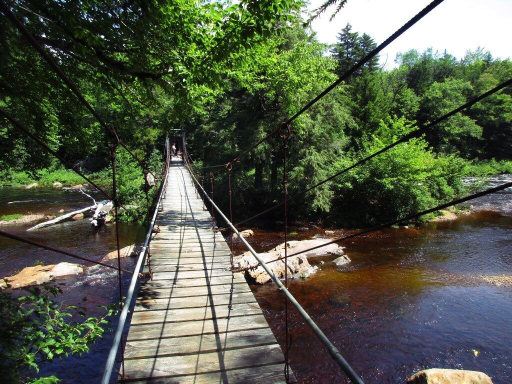
 Whitehouse Suspension Bridge

There are 80 designated campsites in Cattaraugus County in following state forests

There are 80 designated campsites in Cattaraugus County in following state forests …

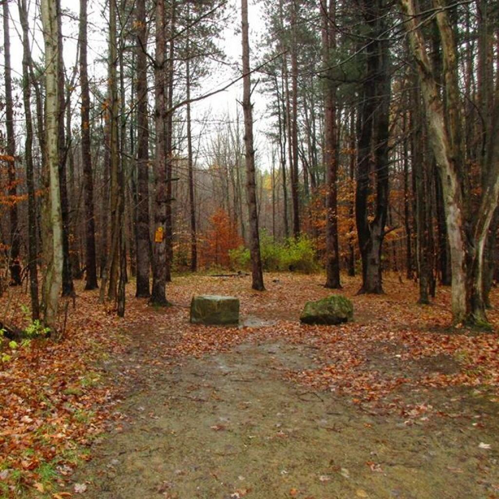
Campsite on West Hill Road

Cattaraugus County State Forest Maps

This listing provides the total number of campsites in each forest along with a link to map and photos of forest.

State Forest Map Number of Campsites
Boyce Hill State Forest 2
Bryant Hill State Forest 1
Bucktooth State Forest 1
Bush Hill State Forest 10
Cattaraugus State Forest 3
Dobbins Memorial State Forest 3
East Otto State Forest 14
Farmersville State Forest 2
Golden Hill State Forest 4
Mccarty Hill State Forest 4
Nine Mile Creek State Forest 3
Pine Hill State Forest 12
Raecher Hill State Forest 2
Rock City State Forest 11
South Valley State Forest 5
Windfall Creek State Forest 3

Cattaraugus County Campsite Coordinates

Here is a listing of the individual campsites. The road indicates the nearest road, links on state forest go to DEC website for more information, while the location link takes you to ACME Mapper to see the exact location …

Name Road State Forest Location
Flt Lean To Bryant Hill Road Boyce Hill State Forest 42.334031456350395, -78.53288931105153
Primitive Campsite Bryant Hill Road Boyce Hill State Forest 42.33203561607121, -78.52072510644783
Primitive Campsite Fadale Road Bryant Hill State Forest 42.287766301177825, -78.5774157216985
Primitive Campsite West Branch Bucktooth Run Road Bucktooth State Forest 42.205385216534836, -78.80556091590128
Designated Camp Site Bush Hill State Forest Road Bush Hill State Forest 42.37521134312278, -78.3723830068076
Designated Camp Site Bush Hill State Forest Road Bush Hill State Forest 42.375432685587, -78.37003424588094
Designated Camp Site Bush Hill State Forest Road Bush Hill State Forest 42.37844883545774, -78.36321615357782
Designated Camp Site Bush Hill State Forest Road Bush Hill State Forest 42.37834161197144, -78.3603878146659
Designated Camp Site Bush Hill State Forest Road Bush Hill State Forest 42.378704575994334, -78.35968870249168
Designated Camp Site Palmer Road Bush Hill State Forest 42.332735974553664, -78.33508401120383
Designated Camp Site Peet Hill Road Bush Hill State Forest 42.37229363838375, -78.37197015797723
Designated Camp Site State Highway 98 Bush Hill State Forest 42.378694393114884, -78.36651378010052
Designated Camp Site State Highway 98 Bush Hill State Forest 42.378944741693765, -78.35539058173165
Designated Camp Site Stebbins Road Bush Hill State Forest 42.37513245260474, -78.33871444372613
Primitive Campsite Toad Hollow Road Cattaraugus State Forest 42.323838469029404, -78.81981283576603
Primitive Campsite West Hill Road Cattaraugus State Forest 42.325245350697024, -78.82172344496075
Primitive Campsite West Hill Road Cattaraugus State Forest 42.32545276366107, -78.82246616963481
Primitive Campsite Bedient Hill Road Dobbins Memorial State Forest 42.28567958355708, -78.78343174073662
Primitive Campsite Bedient Hill Road Dobbins Memorial State Forest 42.2858770172506, -78.78182441930888
Primitive Campsite Kahler Hill Road Dobbins Memorial State Forest 42.2823609209492, -78.78908764990703
Campsite 1 East Otto Forest Access Road East Otto State Forest 42.42956020071717, -78.77841498639349
Campsite 10 East Otto Forest Access Road East Otto State Forest 42.436794682289374, -78.78725605998474
Campsite 11 East Otto Forest Access Road East Otto State Forest 42.43686641131175, -78.78876182516233
Campsite 12 East Otto Forest Access Road East Otto State Forest 42.439942456335444, -78.79280632243916
Campsite 13 Off Road East Otto Forest Access Road East Otto State Forest 42.44116228532883, -78.7935142352489
Campsite 2 East Otto Forest Access Road East Otto State Forest 42.43075196187435, -78.77829192648777
Campsite 3 East Otto Forest Access Road East Otto State Forest 42.431524557985085, -78.77807270060917
Campsite 4 East Otto Forest Access Road East Otto State Forest 42.43246812683191, -78.77812945302628
Campsite 5 East Otto Forest Access Road East Otto State Forest 42.43354865333, -78.77826528183961
Campsite 6 East Otto Forest Access Road East Otto State Forest 42.435748272602346, -78.78009578405866
Campsite 7 East Otto Forest Access Road East Otto State Forest 42.437766021114236, -78.78129798391932
Campsite 8 East Otto Forest Access Road East Otto State Forest 42.438307230216544, -78.78167796579675
Campsite 9 East Otto Forest Access Road East Otto State Forest 42.43658224437387, -78.78115339512692
Off Rd Campsite 14 Campsite Trail East Otto State Forest 42.43495753137711, -78.78631225057045
Designated Camping Site Finger Lakes / North Country Trail Farmersville State Forest 42.395559234340155, -78.32385801814708
Primitive Campsite Huyck Road Farmersville State Forest 42.40195676450733, -78.32651113957189
Designated Camp Site Humphrey Road Golden Hill State Forest 42.24476227074854, -78.53567581233197
Designated Camp Site Humphrey Road Golden Hill State Forest 42.22838609079557, -78.55140114891826
Designated Camp Site Salamanca Sugertown Golden Hill State Forest 42.25727682111409, -78.52462511082716
Designated Camp Site Salamanca Sugertown Golden Hill State Forest 42.252966372418044, -78.52422796002587
8 Ccc Cross Pfar Mc Carthy Hill Road Mccarty Hill State Forest 42.24536126968311, -78.70056799396085
9 Ccc Cross Pfar Mc Carthy Hill Road Mccarty Hill State Forest 42.25008232988369, -78.69743897194299
Designated Campsite Mc Carthy Hill Road Mccarty Hill State Forest 42.25328568563576, -78.69299839361288
Broadwide Landing   Mccarty Hill State Forest 42.24170279920399, -78.68606010543651
Designated Camp Site North Nine Mile Road Nine Mile Creek State Forest 42.15299393539406, -78.54523009763237
Designated Camp Site North Nine Mile Road Nine Mile Creek State Forest 42.13609995741345, -78.56646823383102
Designated Camp Site   Nine Mile Creek State Forest 42.16580689557993, -78.56330674730353
Designated Camping Site Carr Corners Road Pine Hill State Forest 42.0902198677204, -78.97720883047309
Designated Camping Site Carr Corners Road Pine Hill State Forest 42.08987421564301, -78.97718113243893
Designated Camping Site Carr Corners Road Pine Hill State Forest 42.088972084193635, -78.96827770846221
Designated Camping Site Carr Corners Road Pine Hill State Forest 42.08999766571543, -78.97714470943136
Designated Camping Site Carr Corners Road Pine Hill State Forest 42.089992105140524, -78.97802317468417
Designated Camping Site Carr Corners Road Pine Hill State Forest 42.088316667983676, -78.97750870331804
Designated Camping Site Sarver Road Pine Hill State Forest 42.09084333446055, -78.96457500076367
Designated Camping Site West Bank Perimeter Road Pine Hill State Forest 42.09059447216186, -78.9782701169741
Designated Camping Site West Bank Perimeter Road Pine Hill State Forest 42.090410597678044, -78.97737141838545
Designated Camping Site West Bank Perimeter Road Pine Hill State Forest 42.09070243921129, -78.97767425198705
Designated Camping Site West Bank Perimeter Road Pine Hill State Forest 42.09055923398494, -78.97748952634339
Designated Camping Site West Bank Perimeter Road Pine Hill State Forest 42.088333001084294, -78.96315816701363
Designated Camp Site Raecher Road Raecher Hill State Forest 42.21543142820224, -78.59833921002581
Designated Camp Site Salamanca Sugertown Raecher Hill State Forest 42.2239162845665, -78.58440803241541
6 Eckert Pfar Eckert Road Rock City State Forest 42.21386553760053, -78.72868667109137
1 Pavilion Hungry Hollow Road Rock City State Forest 42.20887482379478, -78.71081750896558
10 Hale Pfar Hungry Hollow Road Rock City State Forest 42.210726592762555, -78.70083869524316
2 Camp Seneca Hungry Hollow Road Rock City State Forest 42.22426854552666, -78.70039460166258
2 Pavilion Hungry Hollow Road Rock City State Forest 42.20874441897034, -78.70925235825437
5 Little Rock City Pfar Hungry Hollow Road Rock City State Forest 42.21356536202227, -78.71471680281755
7 Camp Seneca Hungry Hollow Road Rock City State Forest 42.224419413504464, -78.6988716555344
1 Camp Seneca   Rock City State Forest 42.22472181689035, -78.6999719301751
3 Camp Seneca   Rock City State Forest 42.22443219662994, -78.69949145115731
3 Pavilion   Rock City State Forest 42.20829863384421, -78.70878335178874
4 Pavilion   Rock City State Forest 42.207897403667076, -78.70778549612025
Sawmill Campsite Sawmill Run Road South Valley State Forest 42.0412038345878, -79.00831666649613
Phillips Brook Campsite West Bank Perimeter Road South Valley State Forest 42.067833333551825, -78.98651616744397
Phillips Brook Campsite West Bank Perimeter Road South Valley State Forest 42.067053833805446, -78.98539216695083
Primitive Campsite West Bank Perimeter Road South Valley State Forest 42.06781668899903, -78.986579480953
Primitive Campsite West Bank Perimeter Road South Valley State Forest 42.066675066943084, -78.98465915701098
Designated Camp Site Thorpe Hollow Road Windfall Creek State Forest 42.143916972753914, -78.61946242159415
Designated Camp Site Thorpe Hollow Road Windfall Creek State Forest 42.13859287926947, -78.63237608867878
Designated Camp Site   Windfall Creek State Forest 42.11866864256446, -78.63172401550162

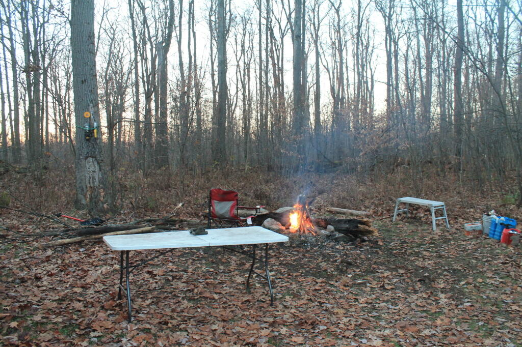
Final Campfire

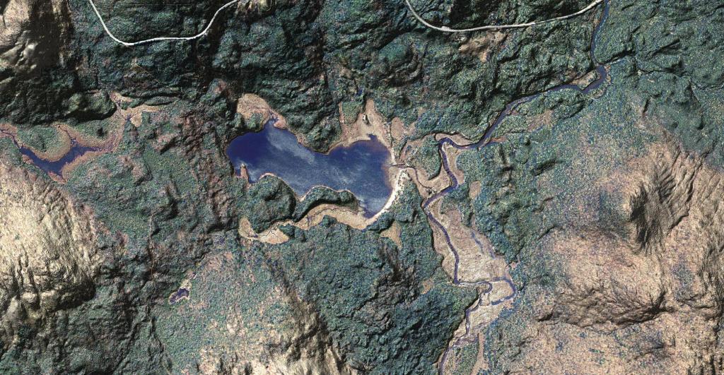
Cheney Pond

Ortho Cheney Pond

This is a beautiful aerial photo super-imposed on the LiDAR hillshade to show the area with detail as you might see it from an airplane in late winter.

You can drive down to Cheney Pond via an unmarked road along Boreas Road, on top of a hill with a pull-off. The road is somewhat rutted but there is a drive-in campsite at the bottom of the road. From there, you can paddle across Cheney Pond and follow a narrow but navigable stream down to Lester Flow, which is little more then a still water in the Boreas River. At one time, Lester Flow was a all flooded but the dam is long gone, just leaving the still water.

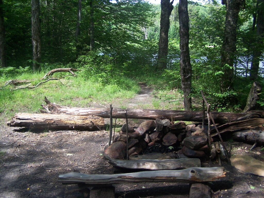
Campsite 10 on Smith Road

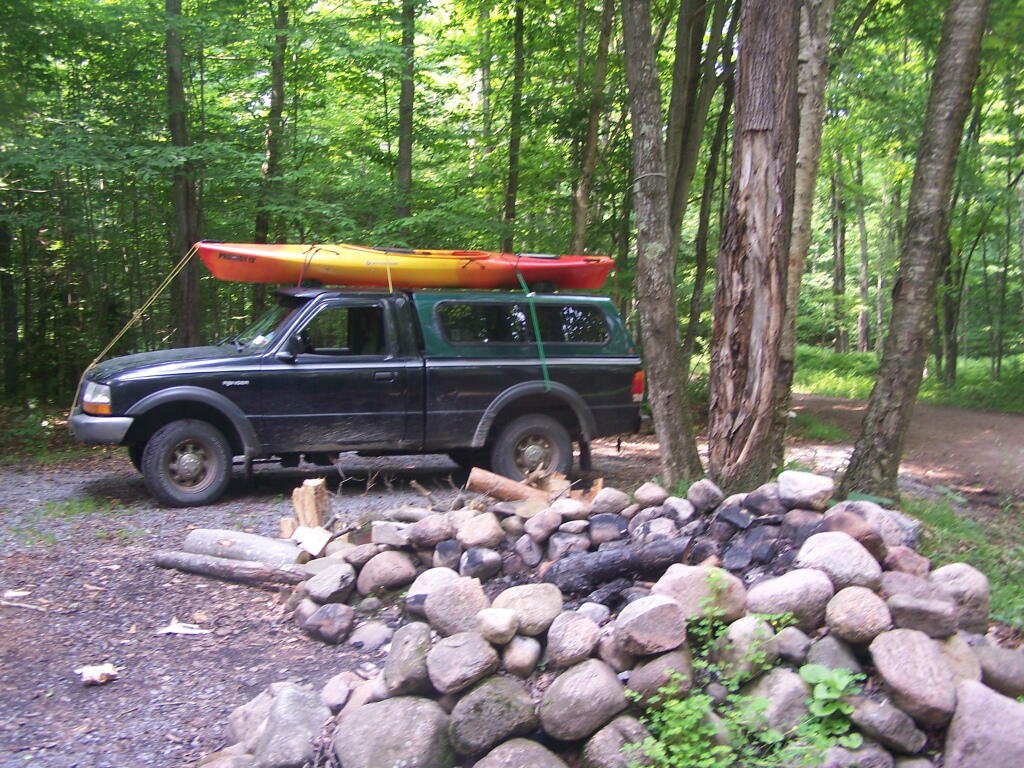
Here it is. No facilities, but there is a stone fire pit, and a nice big grassy campsite. They regularly mow these campsites to keep them from reverting back to woods.

Taken on Tuesday June 28, 2011 at Smith Road.