Here is a Leaflet/KML/Google Maps overview of Lean-tos and Primitive Campsites in an interactive map for NYS DEC Lands and Finger Lakes National Forest Lean-To data and many of campsites come from the NYS DEC, while additional data has been heads-up digitized based on my own exploration.
Google Sheets with Coordinates: Campsites and Lean-Tos
Helpful Hints: In the upper right corner, use the layer button to switch to US Forest Service Maps for more detail on forest service lands, or use the US Topographic Map DRGs to get traditional topographic maps from the USGS.
Updated on 5/13/2021 Moved Pennsylvania, West Virginia and Vermont campsites to a separate maps.
Updated on 3/14/2021 Incorporated additional data found on DEC ARC Map Server at gisservices.dec.ny.gov, adding 81 additional NY State campsites not found on this map.
Updated on 1/31/2021 Fixed overlaps between NYS DEC data and heads up-digitized campsites by myself. Also, re-created all the points in Speculator Tree Farm/Perkins Clearing by geo-referencing and plotting the official map to add campsites to correct locations.
Note: This was not available for a number of years due to the limitations of Google Maps, however since switching to Leaflet, it has made it possible to load in a larger number of points.
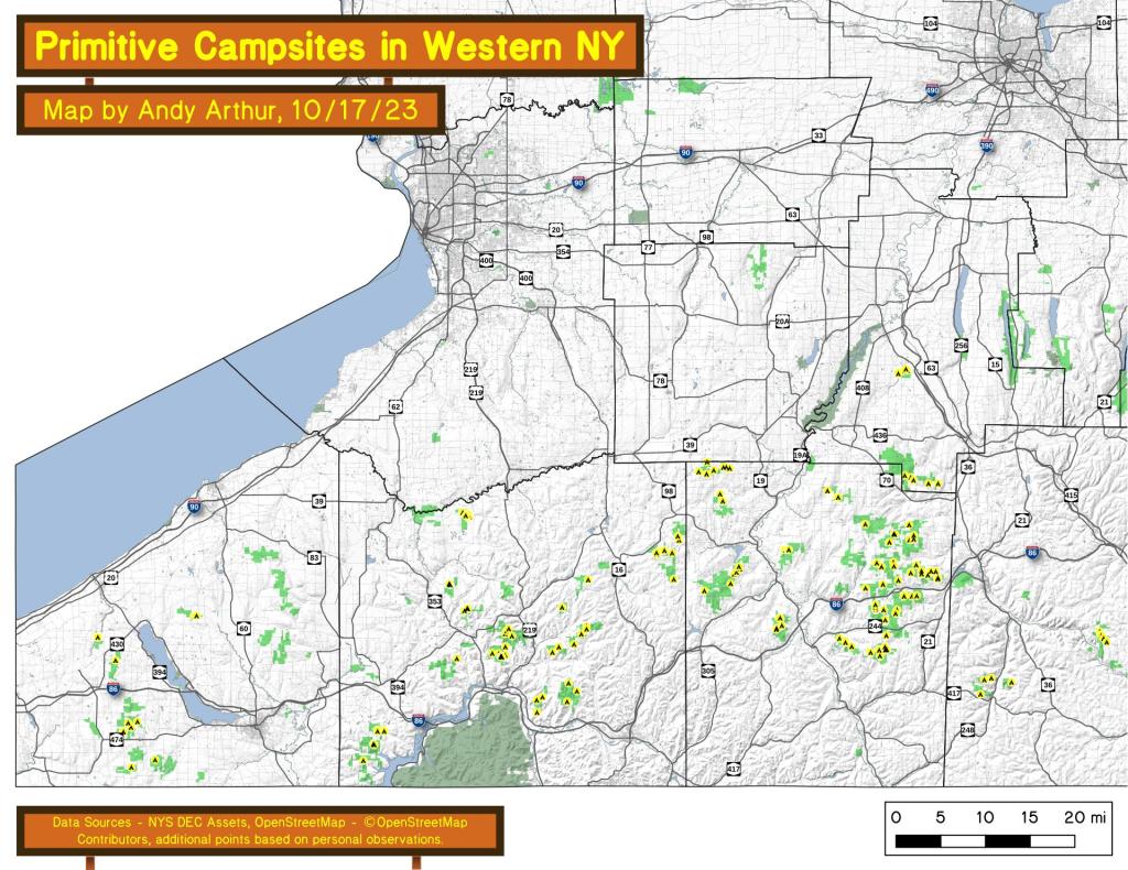
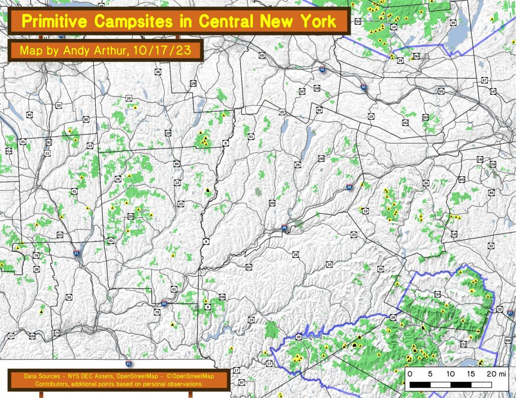
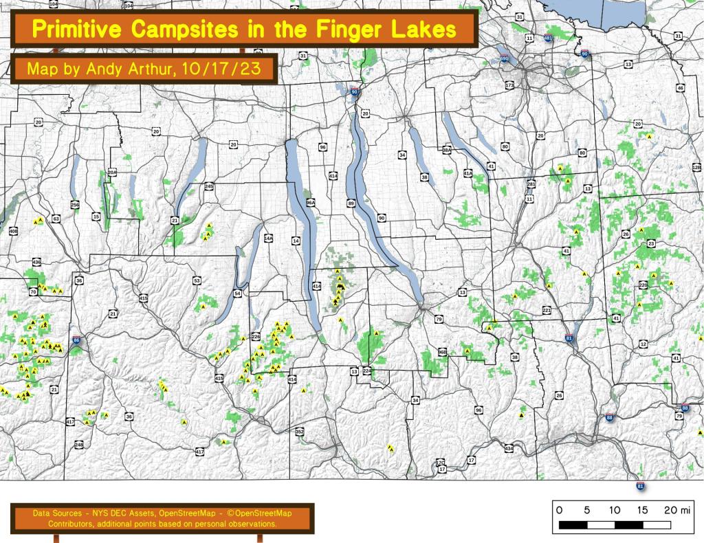
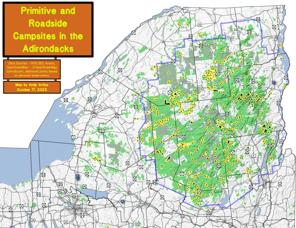
Here are the primitive campsites dataset broken into KML files 🏕 that are less then 1,000 points per file that are more friendly with Google Earth and similar services:
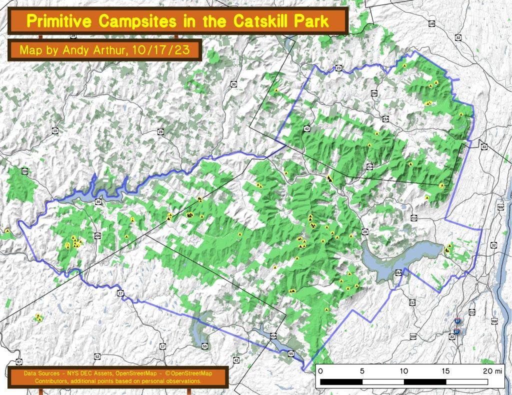
Catskills, Central NY, Western NY - generally campsites South of the Mohawk River / Erie / Barge Canal, extended east by an imaginary line to the Vermont - Massachusetts border.
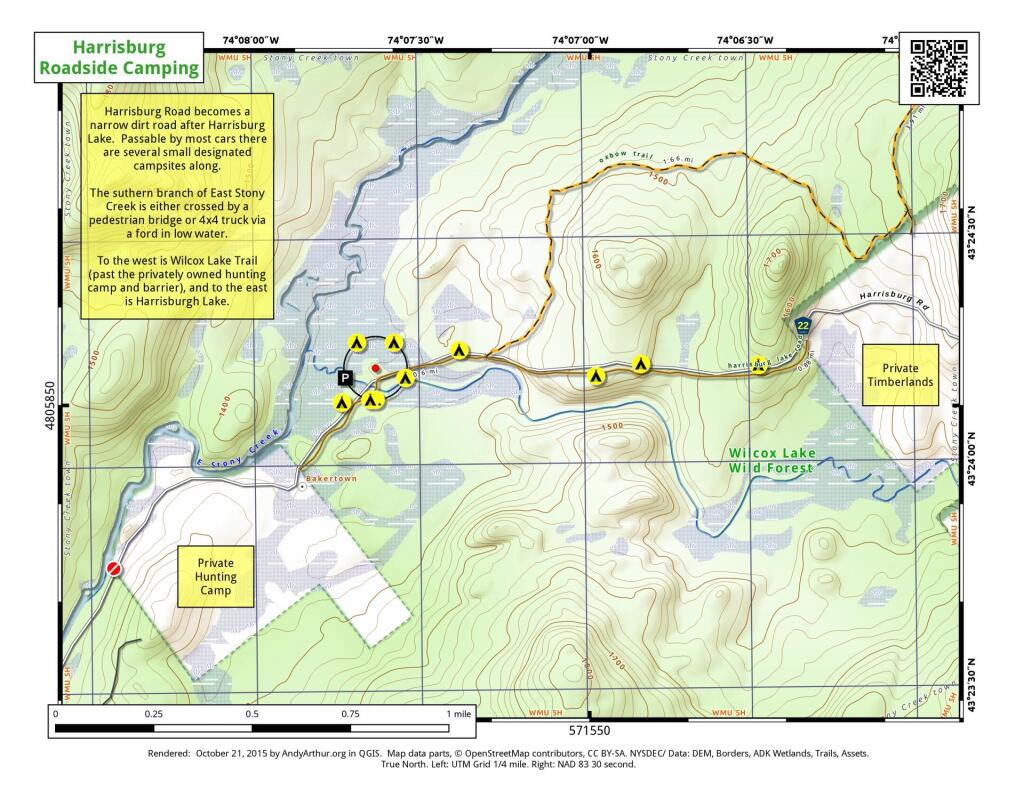
Southern Adirondacks and Tug Hill - generally campsites North of the Mohawk River / Erie / Barge Canal but South of NY 177 (Tug Hill) to NY 26 to Moose River Road to NY 28 to NY 28N to Blue Ridge Road to Johnson Pond Road to NY 74 to Ticonderoga. Includes Tug Hill, Black River WF, Moose River Plains, Wilcox Lake WF, Hammond Pond WF, Vanderwhacker, Cheney Pond, and Pharaoh Lake WF.
North Adirondacks and Tug Hill - generally campsites North of NY 177 (Tug Hill) to NY 26 to Moose River Road to NY 28 to NY 28N to Blue Ridge Road to Johnson Pond Road to NY 74 to Ticonderoga. Includes White Hill SF, Grass River, Pigeon Lake, Ha-De-Ron-Dah, Sargent Ponds, Blue Lake, High Peaks, Five Ponds, Watsons Triangle, St. Regis Canoe, McKenzie, Debar Mnt, Taylor Pond, Valcour Island, Deer River, Brasher Falls, Hammond Pond WF (North of NY 78)
Lean-Tos - DEC lean-tos are in a separate file.