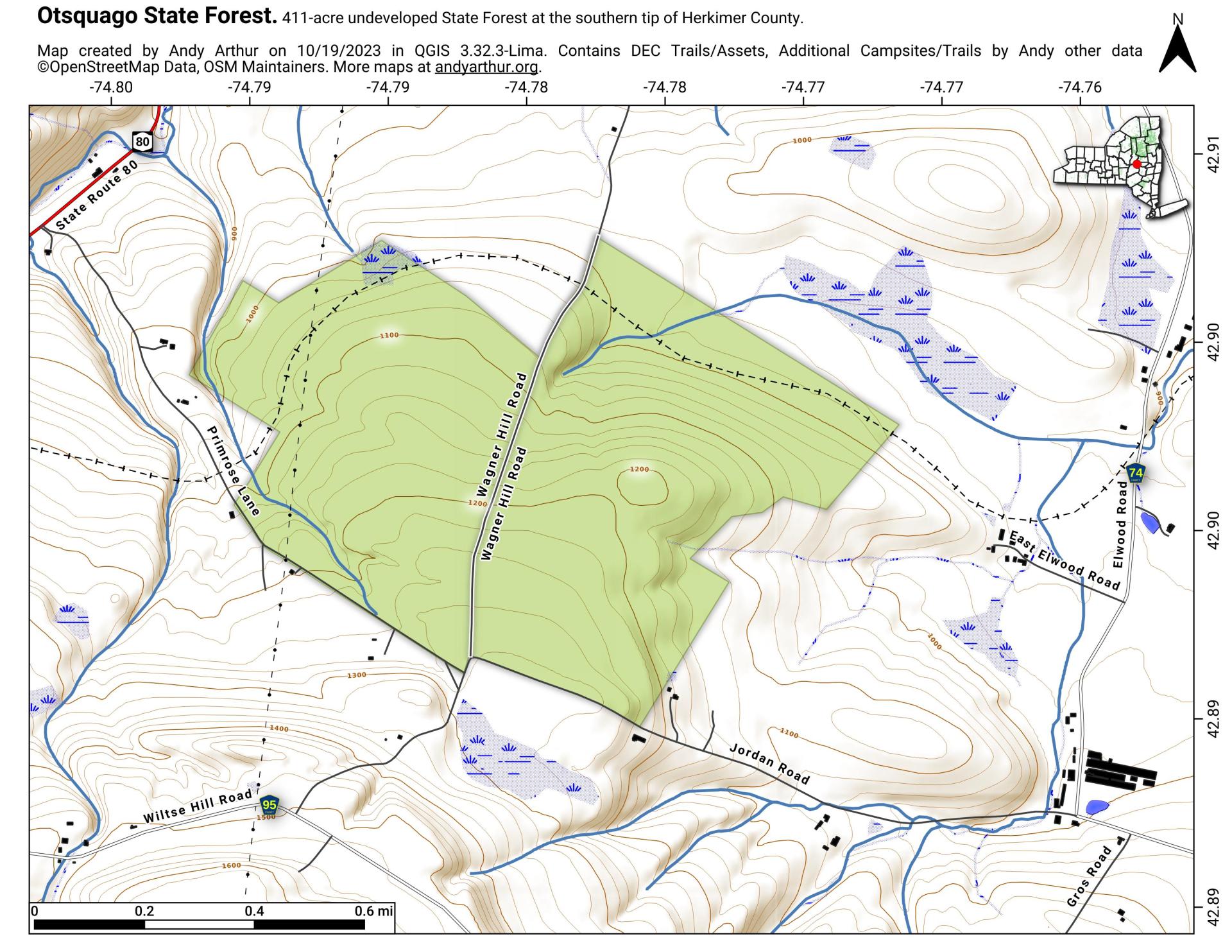
Map: Otsquago State Forest
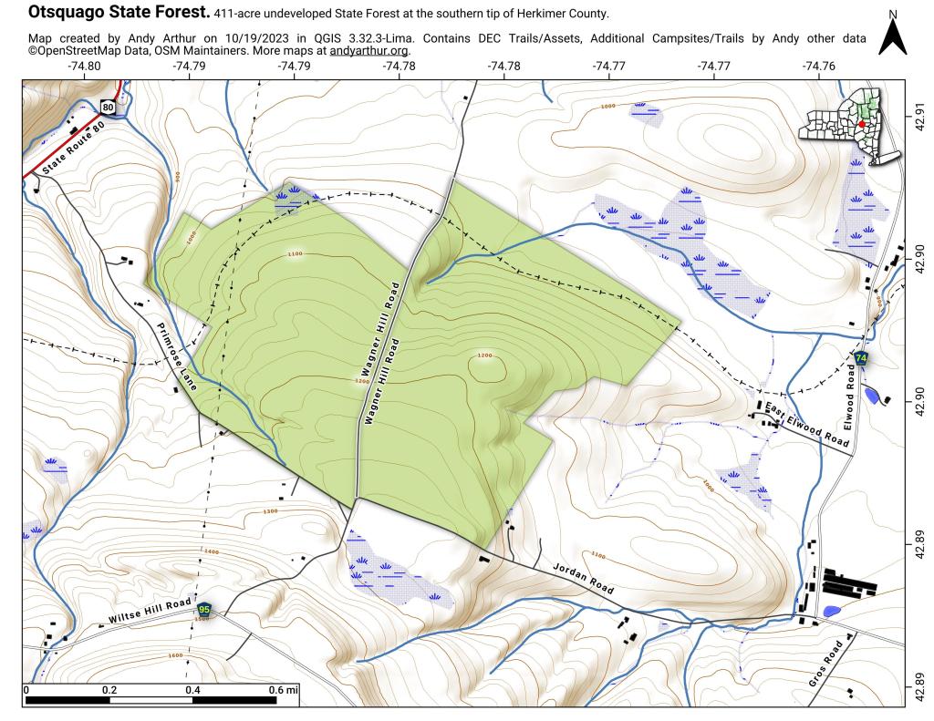
Download a High Resolution JPEG Image of the Otsquago State Forest or an Adobe Acrobat Printable PDF of the Otsquago State Forest.

Bookmark my free Interactive GPS Map for your phone:
https://andyarthur.org/ny
... shows your location as a blue dot in relationship to campsites, trails, state land. This online map requires cell service, won't work in remote country, so also bring a paper map.
Free Download of New & Historical USGS 1:24k Topograpic Maps
Interactive maps with backcountry and roadside camping: New York, Pennsylvania, West Virginia & Vermont. List of NYS DEC Lean-Tos and Firetowers.
Google Spreadsheet with Roadside, Primitive and Pay Campsites
More about Catskill Mountains...
Maps and Interactives
Walton 1948
Phonecia
Margaretville
Contour Map of the Catskills
Catskill Park, 1970
Before the Pepacton Reservior
NYC DEP Watershed Lands
NYC DEP Lands – Year of Acquistion
New York City Catskill Reservior Watersheds
Catskill Park WIlderness Areas
Catskill Park Watersheds
Kingston and Catskill Mountains
Hunter Area Peaks
Catskill Mountains Terrian
Catskill Forest Preserve
Ashokan Reservior 1903 Overlay
Eastern Catskill Mountains
Rondout Reservior
New York City Catskill Watershed
Otsquago State Forest
... photos, maps and other content from from Catskill Mountains.