Map: Newfield State Forest
Download a High Resolution JPEG Image of the Newfield State Forest or an Adobe Acrobat Printable PDF of the Newfield State Forest.

Bookmark my free Interactive GPS Map for your phone:
https://andyarthur.org/ny
... shows your location as a blue dot in relationship to campsites, trails, state land. This online map requires cell service, won't work in remote country, so also bring a paper map.
Free Download of New & Historical USGS 1:24k Topograpic Maps
Interactive maps with backcountry and roadside camping: New York, Pennsylvania, West Virginia & Vermont. List of NYS DEC Lean-Tos and Firetowers.
Google Spreadsheet with Roadside, Primitive and Pay Campsites
More about Newfield State Forest...
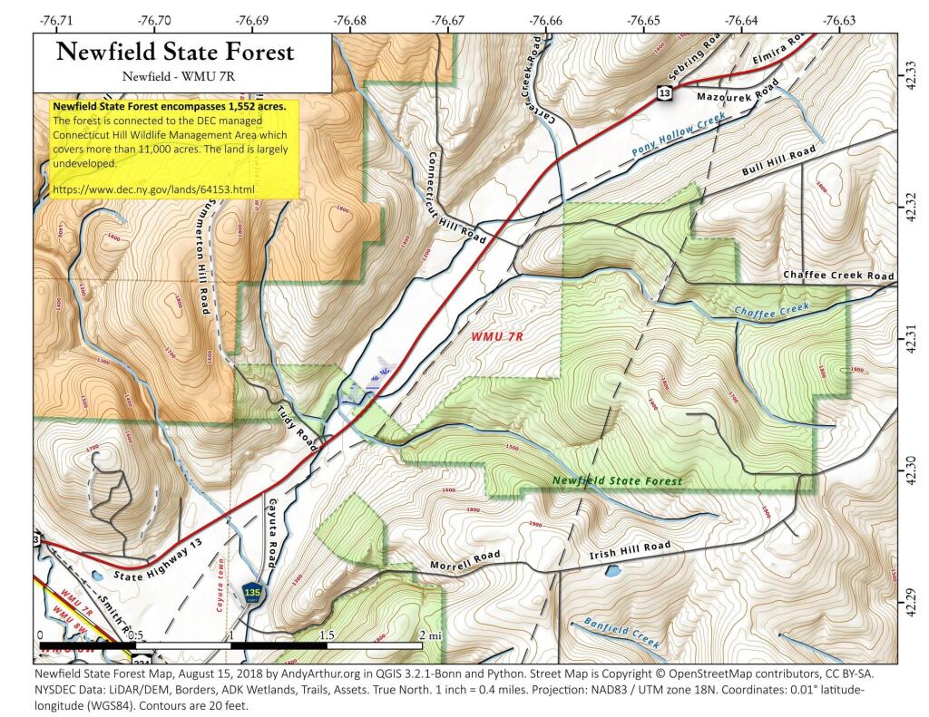
Newfield State Forest encompasses 1,552 acres and is located in the town of Newfield in southwestern Tompkins County on a hilltop that sits high above Pony Hollow. It is a perfect place for activities that can be enjoyed in a primitive forest setting, such as hunting and nature observation. The State Forest is part of a block of nearly 14,000 acres of public open space managed by the DEC. The forest is connected to the DEC managed Connecticut Hill Wildlife Management Area which covers over 11,000 acres.
There are no formal trail networks within the forest. Many game species, such as white tail deer, fox, turkey, raccoon, mink and squirrel are found to be quite abundant within the forest's boundaries, making hunting, nature observation especially enjoyable.
http://www.dec.ny.gov/lands/64153.html
... photos, maps and other content from from Newfield State Forest.