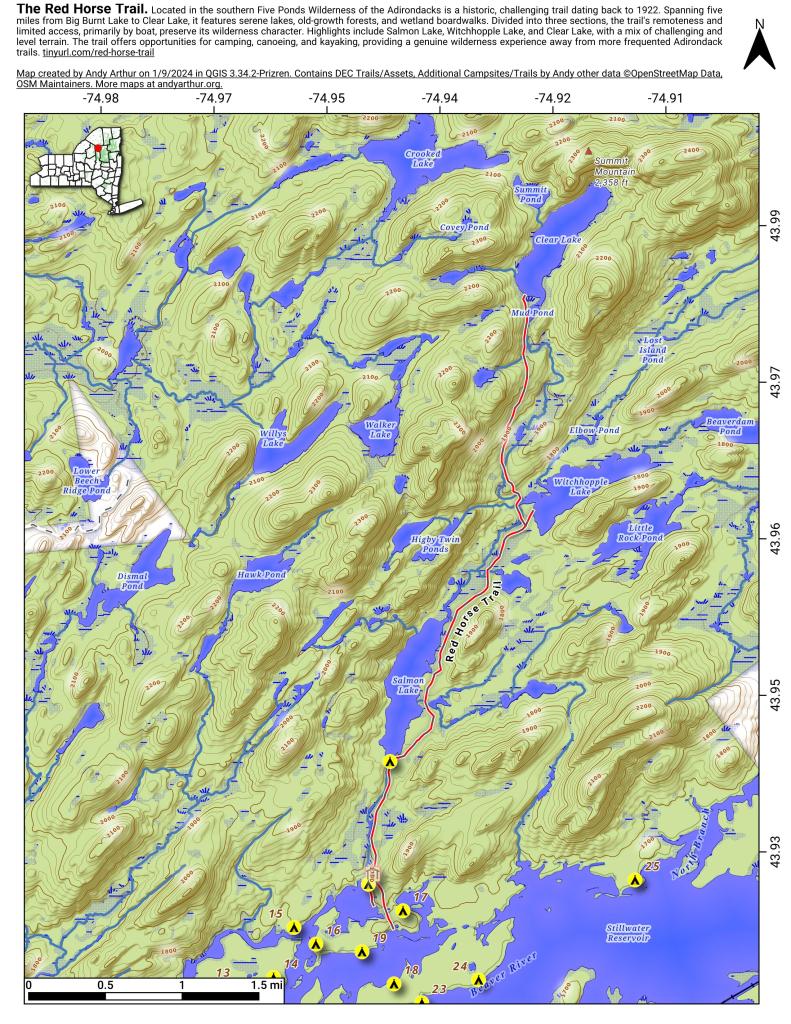
Map: Red Horse Trail
Download a High Resolution JPEG Image of the Red Horse Trail or an Adobe Acrobat Printable PDF of the Red Horse Trail.
About Map: Red Horse Trail ....

Bookmark my free Interactive GPS Map for your phone:
https://andyarthur.org/ny
... shows your location as a blue dot in relationship to campsites, trails, state land. This online map requires cell service, won't work in remote country, so also bring a paper map.
Free Download of New & Historical USGS 1:24k Topograpic Maps
Interactive maps with backcountry and roadside camping: New York, Pennsylvania, West Virginia & Vermont. List of NYS DEC Lean-Tos and Firetowers.
Google Spreadsheet with Roadside, Primitive and Pay Campsites
More about Five Ponds Wilderness...
The Five Ponds Wilderness in the Adirondacks is a pristine 130,000-acre wilderness area characterized by dense forests, crystal-clear ponds, and rugged terrain. Popular for backcountry hiking, camping, and fishing, it offers a serene escape into nature with diverse ecosystems, abundant wildlife, and a network of scenic trails for outdoor enthusiasts.
Maps and Interactives
Five Ponds Wilderness – The Red Horse Trail
Red Horse Trail
... photos, maps and other content from from Five Ponds Wilderness.