Map: Lookout State Forest
Download a High Resolution JPEG Image of the Lookout State Forest or an Adobe Acrobat Printable PDF of the Lookout State Forest.

Bookmark my free Interactive GPS Map for your phone:
https://andyarthur.org/ny
... shows your location as a blue dot in relationship to campsites, trails, state land. This online map requires cell service, won't work in remote country, so also bring a paper map.
Free Download of New & Historical USGS 1:24k Topograpic Maps
Interactive maps with backcountry and roadside camping: New York, Pennsylvania, West Virginia & Vermont. List of NYS DEC Lean-Tos and Firetowers.
Google Spreadsheet with Roadside, Primitive and Pay Campsites
More about Lookout State Forest...
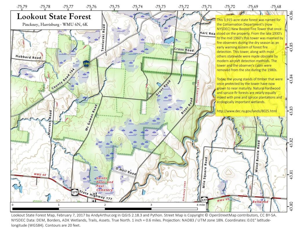
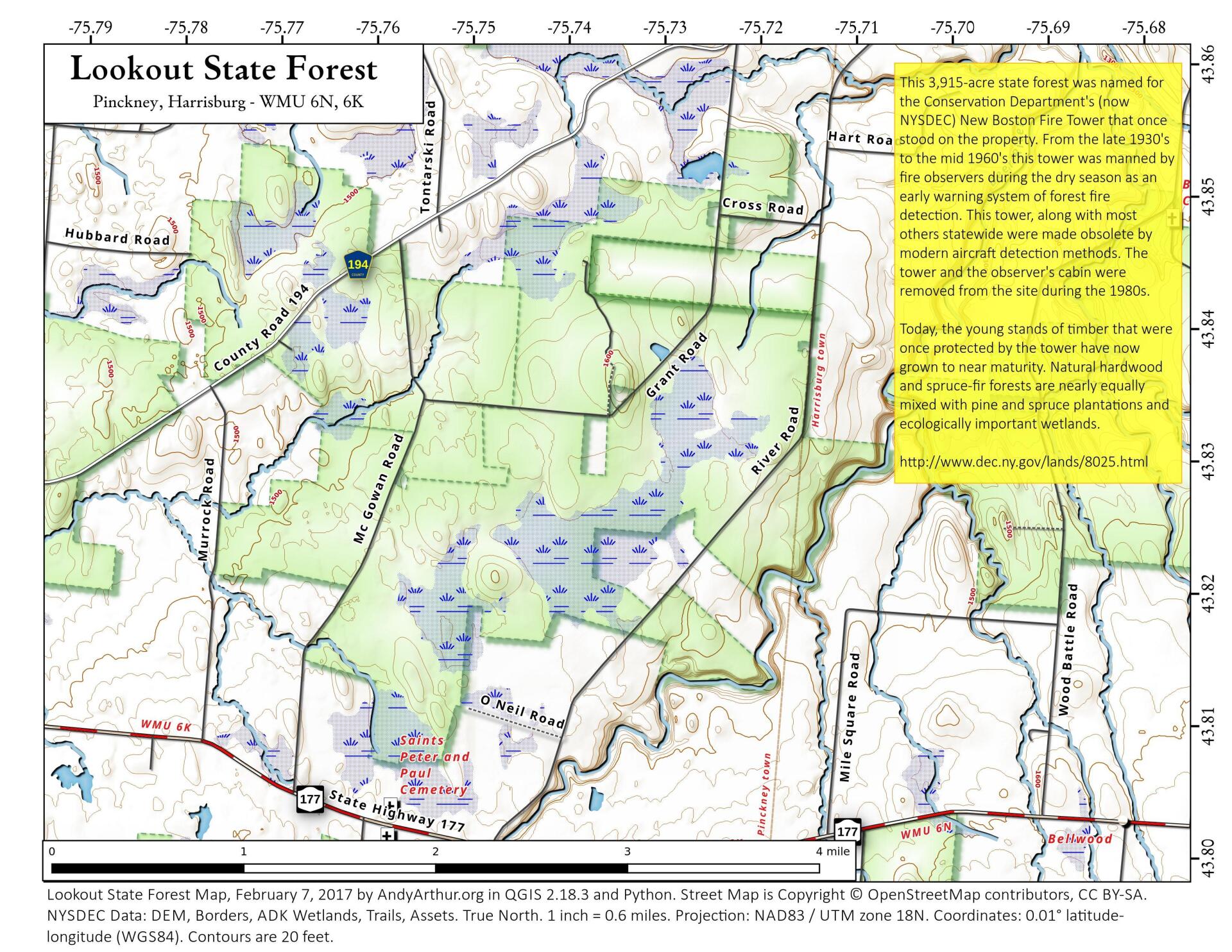
This 3,915-acre state forest was named for the Conservation Department's (now NYSDEC) New Boston Fire Tower that once stood on the property. From the late 1930's to the mid 1960's this tower was manned by fire observers during the dry season as an early warning system of forest fire detection. This tower, along with most others statewide were made obsolete by modern aircraft detection methods. The tower and the observer's cabin were removed from the site during the 1980s.
http://www.dec.ny.gov/lands/8025.html
... photos, maps and other content from from Lewis County.