Map: Jockeybush Lake
Download a High Resolution JPEG Image of the Jockeybush Lake or an Adobe Acrobat Printable PDF of the Jockeybush Lake.

Bookmark my free Interactive GPS Map for your phone:
https://andyarthur.org/ny
... shows your location as a blue dot in relationship to campsites, trails, state land. This online map requires cell service, won't work in remote country, so also bring a paper map.
Free Download of New & Historical USGS 1:24k Topograpic Maps
Interactive maps with backcountry and roadside camping: New York, Pennsylvania, West Virginia & Vermont. List of NYS DEC Lean-Tos and Firetowers.
Google Spreadsheet with Roadside, Primitive and Pay Campsites
More about Jockeybush Lake...
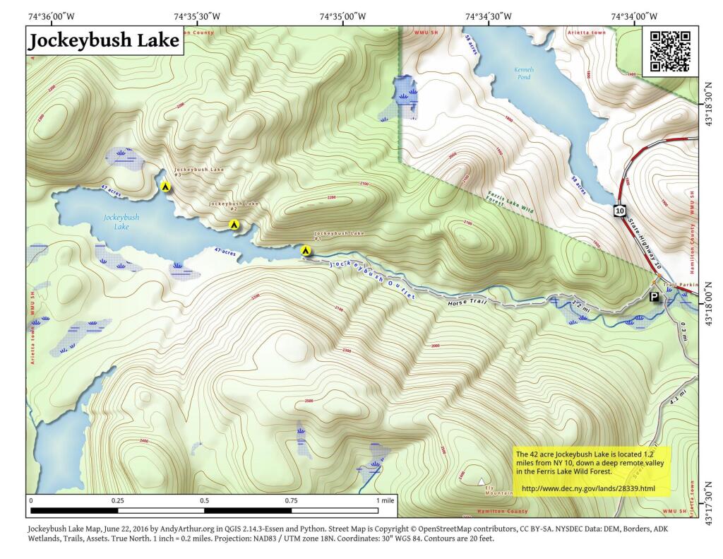
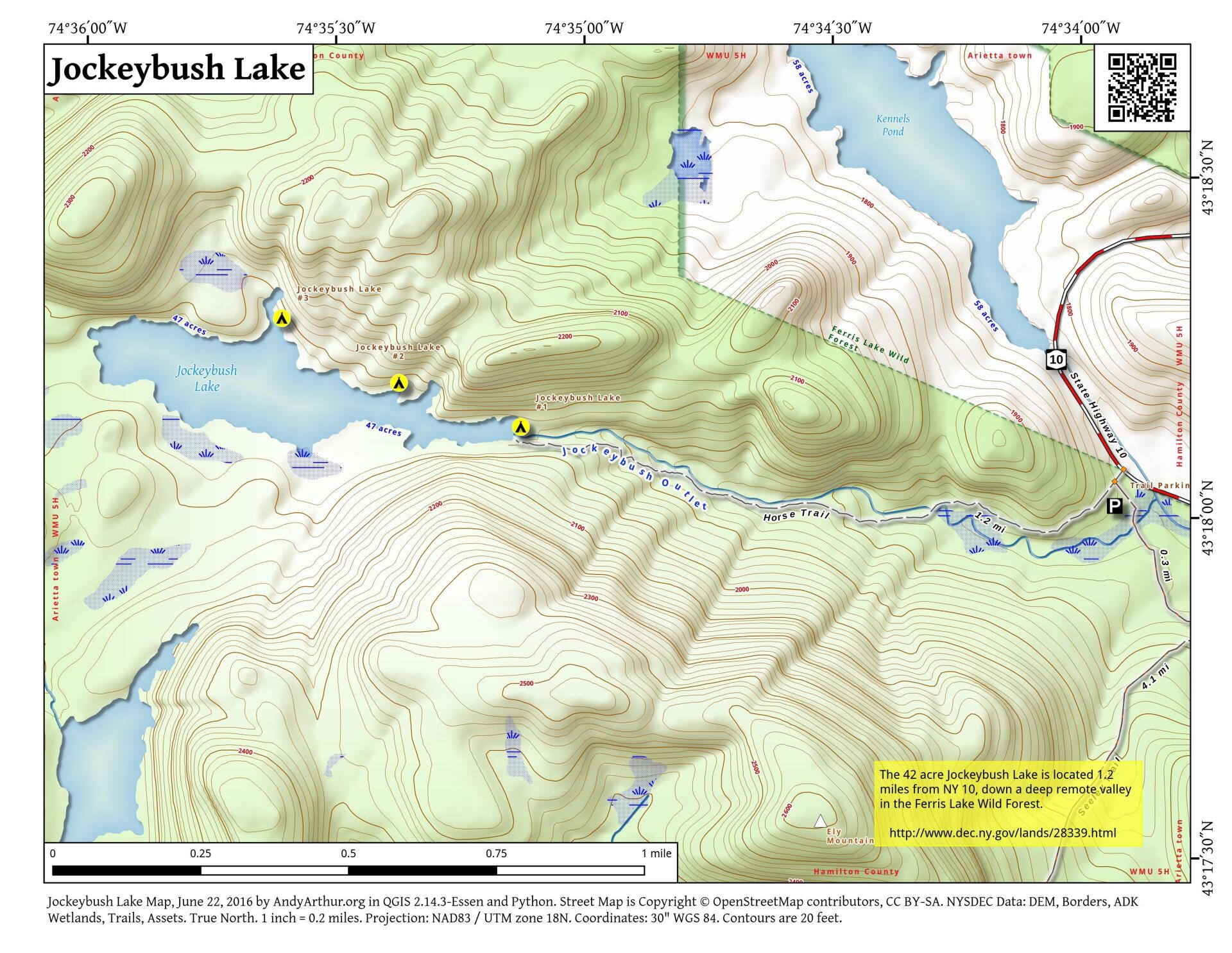
Jockeybush Lake is located in Ferris Lake Wild Forest in the southwestern Adirondacks off NY 10 in Hamilton County. The 1.1 mile trail that leads to the lake has an elevation gain of 221 feet.
This great short hike features views of the stream the trail follows, a few small waterfalls and at the end of the trail, Jockeybush Lake. The trail to the lake is easy to walk except for a few muddy stretches and you may want to avoid the the trail in the spring due to the stream crossing. The trail begins at the parking area on the west side of NY 10. The GPS coordinates are N43 18.061 W74 33.963 for those who have a GPS device in their car. There is a snowmobile trail that also leaves the parking area that might confuse some hikers. The Jockeybush Lake Trail is well marked with signs and DEC plastic markers.
http://www.cnyhiking.com/JockeybushLake.htm
... photos, maps and other content from from Ferris Lake Wild Forest.