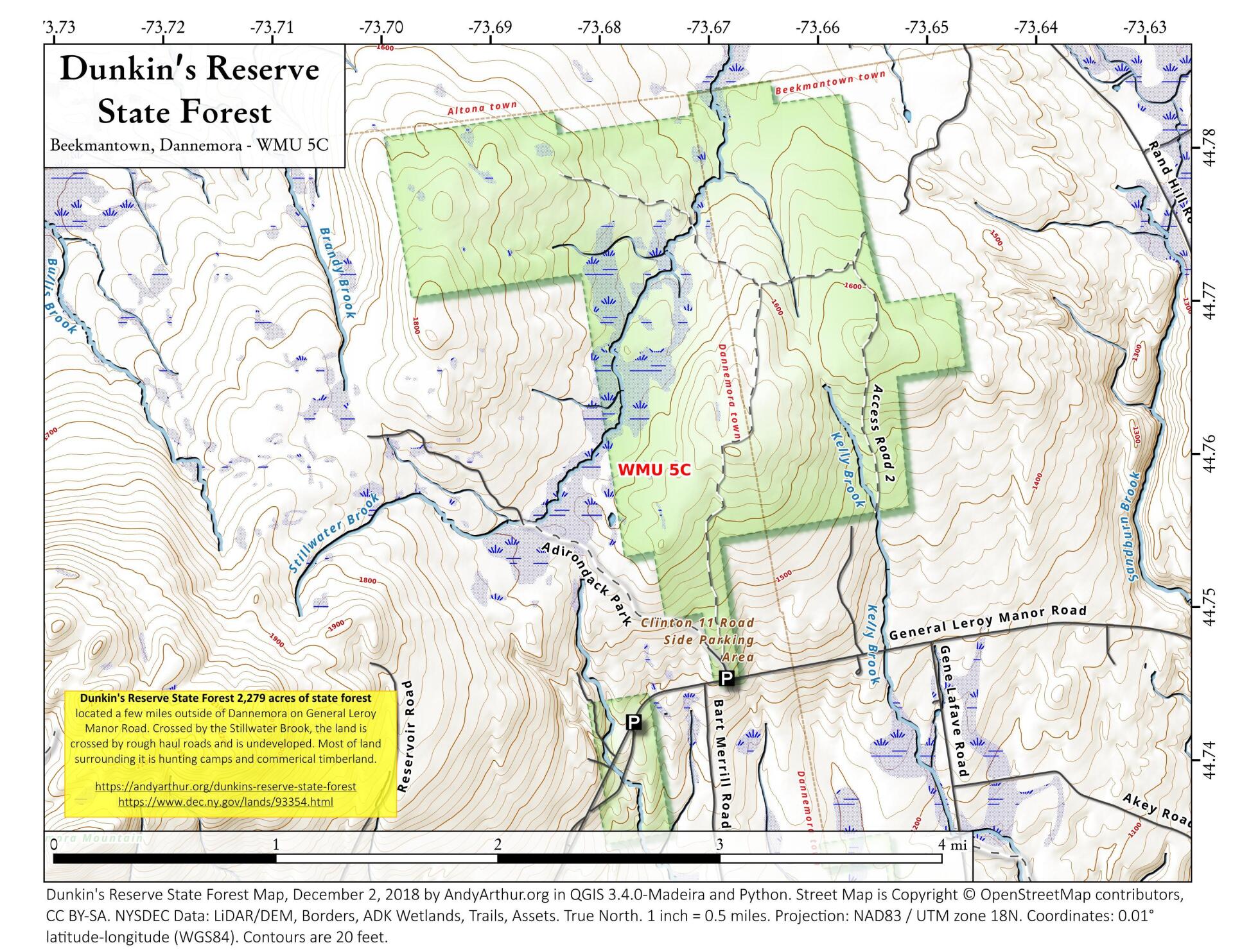
Map: Dunkin's Reserve State Forest

Download a High Resolution JPEG Image of the Dunkin's Reserve State Forest or an Adobe Acrobat Printable PDF of the Dunkin's Reserve State Forest.

Bookmark my free Interactive GPS Map for your phone:
https://andyarthur.org/ny
... shows your location as a blue dot in relationship to campsites, trails, state land. This online map requires cell service, won't work in remote country, so also bring a paper map.
Free Download of New & Historical USGS 1:24k Topograpic Maps
Interactive maps with backcountry and roadside camping: New York, Pennsylvania, West Virginia & Vermont. List of NYS DEC Lean-Tos and Firetowers.
Google Spreadsheet with Roadside, Primitive and Pay Campsites
More about Dormansville, New York...
Dormansville is a hamlet located in the Town of Westerlo, in Albany County at latitude 42.5 and longitude -73.995.
The elevation is 1,014 feet.
http://albanyhilltowns.com/wikiWesterlo/index.php?title=Dormansville
Maps and Interactives
Applebee’s Farm 1952
Dormansville Builidngs
Dunkin’s Reserve State Forest
... photos, maps and other content from from Dormansville, New York.