NYS Metropolitian Region

Download a High Resolution JPEG Image of the NYS Metropolitian Region or an Adobe Acrobat Printable PDF of the NYS Metropolitian Region.
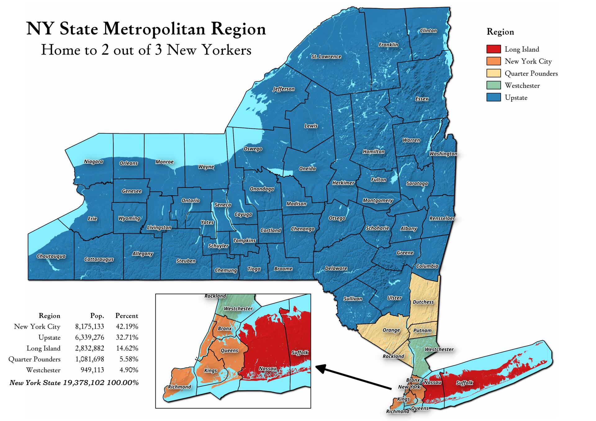
About Map: NYS Metropolitian Region ....
Somebody was asking about a map of the Quarter Pounders, along with Long Island, Westchester, and New York City -- versus Upstate map. This map shows this regions, along with the respective population in each region. The Quarter Pounders -- Dutchess, Orange, Putnam and Rockland Counties have this name, as they each have a quarter weighted vote on the MTA Board.

Bookmark my free Interactive GPS Map for your phone:
https://andyarthur.org/ny
... shows your location as a blue dot in relationship to campsites, trails, state land. This online map requires cell service, won't work in remote country, so also bring a paper map.
Free Download of New & Historical USGS 1:24k Topograpic Maps
Interactive maps with backcountry and roadside camping: New York, Pennsylvania, West Virginia & Vermont. List of NYS DEC Lean-Tos and Firetowers.
Google Spreadsheet with Roadside, Primitive and Pay Campsites
More about New York State...
New York is a state in the Northeastern region of the United States. New York is the 27th-most extensive, the 3rd-most populous, and the 7th-most densely populated of the 50 United States. New York is bordered by New Jersey and Pennsylvania to the south, and by Connecticut, Massachusetts and Vermont to the east. The state has a maritime border with Rhode Island east of Long Island, as well as an international border with the Canadian provinces of Ontario to the west and north, and Quebec to the north. The state of New York is often referred to as New York State to distinguish it from New York City.


