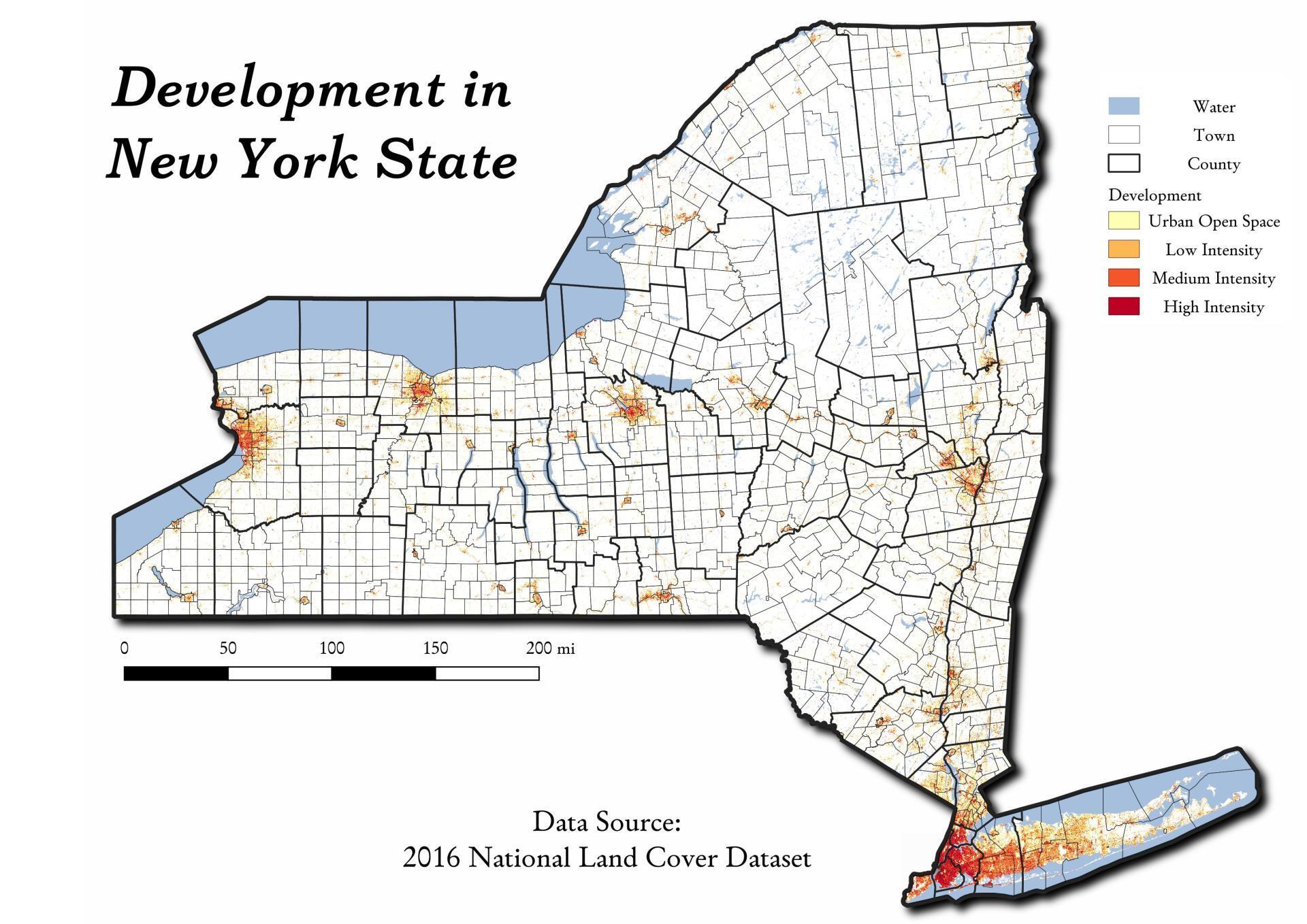
Developed Areas in New York 🗺️
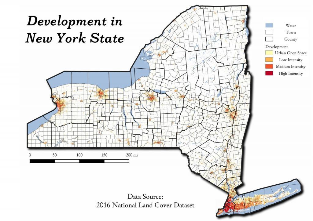
Download a High Resolution JPEG Image of the Developed Areas in New York or an Adobe Acrobat Printable PDF of the Thematic Developed Areas in New York.
About Developed Areas in New York ....
While you can pretty easily see this on satelight images, this map shows the 3.1 million acres of New York State that is developed -- which works out to be 8.9 percent of state's landmass.

More about New York State...
New York is a state in the Northeastern region of the United States. New York is the 27th-most extensive, the 3rd-most populous, and the 7th-most densely populated of the 50 United States. New York is bordered by New Jersey and Pennsylvania to the south, and by Connecticut, Massachusetts and Vermont to the east. The state has a maritime border with Rhode Island east of Long Island, as well as an international border with the Canadian provinces of Ontario to the west and north, and Quebec to the north. The state of New York is often referred to as New York State to distinguish it from New York City.


