Wolf Gull State Forest

Download a High Resolution JPEG Image of the Wolf Gull State Forest or an Adobe Acrobat Printable PDF of the Wolf Gull State Forest.
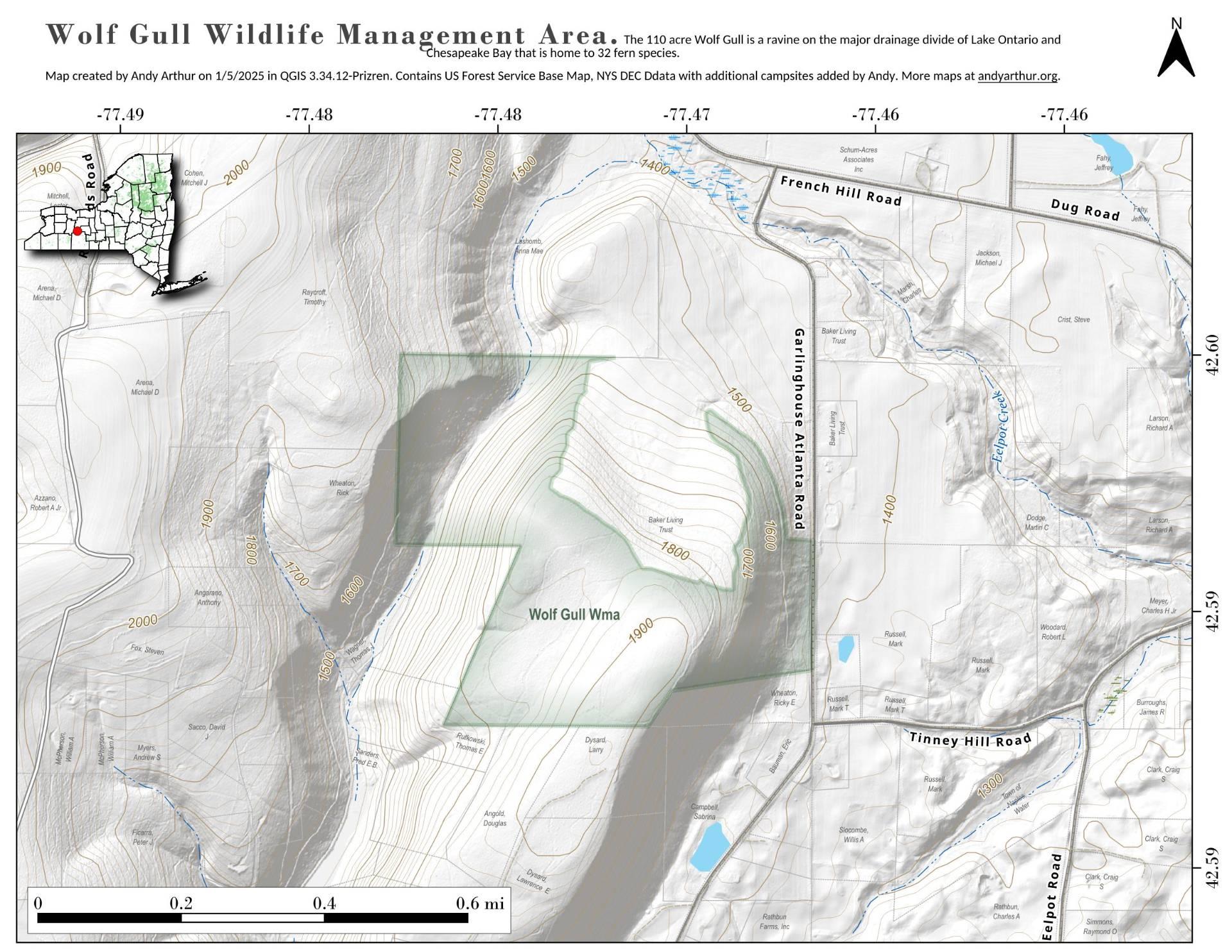
About Map: Wolf Gull State Forest ....
The 110 acre Wolf Gull is a ravine on the major drainage divide of Lake Ontario and Chesapeake Bay that is home to 32 fern species.


Bookmark my free Interactive GPS Map for your phone:
https://andyarthur.org/ny
... shows your location as a blue dot in relationship to campsites, trails, state land. This online map requires cell service, won't work in remote country, so also bring a paper map.
Free Download of New & Historical USGS 1:24k Topograpic Maps
Interactive maps with backcountry and roadside camping: New York, Pennsylvania, West Virginia & Vermont. List of NYS DEC Lean-Tos and Firetowers.
Google Spreadsheet with Roadside, Primitive and Pay Campsites
More about Finger Lakes...
Nestled in the heart of Upstate New York, the Finger Lakes comprise a distinctive network of lakes, presenting a captivating bioregion. This locale has garnered popularity as a sought-after tourist destination. Resembling elongated fingers, these lakes gracefully stretch along a north-south axis. Notably, these majestic lakes, echoing the graceful curvature of human fingers, collectively form a natural wonder evoking awe and inspiration.
Of note, Cayuga Lake and Seneca Lake hold the distinction of being both among the longest and deepest lakes in the United States. Each spanning nearly 40 miles end to end, and never exceeding 3.5 miles in width, they exhibit remarkable proportions. Among these, Cayuga Lake boasts the longest stretch at 38.1 miles, while Seneca Lake commands the largest total area. Delving beneath sea level, Seneca Lake plunges to an astounding 618 feet (188 m) in depth, while Cayuga Lake follows suit at 435 feet (133 m).
Download the PDF Map Pack with All Maps from Finger Lakes.


