2016 Land Use in the Finger Lakes 🗺️
Download a High Resolution JPEG Image of the Terrain 2016 Land Use in the Finger Lakes or an Adobe Acrobat Printable PDF of the Terrain 2016 Land Use in the Finger Lakes.
About 2016 Land Use in the Finger Lakes ....
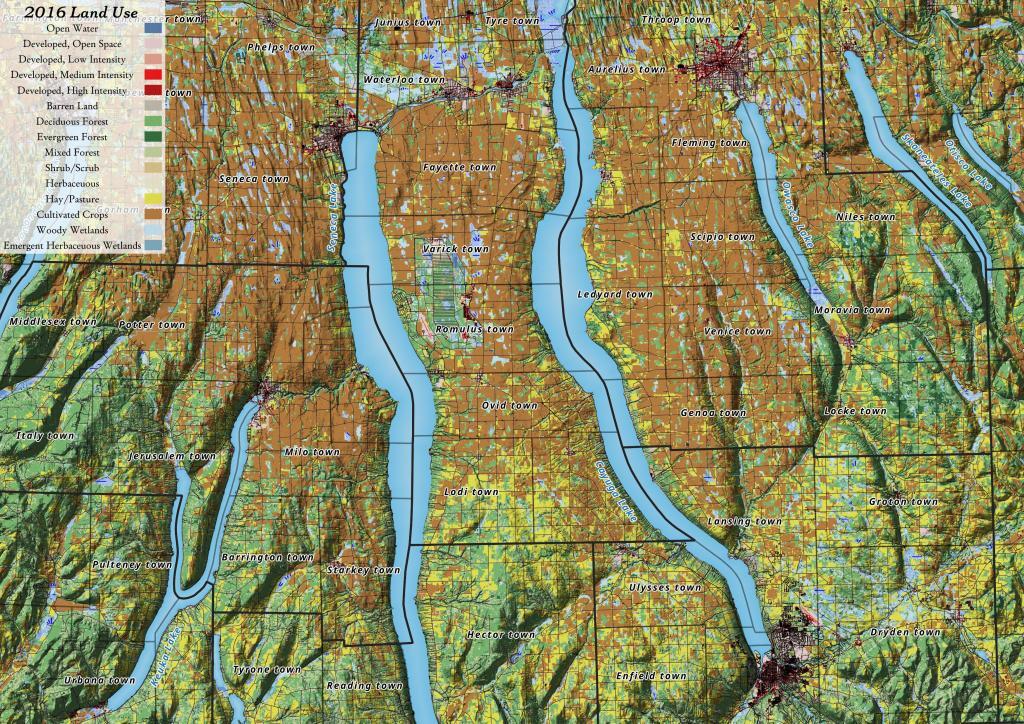
Yesterday, I downloaded the National Land Cover Data for 2016. I had some older data but I hadn't updated it in years, but soon realized I could make some very interesting maps and graphics with this data. The Finger Lakes are kind of interesting to look at in particular as you can see the Northern Finger Lakes have a lot of cultivated lands -- mostly corn and soybeans -- for feeding dairy cattle, while the more upland and rocky lands in the Southern Finger Lakes are either wooded or pasture.

More about Finger Lakes...
Nestled in the heart of Upstate New York, the Finger Lakes comprise a distinctive network of lakes, presenting a captivating bioregion. This locale has garnered popularity as a sought-after tourist destination. Resembling elongated fingers, these lakes gracefully stretch along a north-south axis. Notably, these majestic lakes, echoing the graceful curvature of human fingers, collectively form a natural wonder evoking awe and inspiration.
Of note, Cayuga Lake and Seneca Lake hold the distinction of being both among the longest and deepest lakes in the United States. Each spanning nearly 40 miles end to end, and never exceeding 3.5 miles in width, they exhibit remarkable proportions. Among these, Cayuga Lake boasts the longest stretch at 38.1 miles, while Seneca Lake commands the largest total area. Delving beneath sea level, Seneca Lake plunges to an astounding 618 feet (188 m) in depth, while Cayuga Lake follows suit at 435 feet (133 m).
Download the PDF Map Pack with All Maps from Finger Lakes.


