Rebuilt Driveway  🖼️

Download a High Resolution JPEG Image of the Rebuilt Driveway or an Adobe Acrobat Printable PDF of the Rebuilt Driveway.

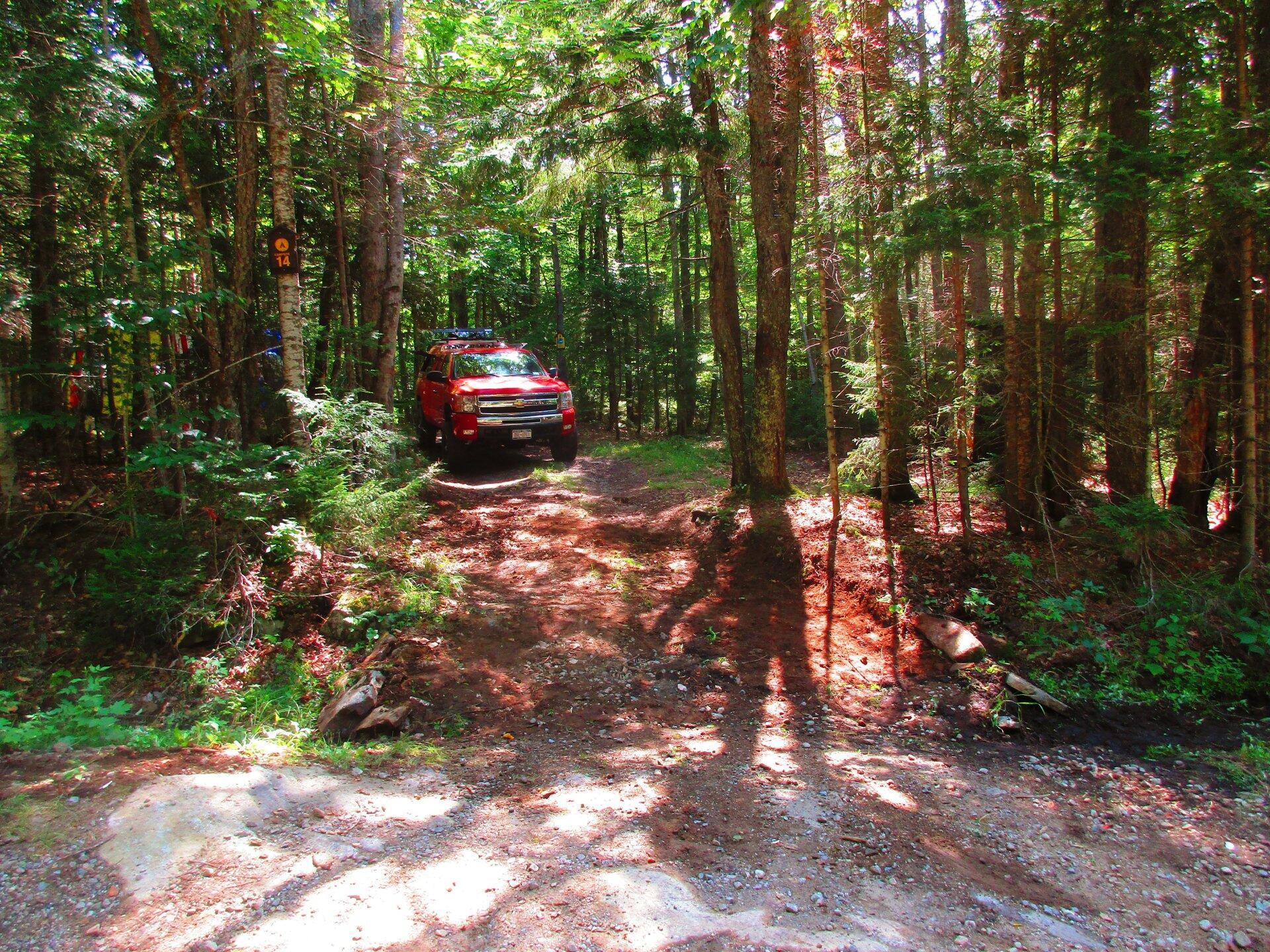
Rebuilt Driveway ...

When I first got to Campsite 14, the driveway up to it was steeply erroded by last years flooding, making it easy for passenger cars and even stock trucks to get hung up. I didn't like how step it was either because I was having trouble getting in and out without four-wheel drive on. So I dredged some material from the drainage ditches, and hauled some heavy rock to build up and smooth the entance to the campsite, so while it's still not perfect -- really needs a culvert -- it should make it a lot easier to get in and out, especilaly for passenger cars. I am hoping the small boulders I put in place along with the ditching I did for rain, will keep this campsite driveway from erroding so quickly in the future.

Taken on Saturday July 25, 2020 at Piseco-Powley Road.

SVGZ Graphic: El Nino vs. High Temperature in January in Albany

More about Piseco-Powley Road...

Stretching from Stratford to Piseco, Piseco-Powley Road winds along the western edge of one of the last remaining old Adirondack dirt roads. Lined with venerable spruce trees, some nearly brushing against the road, it offers a glimpse of nature's untouched beauty. The tranquil West Branch of the East Canada Creek intersects Powley Road at Powley Place. This spot is positioned 8 miles southwest of Piseco Outlet, where NY 10 crosses, and approximately 7.5 miles from the point Piseco-Powley Road branches off from NY 10. When approached from the south, Powley Place is found 10.5 miles northeast from Stratford via Piseco Road. Notably, this area hosts four campsites, forming part of the 22 designated camping spots along Piseco-Powley Road, enhancing the allure of this picturesque route.

http://www.dec.ny.gov/lands/28339.html

Get maps of campsites and destinations as a single-page PDF here: https://www.scribd.com/document/640949248/Piseco-Powley-Road-Campsite-Map-Pack

Map: Big Alderbed Lake Trail
Map: Clockmill Corners to NY 10
Map: Goldmine Stream Falls
Map: House Pond Trail
Map: Lower Powley Bridge to Sugarbush Mountain
Map: Meco Lake Trail (Piseco-Powley Road)
Map: Overview Map Piseco-Powley Road
Map: Powley Place - East Canada Creek - Kayak Canoe
Map: Sand Lake
Map: Sand Lake Trail
Map: Sugarbush Mountain to Clockmill Corners
Terrain Map: Edick Road Swimming Hole
Terrain Map: Juneteenth 2022 Weekend
Terrain Map: Powley Road
Thematic Map: Piseco Road Swimming Holes
Photo: Reflect
Photo: Trees Along the West Branch
Photo: Clouds varied a lot
Photo: Out on Lake
Photo: Big Alderbed
Photo: Ferris Lake Road
Photo: Sand Lake
Photo: Tree Along the River
Photo: End Of The Day
Photo: Morning

Leave a Reply

Your email address will not be published. Required fields are marked *