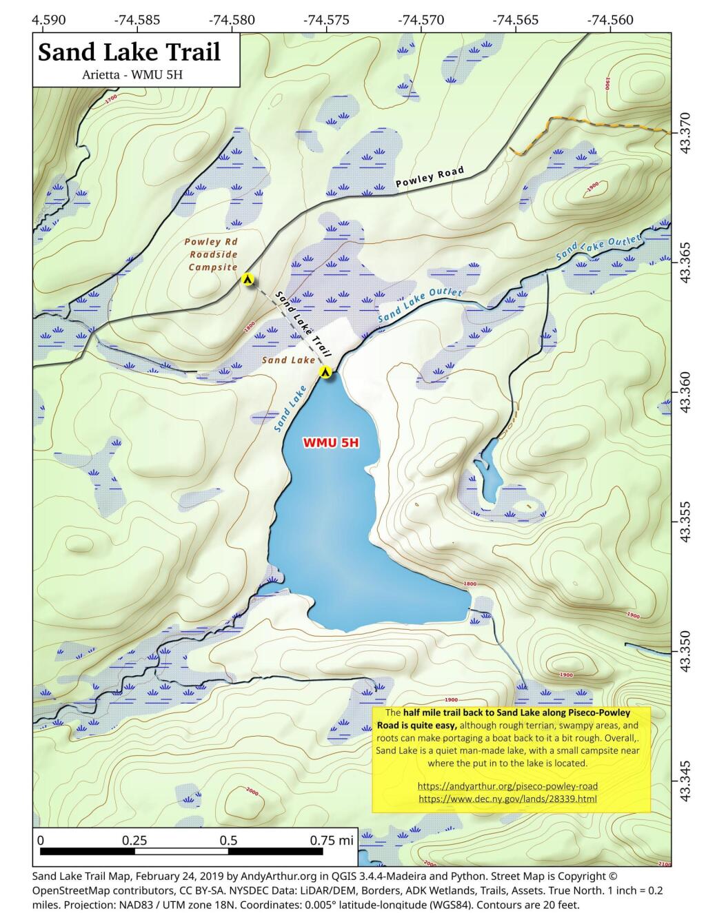
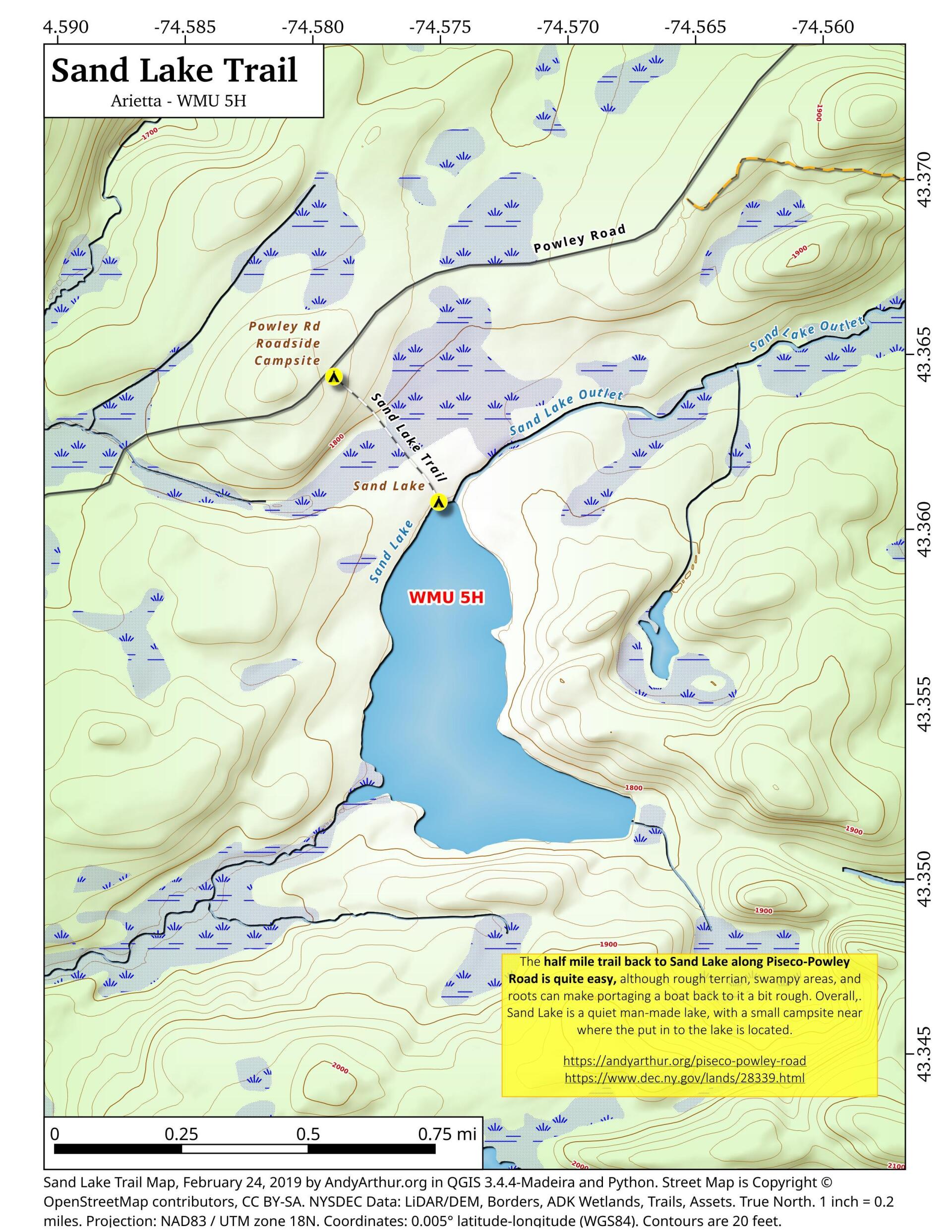
Sand Lake Trail
Download a High Resolution JPEG Image of the Sand Lake Trail or an Adobe Acrobat Printable PDF of the Sand Lake Trail.
About Map: Sand Lake Trail ....
The Sand Lake Trail is about a half mile long but can be a somewhat difficult portage at the end due to the swampy, narrow trail. But it's a nice little wilderness lake, with a campsite, not too remote off of Piseco-Powley Road. There also is a designated roadside campsite at the trailhead.


Bookmark my free Interactive GPS Map for your phone:
https://andyarthur.org/ny
... shows your location as a blue dot in relationship to campsites, trails, state land. This online map requires cell service, won't work in remote country, so also bring a paper map.
Free Download of New & Historical USGS 1:24k Topograpic Maps
Interactive maps with backcountry and roadside camping: New York, Pennsylvania, West Virginia & Vermont. List of NYS DEC Lean-Tos and Firetowers.
Google Spreadsheet with Roadside, Primitive and Pay Campsites
More about Piseco-Powley Road...
The 17-mile Piseco-Powley Road is a remote dirt route cutting through the Adirondack's Ferris Lake Wild Forest. It features 22 primitive roadside campsites, including four spots at Powley Place where the road crosses the West Branch of the East Canada Creek.
Download the PDF Map Pack with All Maps from Piseco-Powley Road.


")


![Photo: Finding the Cold [Expires July 21 2026]](/data/photo_24877_small.jpg "Photo: Finding the Cold [Expires July 21 2026]")


No Comments
Hi I’m local from the area , I remember going to teals pond when I was younger and I’m older now coming back into town and wanted to visit it again I’m wondering where it is located again ? Any idea ?
I think your thinking of a different Sand Lake, the one in Rensselaer County? http://mapper.acme.com/?ll=42.64379,-73.52110&z=17&t=M