Big Alderbed Lake Trail
Download a High Resolution JPEG Image of the Big Alderbed Lake Trail or an Adobe Acrobat Printable PDF of the Big Alderbed Lake Trail.
About Map: Big Alderbed Lake Trail ....
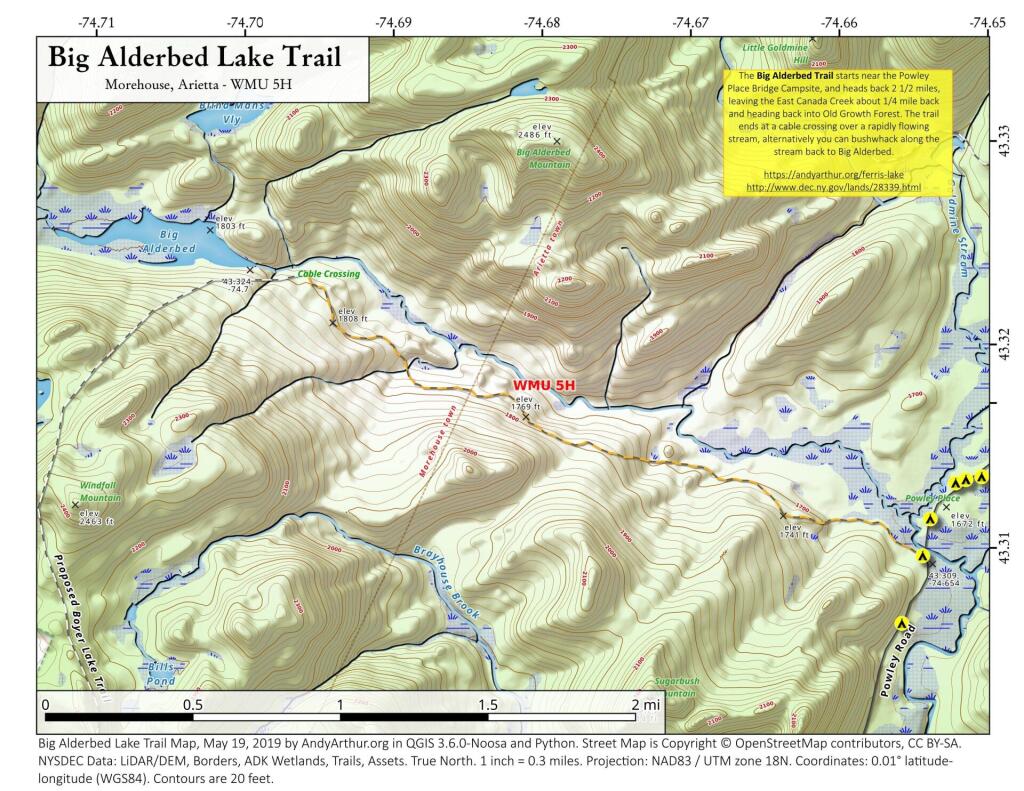
There is an old snowmobile trail/woods road by the Powley Place Bridge, that extends 2.5 miles west to Big Alderbed, that takes you to a wire crossing over the East Branch. The trail follows the East Branch for a short distance, then heads back into an interesting Old Growth Forest with a lot of big trails. To reach Big Alderbed -- which is largely drained wetland due to a failed dam -- you have to bushwhack along the stream to the mouth of the wetland.


Bookmark my free Interactive GPS Map for your phone:
https://andyarthur.org/ny
... shows your location as a blue dot in relationship to campsites, trails, state land. This online map requires cell service, won't work in remote country, so also bring a paper map.
Free Download of New & Historical USGS 1:24k Topograpic Maps
Interactive maps with backcountry and roadside camping: New York, Pennsylvania, West Virginia & Vermont. List of NYS DEC Lean-Tos and Firetowers.
Google Spreadsheet with Roadside, Primitive and Pay Campsites
More about Piseco-Powley Road...
The 17-mile Piseco-Powley Road is a remote dirt route cutting through the Adirondack's Ferris Lake Wild Forest. It features 22 primitive roadside campsites, including four spots at Powley Place where the road crosses the West Branch of the East Canada Creek.
Download the PDF Map Pack with All Maps from Piseco-Powley Road.


")


