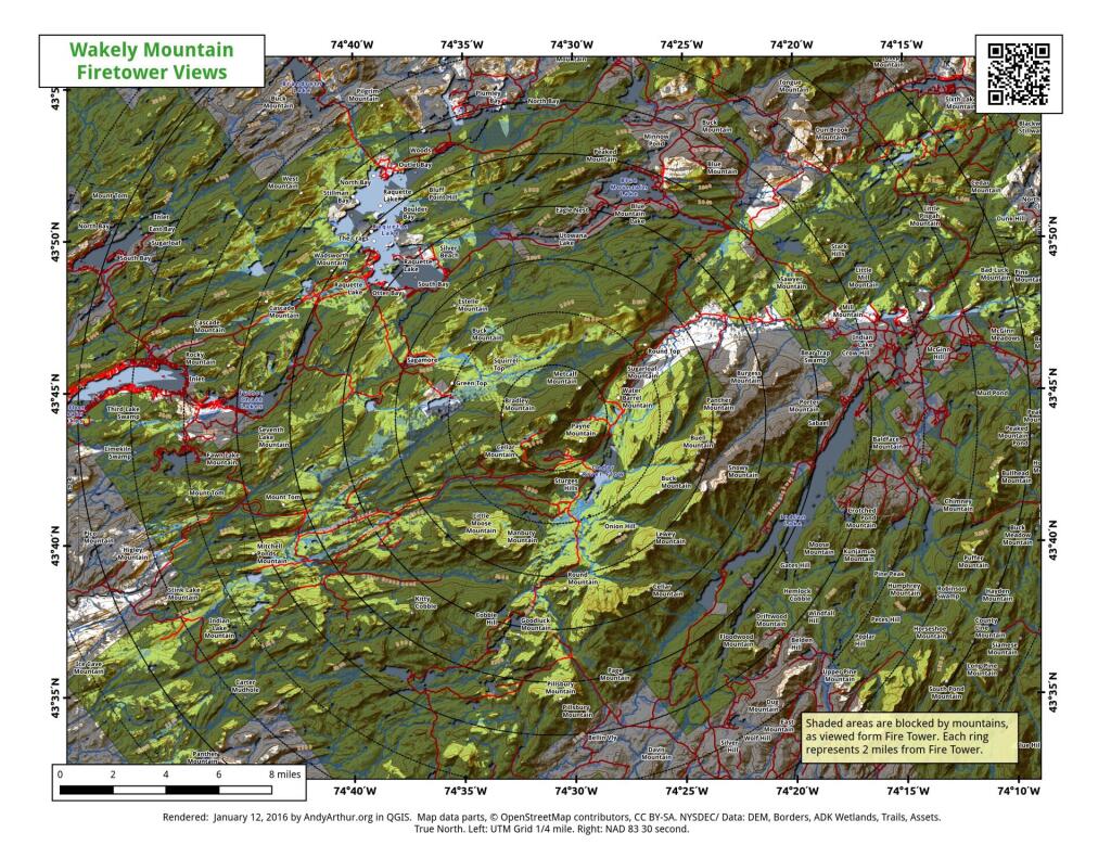
Wakely Mountain Firetower Views
This map gives an overview of mountains and lakes that are visible (and not visible) from Wakely Mountain Firetower. I'm new at doing visibility analysis so it's possible that I don't have the visibility completely correct, but it's an interesting experiment.

The section of Cedar River – Limekiln Lake Road along the Silver River didn’t used to exist
There was no connection between Cellar Mountain Road and Moose River Road along the Silver River until the Conservation Department built the connection in the late 1950s before acquiring the lands due to the parcels being owned by different companies.

Sly Pond
The remote Sly Pond is one of the highest bodies of water in Adirondack Park at an elevation of 2,872 feet. It was once infamous for being a marker of how acidic Adirondack lakes had become by the eighties, with the DEC recording in 1980 the pond having an acidity of 3.54 which is about as "acidic as a dill pickle".


")