Natural Rock Dam Trail
Download a High Resolution JPEG Image of the Natural Rock Dam Trail or an Adobe Acrobat Printable PDF of the Natural Rock Dam Trail.
")

Bookmark my free Interactive GPS Map for your phone:
https://andyarthur.org/ny
... shows your location as a blue dot in relationship to campsites, trails, state land. This online map requires cell service, won't work in remote country, so also bring a paper map.
Free Download of New & Historical USGS 1:24k Topograpic Maps
Interactive maps with backcountry and roadside camping: New York, Pennsylvania, West Virginia & Vermont. List of NYS DEC Lean-Tos and Firetowers.
Google Spreadsheet with Roadside, Primitive and Pay Campsites
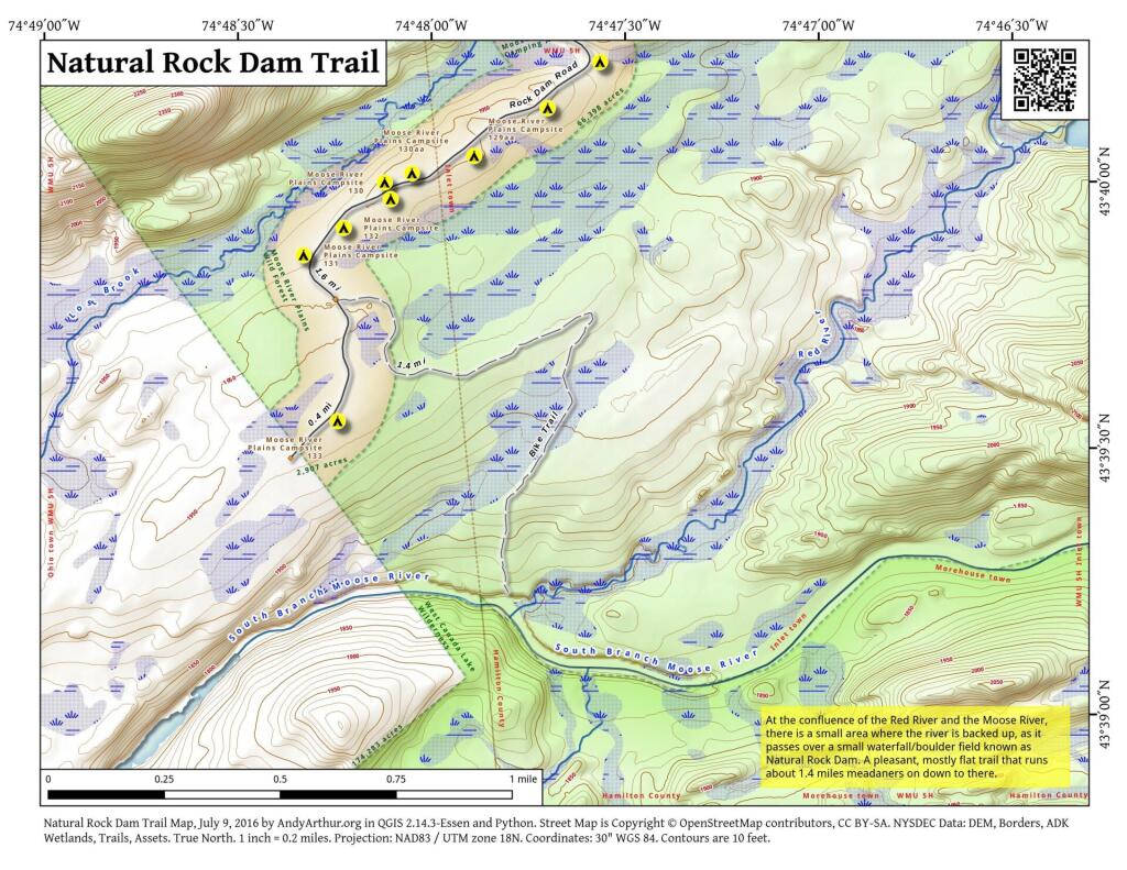
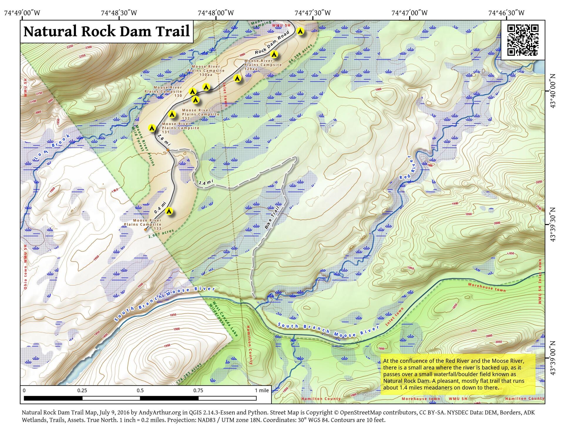
More about Moose River Plains...
Spanning Herkimer and Hamilton Counties, the Moose River Plains Wild Forest offers an array of activities, including camping, hiking, mountain biking, fishing, hunting, and canoeing. Free campsites are accessible from late May to December's end. Winter highlights snowmobiling along the Limekiln Lake-Cedar River Road linking Inlet and Indian Lake. Must-visit spots encompass Cedar River Flow, Moose-spotting at Helldiver Pond, scenic Wakely Mountain with its firetower, as well as numerous smaller ponds and lesser-known trails. This diverse landscape caters to a range of outdoor pursuits, making it a year-round destination for nature enthusiasts and adventurers.
Download the PDF Map Pack with All Maps from Moose River Plains.


 compare to Moose River Plains Camping Area?")


