Moose River Plains Recreation Area
Download a High Resolution JPEG Image of the Moose River Plains Recreation Area or an Adobe Acrobat Printable PDF of the Moose River Plains Recreation Area.
About Map: Moose River Plains Recreation Area ....
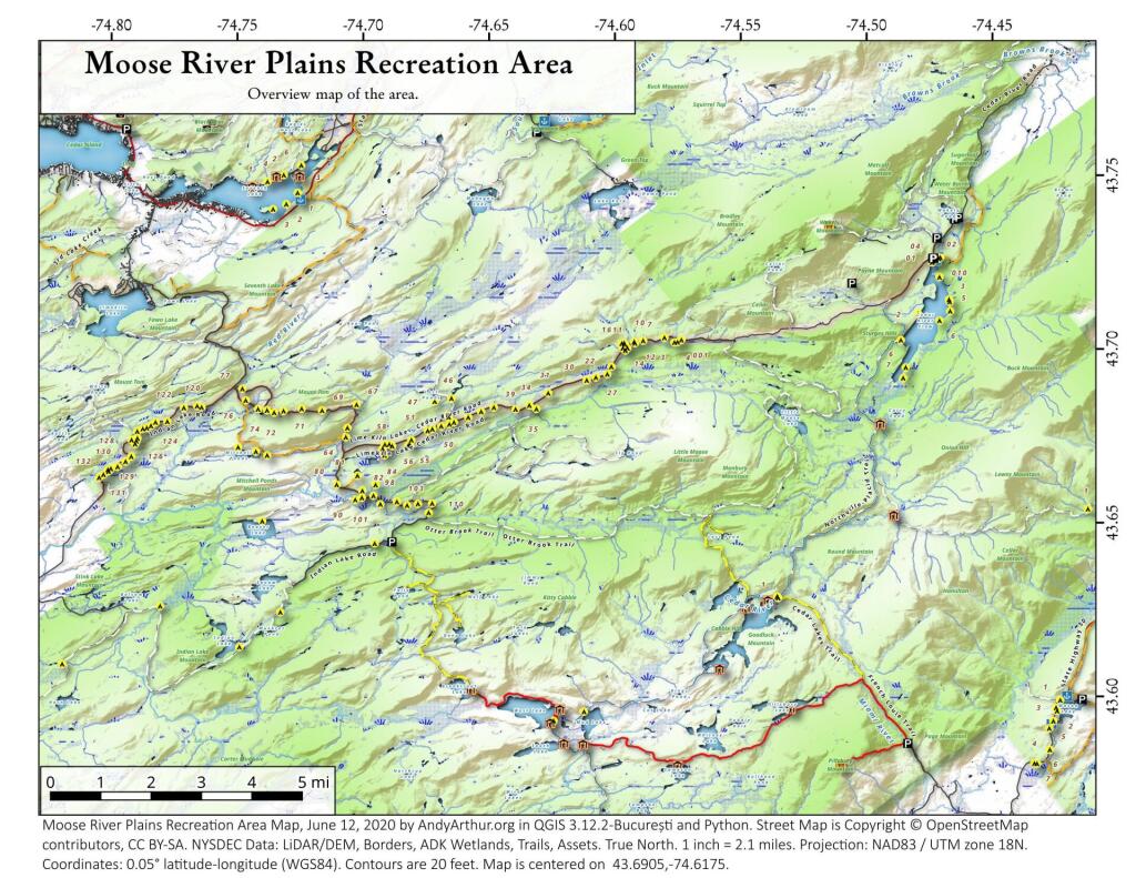
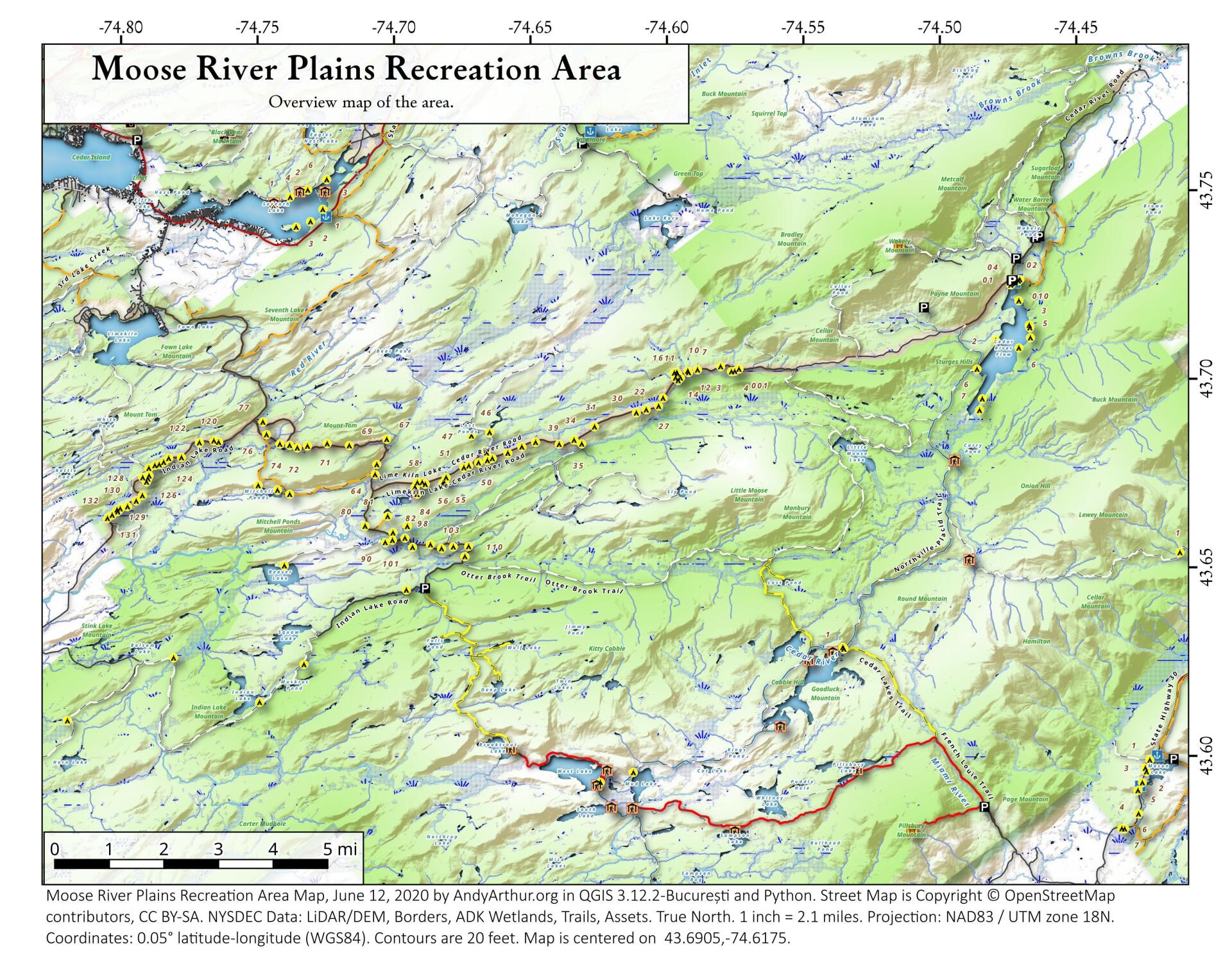
Overview map of Moose River Plains. This shows the location of the campsites and major trails throughout the area. I probably could improve on this map, but I think this does give on a good overview that can be easily printed on an 8x11" sheet of paper.


Bookmark my free Interactive GPS Map for your phone:
https://andyarthur.org/ny
... shows your location as a blue dot in relationship to campsites, trails, state land. This online map requires cell service, won't work in remote country, so also bring a paper map.
Free Download of New & Historical USGS 1:24k Topograpic Maps
Interactive maps with backcountry and roadside camping: New York, Pennsylvania, West Virginia & Vermont. List of NYS DEC Lean-Tos and Firetowers.
Google Spreadsheet with Roadside, Primitive and Pay Campsites
More about Moose River Plains...
Spanning Herkimer and Hamilton Counties, the Moose River Plains Wild Forest offers an array of activities, including camping, hiking, mountain biking, fishing, hunting, and canoeing. Free campsites are accessible from late May to December's end. Winter highlights snowmobiling along the Limekiln Lake-Cedar River Road linking Inlet and Indian Lake. Must-visit spots encompass Cedar River Flow, Moose-spotting at Helldiver Pond, scenic Wakely Mountain with its firetower, as well as numerous smaller ponds and lesser-known trails. This diverse landscape caters to a range of outdoor pursuits, making it a year-round destination for nature enthusiasts and adventurers.
Download the PDF Map Pack with All Maps from Moose River Plains.


 compare to Moose River Plains Camping Area?")


![Photo: Summner Stream [Expires July 24 2026]](/data/photo_25085_small.jpg "Photo: Summner Stream [Expires July 24 2026]")


![Photo: Stickered [Expires July 24 2026]](/data/photo_25064_small.jpg "Photo: Stickered [Expires July 24 2026]")
No Comments
Hi There – I love your site and the work that you are doing.
I work with partners to locate native and heritage strain brook trout in the Adirondacks, to preserve them and their habitats. We are planning an expedition this Spring from the Lost Ponds campsites up the Sumner Stream corridor to Lake Kora. Is there any chance you could produce a high quality map of these environs in the MRP?