primative camping

Aldrich Pond Wild Forest
The Aldrich Pond Wild Forest Wild Forest Unit Management Plan mentions the following about Roadside Camping in the area…
“Most of the camping on this area occurs during the hunting season and much of this is along the Streeter Lake Road. Sixteen campsites have been designated along this corridor and two pit privies established to accommodate this use.”
— NYSDEC Aldrich Pond Wild Forest UMP.
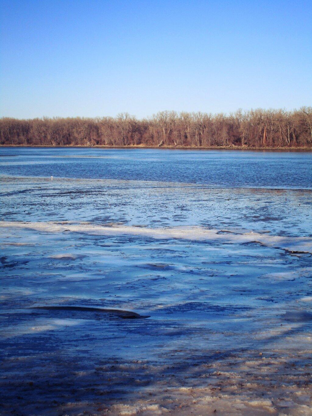
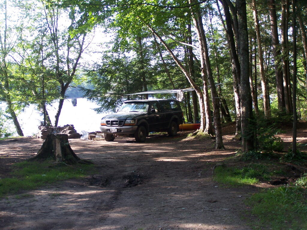
Roadside Campsite.
| Road | Number of Sites |
|---|---|
| Streeter Lake Rd. | 16 |
More Resources…
|
|
View Street Lake Campsites in a larger map
Jessup River Wild Forest
Jessup River Wild Forest is a parcel of lands surrounding the International Paper’s Perkins Clearing Timberlands and Speculator Tree Farm. There are about a dozen informal campsites along Mason Pond on Perkins Clearing Road that are popular, with about 6 of them with direct road access for a small vehicle like a pop-up trailer or a pickup truck with a cap. Only a few of the sites are clearly designated as such, but they all are very well used.
Significant noise pollution from NY 30 can be heard at some of the sites. There are no outhouses, although there are five gallon buckets people use for toilets. Besides the sites on Perkins Clearing Road in Jessup River Wild Forest, there are also eight designated road-side sites in International Paper Timberlands known as Perkins Clearing, just south of Jessup River Wild Forest.
The following changes are proposed in the Jessup River Wild Forest Unit Managemen Plan.
“Close Undesignated Campsites and /or Restrict Type of Camping. This alternative would propose the removal of user created primitive tent sites within 150 of water or road for environmental or social reasons. Camping structures would be restricted by regulation to “tents, tarps and lean-to’s as required by the APSLMP, thereby eliminating use of travel trailers, “pop-up” style campers, tent trailers, or structures of similar fashion. This option would eliminate opportunities for individuals seeking an easily accessible camping site close to a lake or road. Current regulations allow for camping anywhere in the JRWF as long as the 150 foot set back requirement is met. People would probably still park by the road and camp further in without any controls. This alternative would also restrict opportunities for mobility impaired individuals to access the lake and/or camp on JRWF lands. Therefore, this alternative will not be supported by this UMP.”
“The preferred alternative is to designate sites taking into consideration day use of the area, appropriate existing sites, APSLMP spacing guidelines, and terrain constraints. Because of their anticipated popularity, permits to stay for more than three nights will not be issued for sites in heavy demand during the core camping season. The camping areas at the northwest end of the lake will be closed due to conflicts with day users and environmental constraints. Other sites that are unsuitable or too close to the water will be closed and revegetated.”
“The closure of fourteen sites along with official designation of 10 suitable sites will reduce the amount of camping the area is currently experiencing. When all sites have been occupied, users will be directed to camp elsewhere. The opening of the adjacent IP lands to camping under the conservation easement will accommodate overflow camping. Use levels and site impacts will be closely monitored on the designated sites. If LAC standards are exceeded, the individual site will be closed and/or rehabilitated.”
— NYSDEC Jessup River Wild Forest UMP.
Confirmed Roadside Campsites.
| Road | Number of Campsites |
|---|---|
| Perkins Clearing Road at Mason Lake |
6 drive-in sites 4 tent sites |
Maps.
Map of Jessup River Wild Forest. Inset is Perkins Clearing and Speculator Tree Farm Easements. Campsites do not appear on these maps, but they give a general overview of the area.
Map of Perkins Clearing and Speculator Tree Farm. There are 10 campsites designated on these parcels, drive around to find them. Campsites do not appear on this map.
More Resources…
|
|


Saranac Lakes Wild Forest
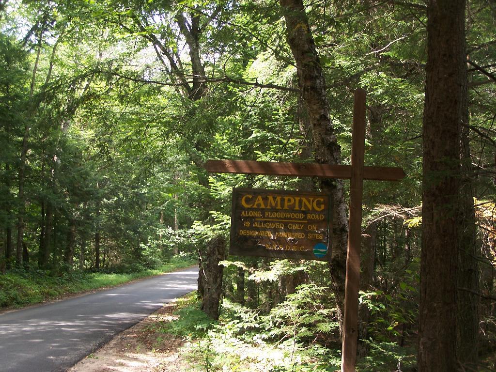
There are 16 designated campsites along Floodwood Road. Of those sites, one is located on Middle Pond, five densely spaced on Poliwog Pond, 10 others spread out along the road, approximently 1/4 mile apart. There has been discussion of closing and/or relocating some of the five designated campsites on Poliwog Pond. They literally are spaced within 10 feet of each other, with no buffers. The other sites are nicer along Floodwood Road. Note that there is an aggressive enforcement presence on Floodwood Road, so if you are going here just to hang out, be aware State Forest Rangers may be checking for compliance with law (camping in designated locations only, staying less then 3 nights without a permit, not being too noisey or disruptive).
The SUNY ESF/APA Roadside Camping in Adirondack Park Study also mentions 3 campsites on Hoel Pond Road which is just off Floodwood Road, and 9 campsites on Fish Hachery Road, just off of NY 30. The Unit Management Plan is not online, and they do not appear on State Land Interactive Mapper, so I can not confirm the current existence of these sites, so they are not included in the list.
Sarnac Lakes Wild Forest Map.
Please be aware that this map does not indicate campsite locations.
Confirmed Roadside Campsites.
| Road | Number of Campsites |
|---|---|
| Floodwood Road | 16 |
More Resources…
|
|
Vanderwhacker Mountain Wild Forest
The Vanderwhacker Mountain Wild Forest Unit Management Plan mentions the following about Roadside Camping in the area…
“The area has a diverse mix of camping options available to visitors. There are designated interior camping facilities at Stony Pond, Cheney Pond, 29th Pond, and Newcomb Lake. There are also many Vanderwhacker Mountain Wild Forest roadside locations used seasonally by hunters and during the summer by others along the Northwoods Club Road, the Moose Pond Road, State Route 28N and at other locations. There is generally an increasing in camping in VMWF during the regular big game season.”
— NYSDEC Vanderwhacker Mountain Wild Forest UMP.
Current Campsites Map.
Roadside Campsites Designated in UMP.
| Road | Number of Campsites |
|---|---|
| Boreas Road | 1 |
| Moose Pond Road | 3 |
| North Woods Road | 3 |
| NY 28N at Boreas River | 1 |
More Resources…
|