Day: April 7, 2026💾
🗺️ Maps


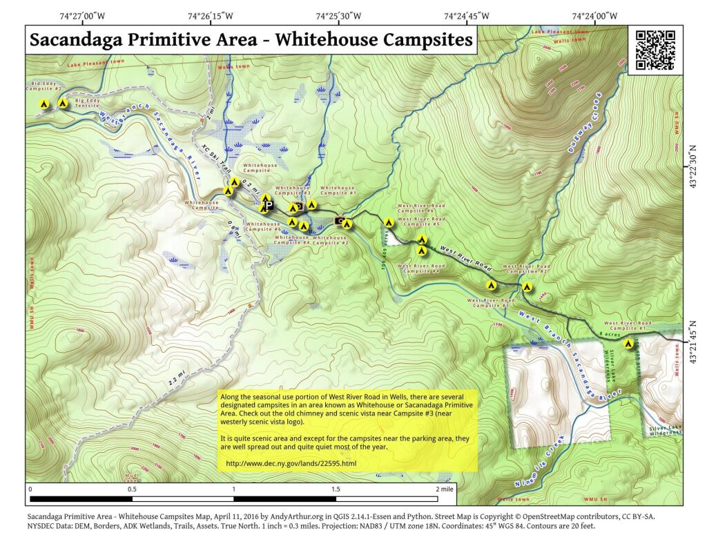
Sacandaga Primitive Area – Whitehouse Campsites
The DEC recently GPS'd the various designated campsites at Whitehouse area of the Sacanadaga Primitive Area along West River Road in Wells. This provides a pretty accurate map of the various campsite locations. West River Road isn't open to motor vehicles yet, but will open later in May once the frost is out of the ground and the dirt road isn't too soft.