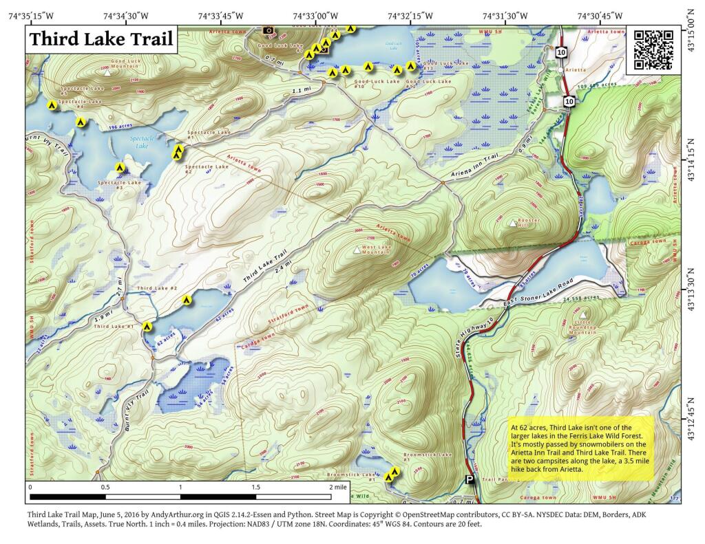
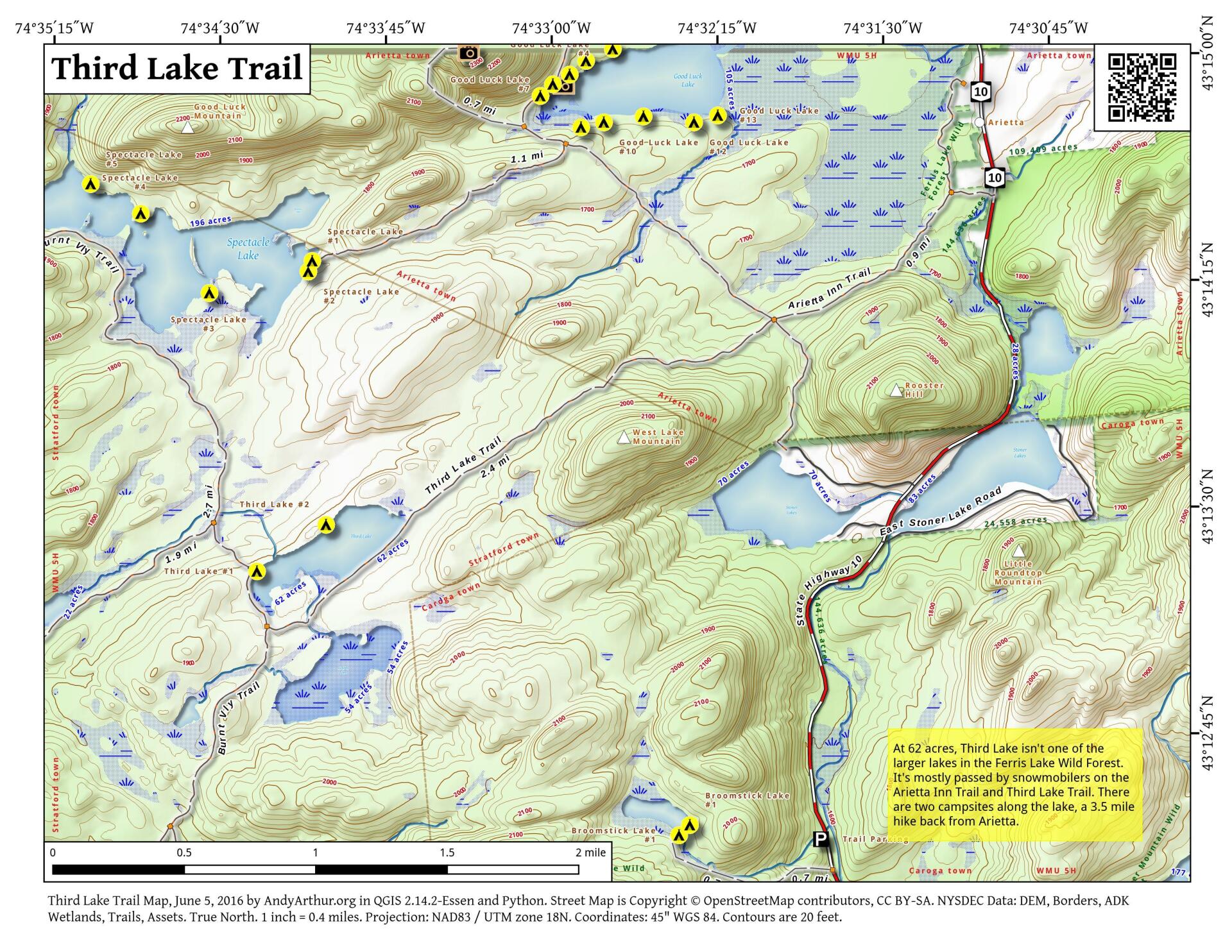
Third Lake Trail
Download a High Resolution JPEG Image of the Third Lake Trail or an Adobe Acrobat Printable PDF of the Third Lake Trail.


Bookmark my free Interactive GPS Map for your phone:
https://andyarthur.org/ny
... shows your location as a blue dot in relationship to campsites, trails, state land. This online map requires cell service, won't work in remote country, so also bring a paper map.
Free Download of New & Historical USGS 1:24k Topograpic Maps
Interactive maps with backcountry and roadside camping: New York, Pennsylvania, West Virginia & Vermont. List of NYS DEC Lean-Tos and Firetowers.
Google Spreadsheet with Roadside, Primitive and Pay Campsites
More about Ferris Lake Wild Forest...
Encompassing a vast expanse of 147,454 acres, the Ferris Lake Wild Forest is characterized by the presence of ancient spruce stands. These can be observed along the Powley-Piseco Road, the northern banks of Alderbed Stream, the vicinity of Blind Man’s Vly, and the slopes of both Big and Little Alderbed Mountains. Adding to its allure, the region boasts an array of ponds, lakes, and streams, attracting outdoor enthusiasts and sportsmen year-round.
The Wild Forest accommodates 14.6 miles of hiking trails, along with an extensive 117-mile network of snowmobile trails (many of which are multi-use), catering to various recreational preferences. With 97 primitive campsites, a boat launch, and a boat dock, the area is well-equipped for adventurers. Furthermore, the public can access 10.95 miles of roads, granting motorized entry to this expansive and captivating property.
https://www.dec.ny.gov/lands/114279.html
Download the PDF Map Pack with All Maps from Ferris Lake Wild Forest.


