Lyon Mountain Fire Tower
Download a High Resolution JPEG Image of the Lyon Mountain Fire Tower or an Adobe Acrobat Printable PDF of the Lyon Mountain Fire Tower.

Bookmark my free Interactive GPS Map for your phone:
https://andyarthur.org/ny
... shows your location as a blue dot in relationship to campsites, trails, state land. This online map requires cell service, won't work in remote country, so also bring a paper map.
Free Download of New & Historical USGS 1:24k Topograpic Maps
Interactive maps with backcountry and roadside camping: New York, Pennsylvania, West Virginia & Vermont. List of NYS DEC Lean-Tos and Firetowers.
Google Spreadsheet with Roadside, Primitive and Pay Campsites
More about Lyon Mountain...
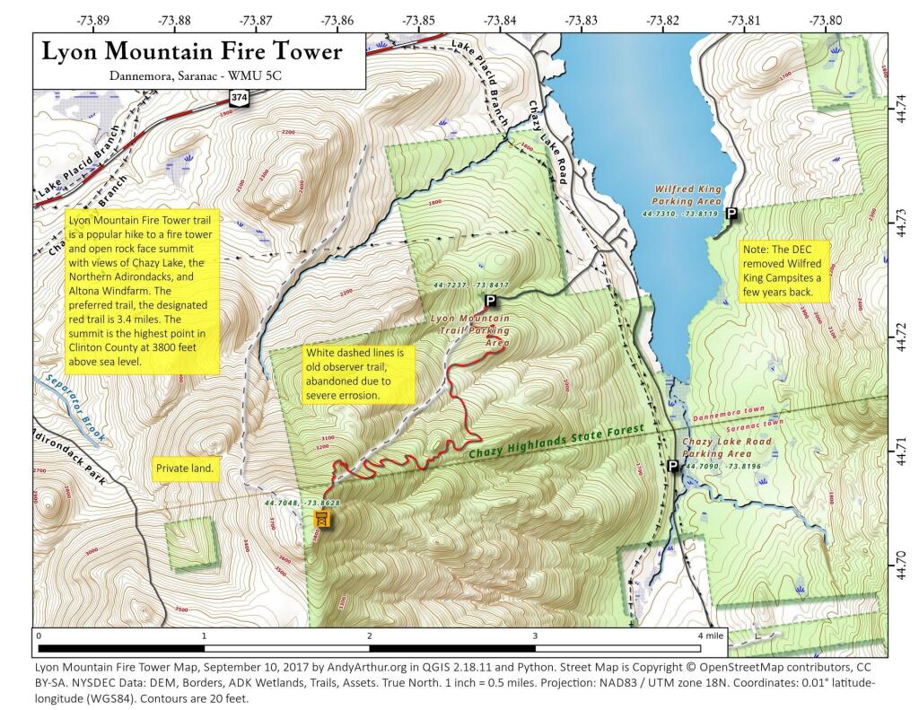
Lyon Mountain, at 3830 feet, is the highest point in Clinton County and the highest point north of the Saranac River. It is located in the northeastern part of Adirondack Park, west of Plattsburgh, NY in the Chazy Highlands Wild Forest. There is a new 3.4 mile trail that winds its way to the summit and fire tower. The trail has an overall elevation gain of 1900 feet over the 3.4 miles.
The hike is long but you are rewarded with a 360 degree view from the fire tower. Views all the way to Montreal to the north, the Green Mountains and Vermont to the East and the high peaks to the south.
http://www.cnyhiking.com/LyonMountain.htm


