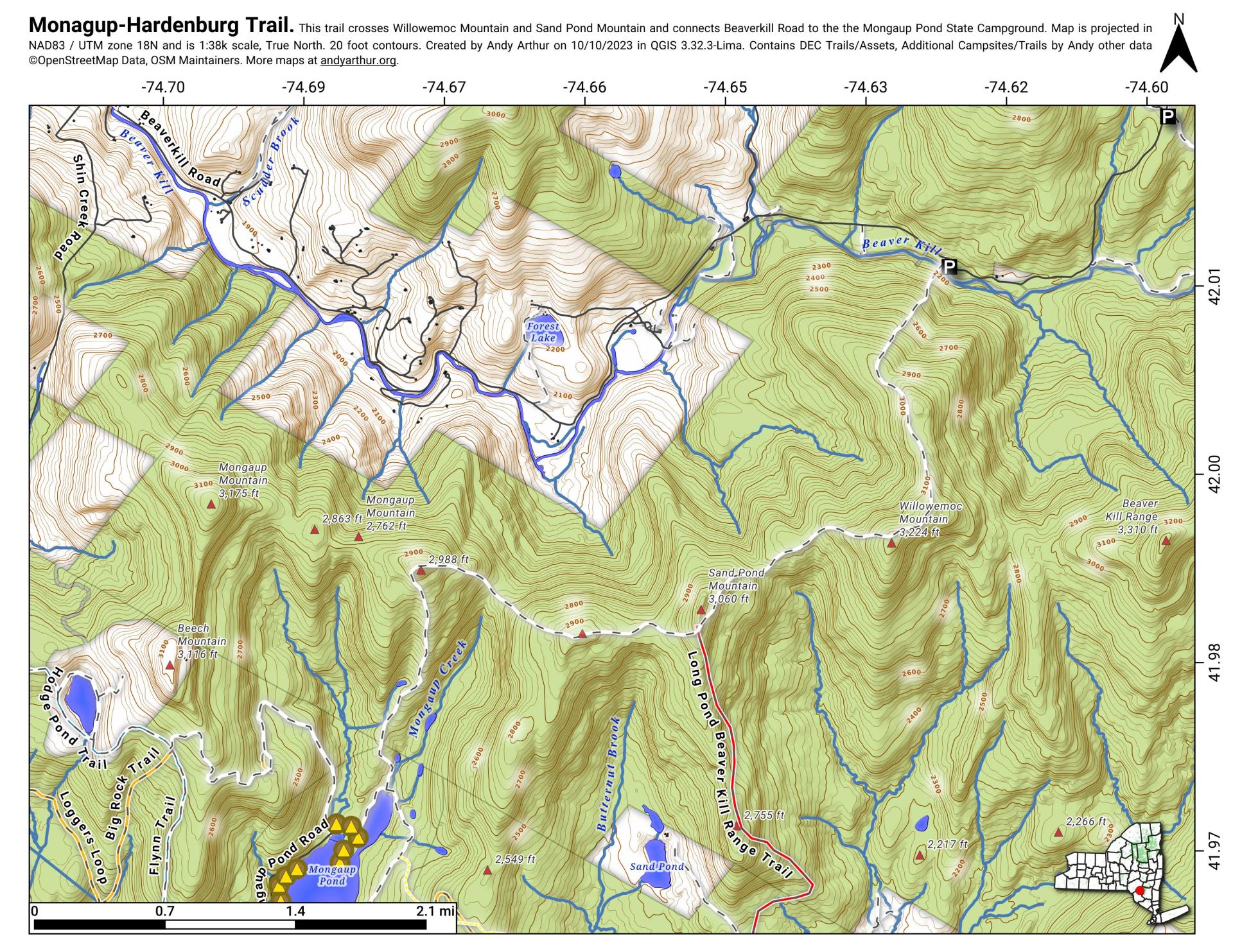
Mongaup Hardenburg Trail
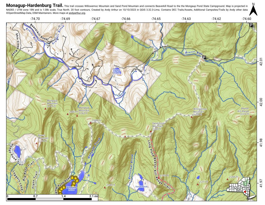
Download a High Resolution JPEG Image of the Mongaup Hardenburg Trail or an Adobe Acrobat Printable PDF of the Mongaup Hardenburg Trail.


Bookmark my free Interactive GPS Map for your phone:
https://andyarthur.org/ny
... shows your location as a blue dot in relationship to campsites, trails, state land. This online map requires cell service, won't work in remote country, so also bring a paper map.
Free Download of New & Historical USGS 1:24k Topograpic Maps
Interactive maps with backcountry and roadside camping: New York, Pennsylvania, West Virginia & Vermont. List of NYS DEC Lean-Tos and Firetowers.
Google Spreadsheet with Roadside, Primitive and Pay Campsites
More about Balsam Lake Mountain Wild Forest...
Located in the southwest corner of the Catskill Park, Balsam Lake Mountain Wild Forest contains more than 13,500 acres of "forever wild" Forest Preserve. With an extensive trail network to several ponds, this wild forest is ideal for hiking, camping, fishing, hunting, backpacking, canoeing and cross-country skiing.
The Balsam Lake Mountain Wild Forest is located 8 miles south of Margaretville (Route 28) and 18 miles north of Livingston Manor (Route 17). It lies mainly within the western Ulster County town of Hardenburgh, with small appendages in the towns of Middletown and Andes in Delaware County.
The terrain is a combination of high mountain ridges, steep sided valleys, numerous brooks and ponds, with elevations ranging from a low of 1,740 feet along Mill Brook to a high of 3,723 feet at the summit of Balsam Lake Mountain.
Download the PDF Map Pack with All Maps from Balsam Lake Mountain Wild Forest.


No Comments
What you said about BLM Wild Forest is true. Bit the trail isn’t in it. The south side of Beaverkill Road is Big Indian Wilderness.