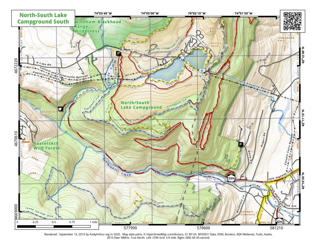
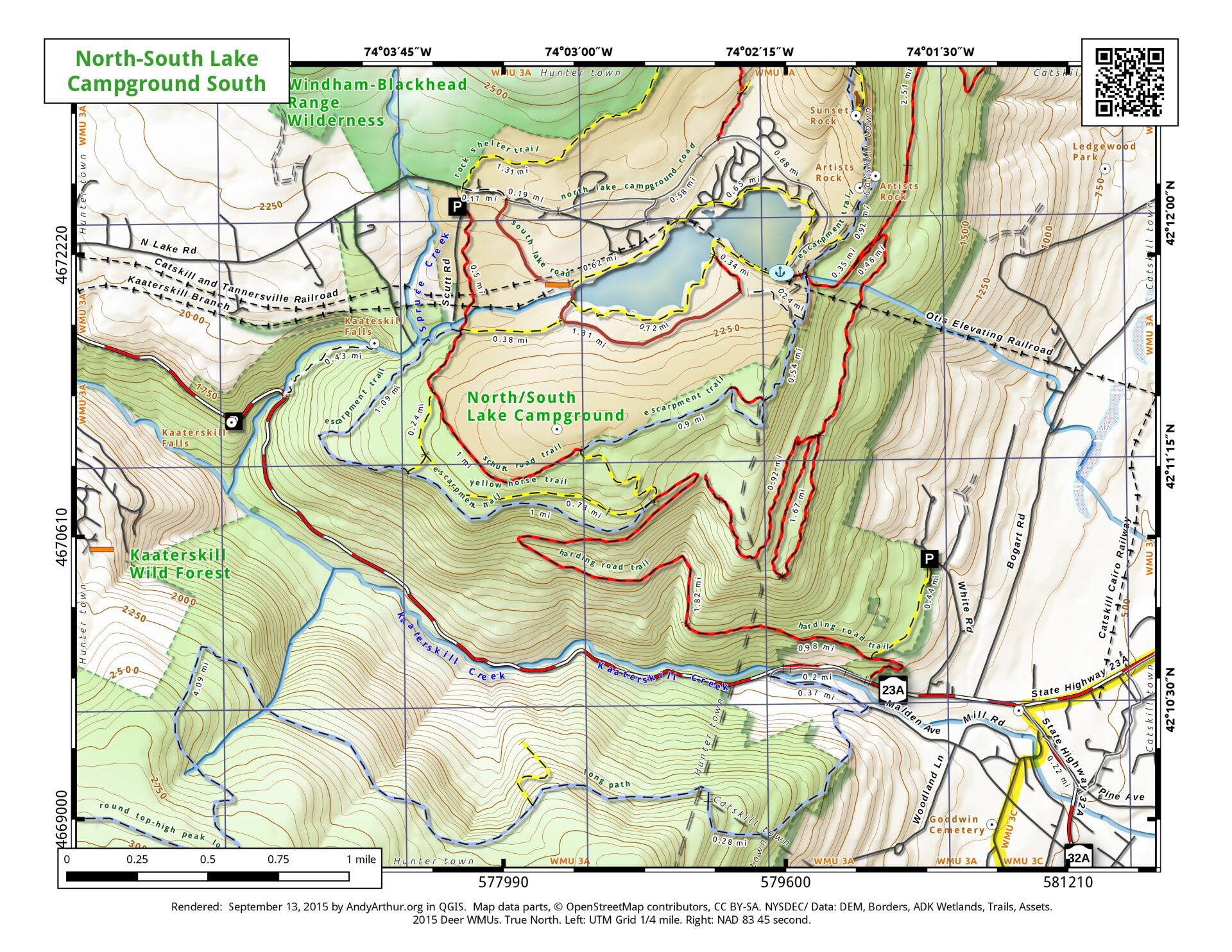
North-South Lake Campground and Kaaterskill Clove
Download a High Resolution JPEG Image of the North-South Lake Campground and Kaaterskill Clove or an Adobe Acrobat Printable PDF of the North-South Lake Campground and Kaaterskill Clove.
About Map: North-South Lake Campground and Kaaterskill Clove ....
Here is a revised map of the North-South Lake Campground and the various trails of the Kaaterskill Clove. Further revisions of this map will be needed for 2016, to reflect the additional new trails being added around Kaaterskill Falls.


Bookmark my free Interactive GPS Map for your phone:
https://andyarthur.org/ny
... shows your location as a blue dot in relationship to campsites, trails, state land. This online map requires cell service, won't work in remote country, so also bring a paper map.
Free Download of New & Historical USGS 1:24k Topograpic Maps
Interactive maps with backcountry and roadside camping: New York, Pennsylvania, West Virginia & Vermont. List of NYS DEC Lean-Tos and Firetowers.
Google Spreadsheet with Roadside, Primitive and Pay Campsites
More about Kaaterskill Clove...
Download the PDF Map Pack with All Maps from Kaaterskill Clove.


