Kaaterskill Clove 📍

🗺️ Maps 🖼️ Photos

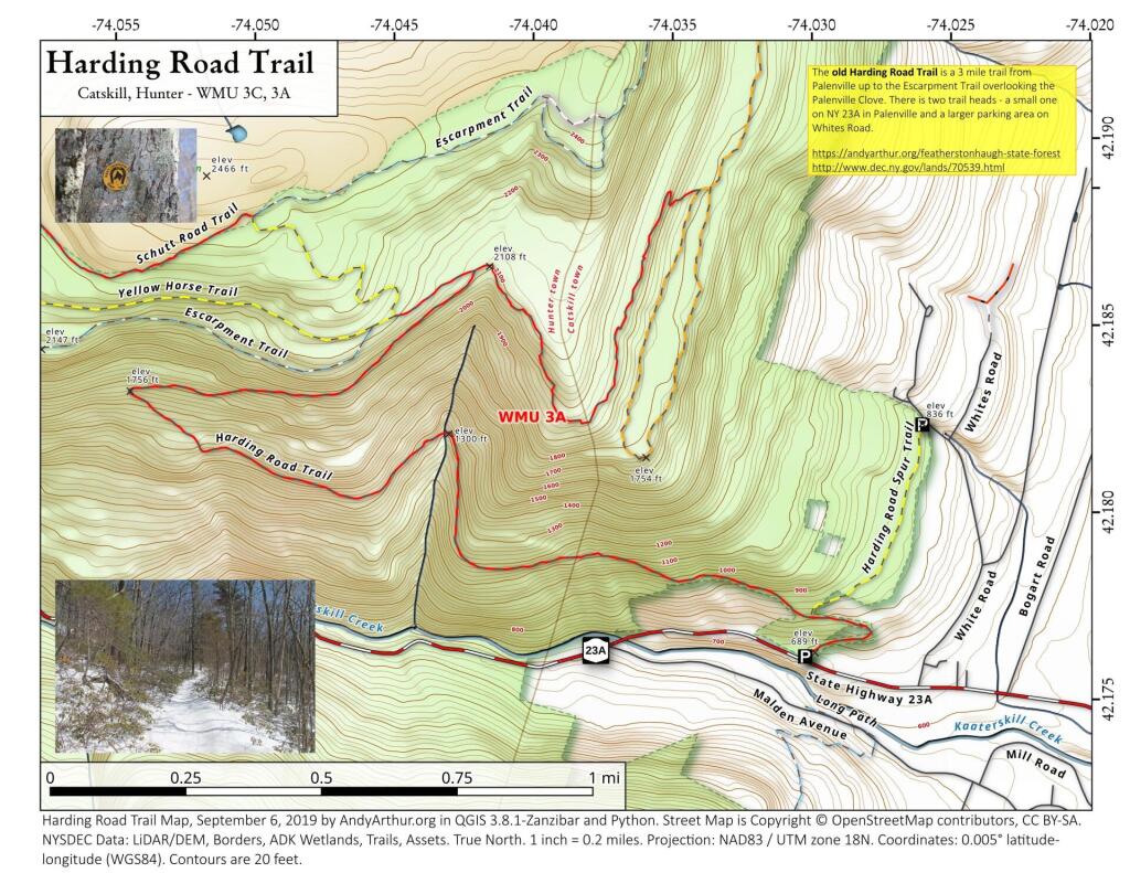
Harding Road Trail

The Harding Road Trail is an old carriageway built to the former Kaaterskill Mountain House, long abandoned but still largely remaining 25-foot wide road cut into the side of South Mountain, running 2 miles from Palenville to the old carriageway looping around South Mountain.  Additional parking is available along Whites Road.

 Harding Road Trail

Map: Battery Diagram

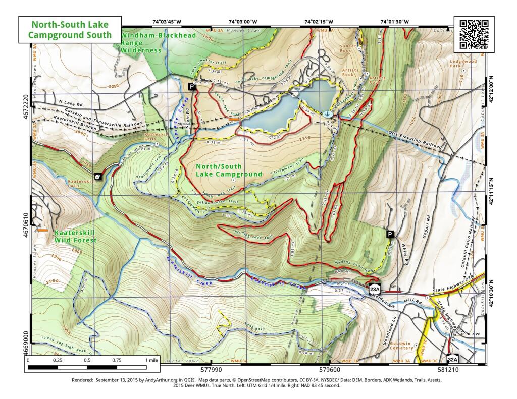
North-South Lake Campground and Kaaterskill Clove

Here is a revised map of the North-South Lake Campground and the various trails of the Kaaterskill Clove. Further revisions of this map will be needed for 2016, to reflect the additional new trails being added around Kaaterskill Falls.

 North-South Lake Campground and Kaaterskill Clove

Thematic Map: Percent of Land Forested – New York State Counties in 2021
Map: Severence Hill Trail