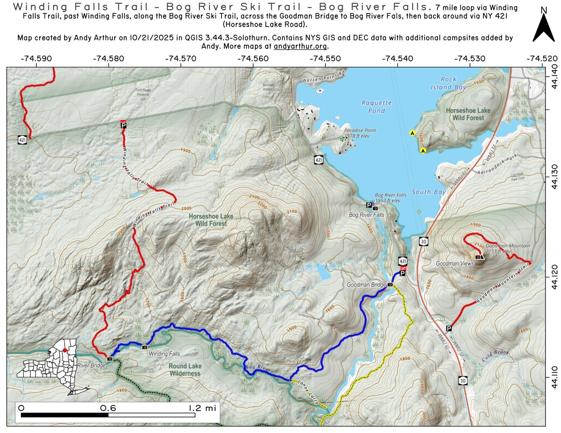
Winding Falls Trail – Bog River Ski Trail – Bog River Falls

Download a High Resolution JPEG Image of the Winding Falls Trail - Bog River Ski Trail - Bog River Falls or an Adobe Acrobat Printable PDF of the Winding Falls Trail - Bog River Ski Trail - Bog River Falls.


Bookmark my free Interactive GPS Map for your phone:
https://andyarthur.org/ny
... shows your location as a blue dot in relationship to campsites, trails, state land. This online map requires cell service, won't work in remote country, so also bring a paper map.
Free Download of New & Historical USGS 1:24k Topograpic Maps
Interactive maps with backcountry and roadside camping: New York, Pennsylvania, West Virginia & Vermont. List of NYS DEC Lean-Tos and Firetowers.
Google Spreadsheet with Roadside, Primitive and Pay Campsites
More about Horseshoe Lake Wild Forest...
Located mostly on the southern shores of Tupper Lake, Horseshoe Lake Wild Forest is popular for those adventurers looking to escape the crowds of Tupper Lake. There are six primitive camping spots available along Horseshoe Lake, with a few others away from the lake. The wild forest also has access of Lows Lake & Hitchins Pond Primitive Area for those looking to explore the area. The Bog River is a very popular destination, however the most popular hiking destination is the fire tower on Mount Arab.
http://www.cnyhiking.com/HorseshoeLakeWildForest.htm
Download the PDF Map Pack with All Maps from Horseshoe Lake Wild Forest.


