The Gates Are Open! The Gates Are Open!

For roughly six months out of the year — from the first significant snow storm until the end of mud season, the gates to many of the most popular roads in the Adirondacks are closed to prevent idiots from getting stuck, and to keep the backcountry roads from getting too torn up.

Gate at Otter Brook Bridge

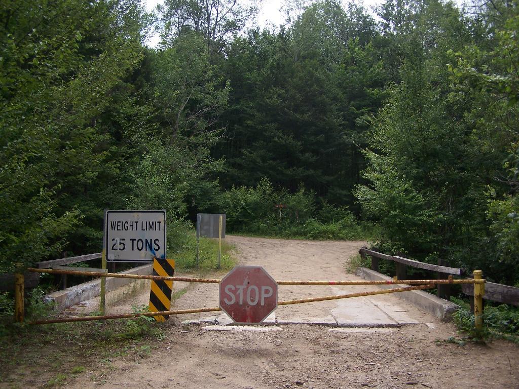
Yet, that season has come to an end. Mud season is now just history. Okay, maybe the roads are somewhat sloppy from recent rains, but at least now the opening of the gates marks the start of Adirondack Summer 2012.

Otter Brook Bridge

So many adventures are ahead. So many summer time memories to be created as we proceed through summer. Most places in the park now are open, with so many chances to get away and freely explore whereever and whenever we want.

Map: Bear Pond Trail
Map: Beaver Lake
Map: Ice House Pond
Map: Moose River Plains Camping Area 1-30
Map: Moose River Plains Camping Area 123-131
Map: Moose River Plains Camping Area 30-40
Map: Moose River Plains Camping Area 41-61
Map: Moose River Plains Camping Area 64-74
Map: Moose River Plains Camping Area 71-123
Map: Moose River Plains Camping Area 80-110
Map: Moose River Plains Camping Area 80-111
Map: Moose River Plains Recreation Area
Map: Natural Rock Dam Trail
SVGZ Graphic: Jun-2026-moon-phase [Expires June 16 2026]
Terrain Map: How does the area of Manhattan (rotated) compare to Moose River Plains Camping Area?
Terrain Map: Moose River Plains
Terrain Map: Topography Of Moose River Plains
Photo: Onion Hill
Photo: Muddy at Moose River Plains
Photo: Bridge Over Cedar River
Photo: Wakely Fire Tower
Photo: Despite The Sign, This Isn't a Loop
Photo: Firetower Cabin
Photo: Camping Down By Otter Brook
Photo: Red River
Photo: Clouds Parting for Clear Day
Photo: Deteriorating Tower Foundations

Leave a Reply

Your email address will not be published. Required fields are marked *