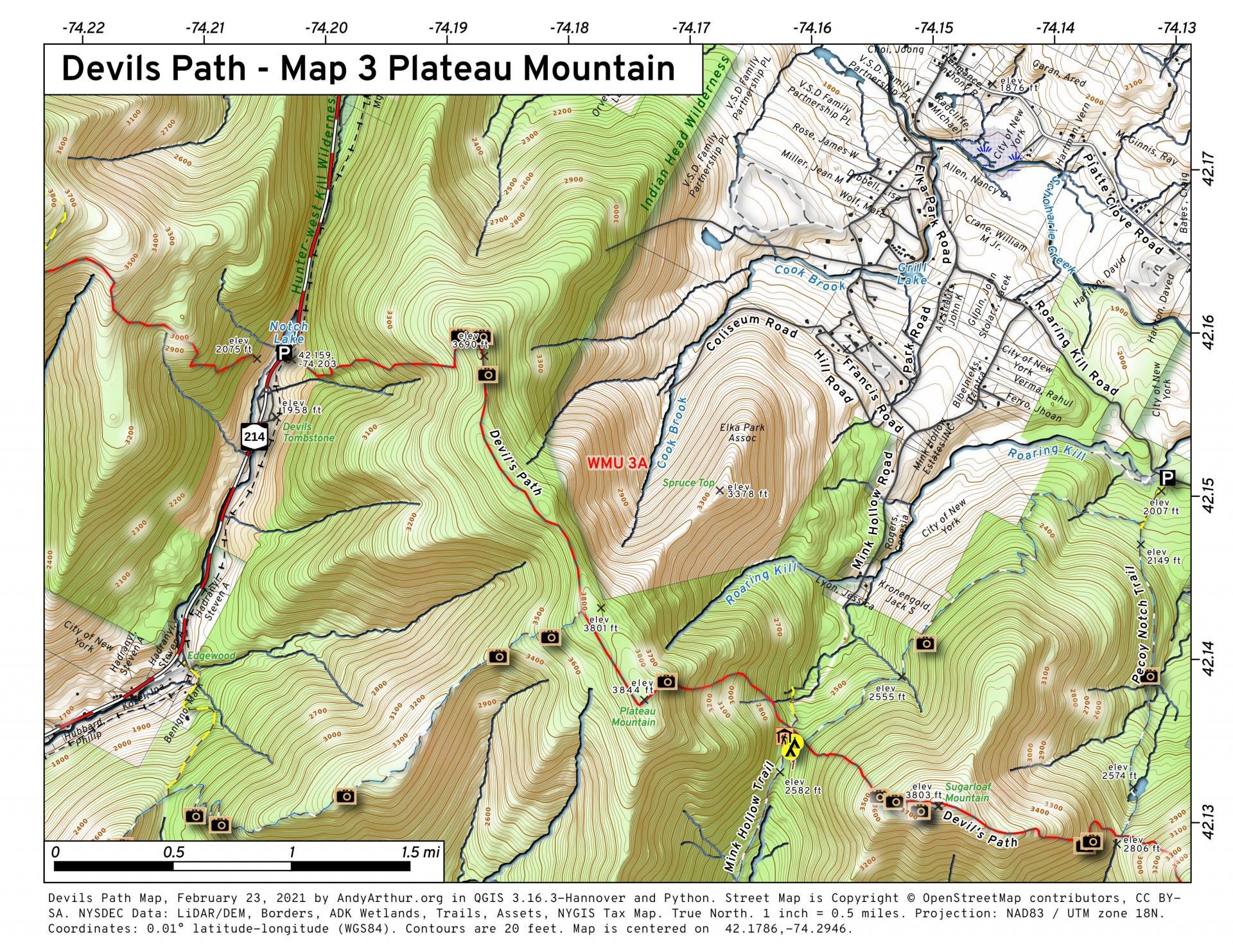
Devils Path – Map 3 Plateau Mountain
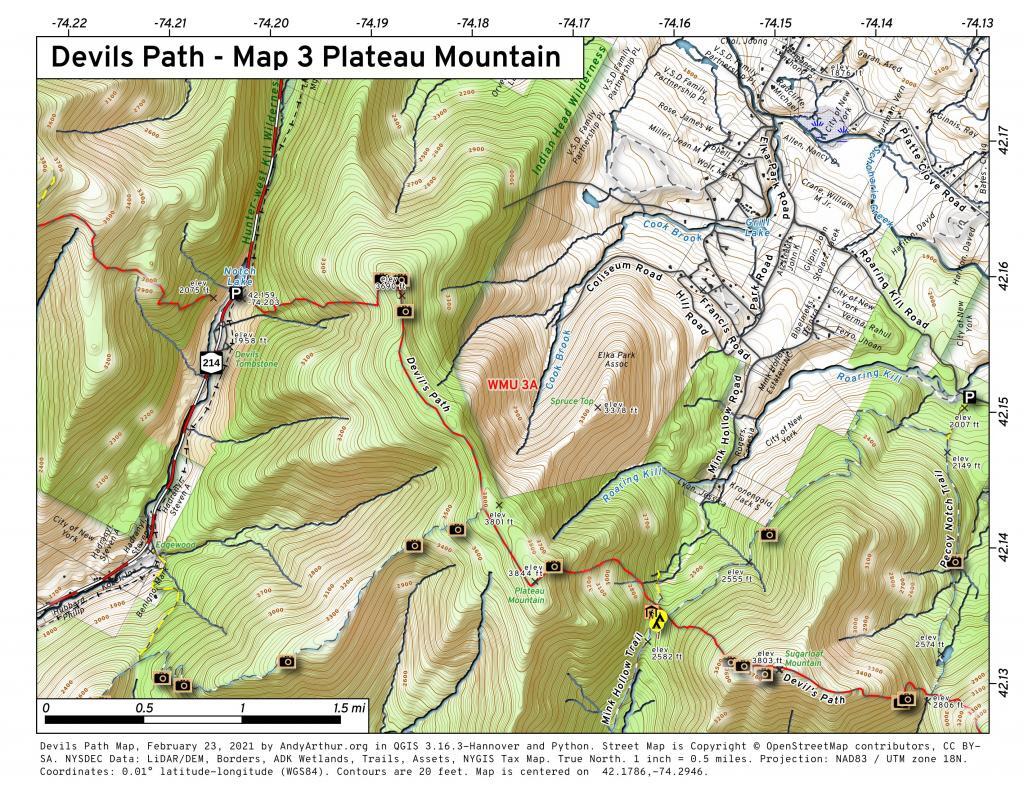
Download a High Resolution JPEG Image of the Devils Path - Map 3 Plateau Mountain or an Adobe Acrobat Printable PDF of the Devils Path - Map 3 Plateau Mountain.


Bookmark my free Interactive GPS Map for your phone:
https://andyarthur.org/ny
... shows your location as a blue dot in relationship to campsites, trails, state land. This online map requires cell service, won't work in remote country, so also bring a paper map.
Free Download of New & Historical USGS 1:24k Topograpic Maps
Interactive maps with backcountry and roadside camping: New York, Pennsylvania, West Virginia & Vermont. List of NYS DEC Lean-Tos and Firetowers.
Google Spreadsheet with Roadside, Primitive and Pay Campsites
More about Devil's Path...
The Devil's Path is the name of a mountain range and hiking trail in the Greene County portion of New York's Catskill Mountains. The mountains commonly considered to be part of the Devil's Path are, from west to east, West Kill, Hunter, Plateau, Sugarloaf, Twin, and Indian Head.
The name comes from early settlers of the region, who believed the range's craggy cliffs were specially built by the devil so that he alone could climb them and occasionally retreat from the world of men. Today, they are famous for the deep gaps between them, which get lower in elevation as the mountains between them get higher when proceeding westward on the hiking trail.
The mountains and the land around them were acquired by the state as Forest Preserve and made part of the Catskill Park in the 1920s and '30s. Today the area is managed by the New York State Department of Environmental Conservation as the Indian Head Wilderness Area.
http://en.wikipedia.org/wiki/Devil's_Path_(hiking_trail)
Download the PDF Map Pack with All Maps from Devil's Path.


