Kasoag State Forest
Download a High Resolution JPEG Image of the Kasoag State Forest or an Adobe Acrobat Printable PDF of the Kasoag State Forest.


Bookmark my free Interactive GPS Map for your phone:
https://andyarthur.org/ny
... shows your location as a blue dot in relationship to campsites, trails, state land. This online map requires cell service, won't work in remote country, so also bring a paper map.
Free Download of New & Historical USGS 1:24k Topograpic Maps
Interactive maps with backcountry and roadside camping: New York, Pennsylvania, West Virginia & Vermont. List of NYS DEC Lean-Tos and Firetowers.
Google Spreadsheet with Roadside, Primitive and Pay Campsites
More about Kasoag State Forest...
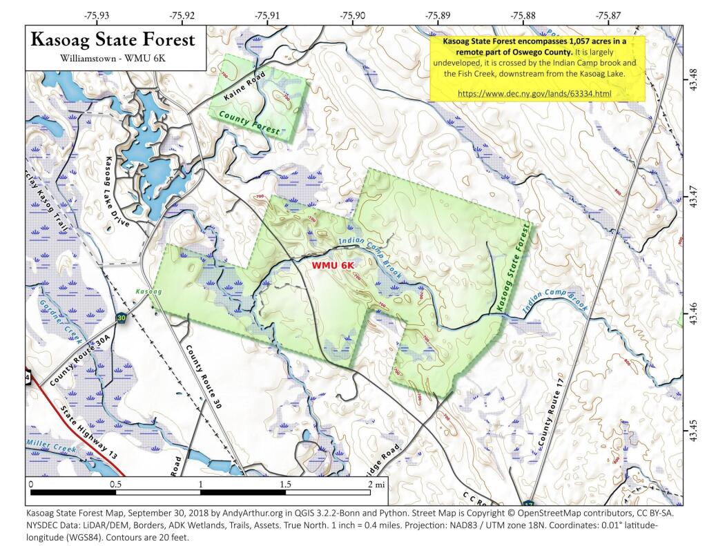
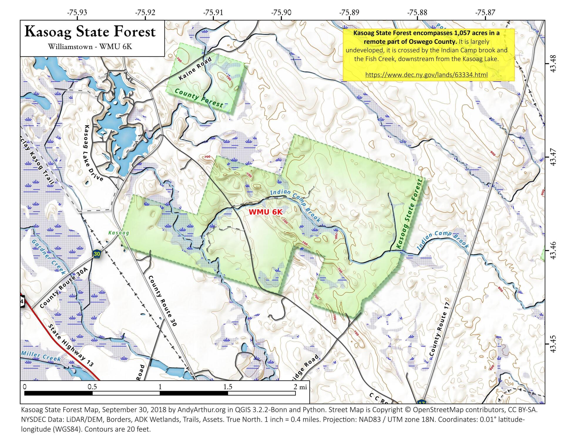
Kasoag State Forest is a 1,057-acre state forest located on the Tug Hill Plateau near the hamlet of the same name. The property features one
short, designated hiking trail. Fish Creek and Indian Camp Brook converge inside the forest, creating a
diverse swamp habitat. Inside the forest, you can spot prominent eskers—narrow, steep-sided ridges of sand and gravel deposited
by glacial meltwater rivers—weaving through the wooded areas. The soil remains
moderately rocky and highly acidic, sustaining dense northern hardwood and coniferous stands.