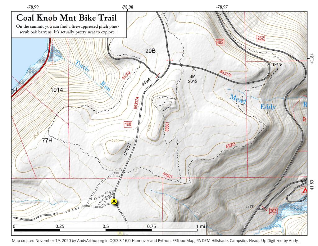
Coal Knob Mnt Bike Trails
Download a High Resolution JPEG Image of the Coal Knob Mnt Bike Trails or an Adobe Acrobat Printable PDF of the Coal Knob Mnt Bike Trails.
About Map: Coal Knob Mnt Bike Trails ....
The Coal Knob Bicycle Trail to the summit is neat as it contains pitch pine, scrub oak and mountain laurel although it's been fire supressed in recent years.

Bookmark my free Interactive GPS Map for your phone:
https://andyarthur.org/ny
... shows your location as a blue dot in relationship to campsites, trails, state land. This online map requires cell service, won't work in remote country, so also bring a paper map.
Free Download of New & Historical USGS 1:24k Topograpic Maps
Interactive maps with backcountry and roadside camping: New York, Pennsylvania, West Virginia & Vermont. List of NYS DEC Lean-Tos and Firetowers.
Google Spreadsheet with Roadside, Primitive and Pay Campsites
More about Jakes Rocks...
Scenic views of Jackson Bay (Allegheny Reservoir) and the Kinzua Dam are offered via hardened walking paths and from vehicles at vista points located on the exit road. Other facilities include: vault restrooms, picnic tables, grills and informational signing.
http://www.fs.usda.gov/recarea/allegheny/recreation/hunting/recarea/?recid=6092&actid=54
Download the PDF Map Pack with All Maps from Jakes Rocks.


