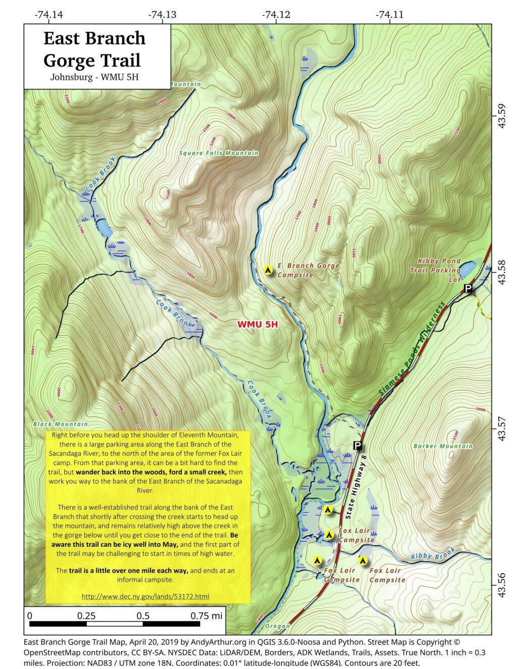
East Branch Gorge Trail
Download a High Resolution JPEG Image of the East Branch Gorge Trail or an Adobe Acrobat Printable PDF of the East Branch Gorge Trail.


Bookmark my free Interactive GPS Map for your phone:
https://andyarthur.org/ny
... shows your location as a blue dot in relationship to campsites, trails, state land. This online map requires cell service, won't work in remote country, so also bring a paper map.
Free Download of New & Historical USGS 1:24k Topograpic Maps
Interactive maps with backcountry and roadside camping: New York, Pennsylvania, West Virginia & Vermont. List of NYS DEC Lean-Tos and Firetowers.
Google Spreadsheet with Roadside, Primitive and Pay Campsites
More about East Branch Sacandaga River...
Stretching between Wevertown and Wells along NY 8, the East Branch of Sacandaga River offers a picturesque route hosting roadside campsites and trailheads to secluded spots. While proximity to a well-maintained state highway makes these campsites accessible during shoulder seasons and winter (with snow shovel), traffic noise can be a drawback. The river features noteworthy sites like Griffin Falls, Cod Pond, the captivating Stewart Creek, the ruins of Fox Lair Camp, the East Branch Trail leading to East Branch Falls, and scenic Eleventh Mountain. This scenic drive intertwines nature and exploration, inviting travelers to discover hidden gems along the East Branch of Sacandaga River.
Download the PDF Map Pack with All Maps from East Branch Sacandaga River.


