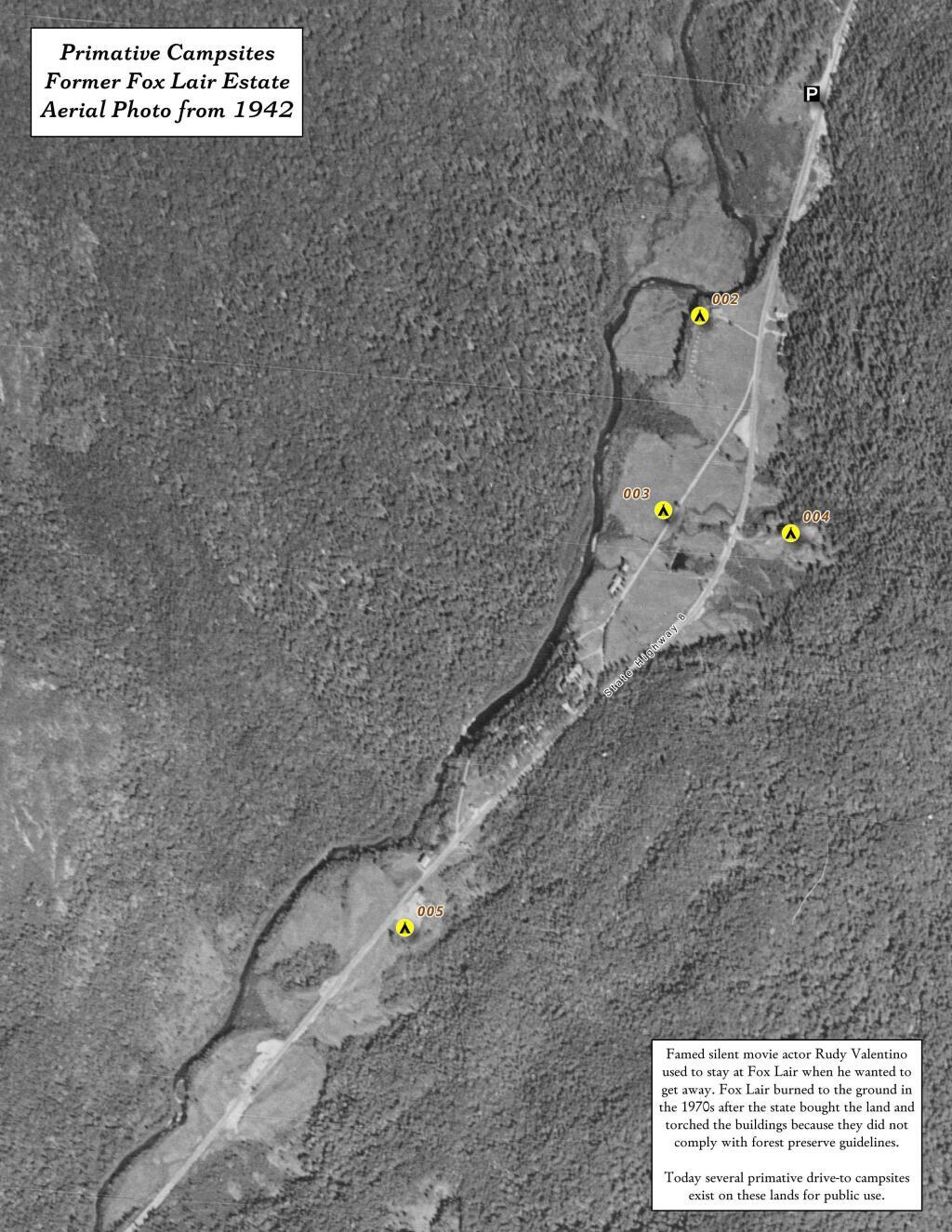
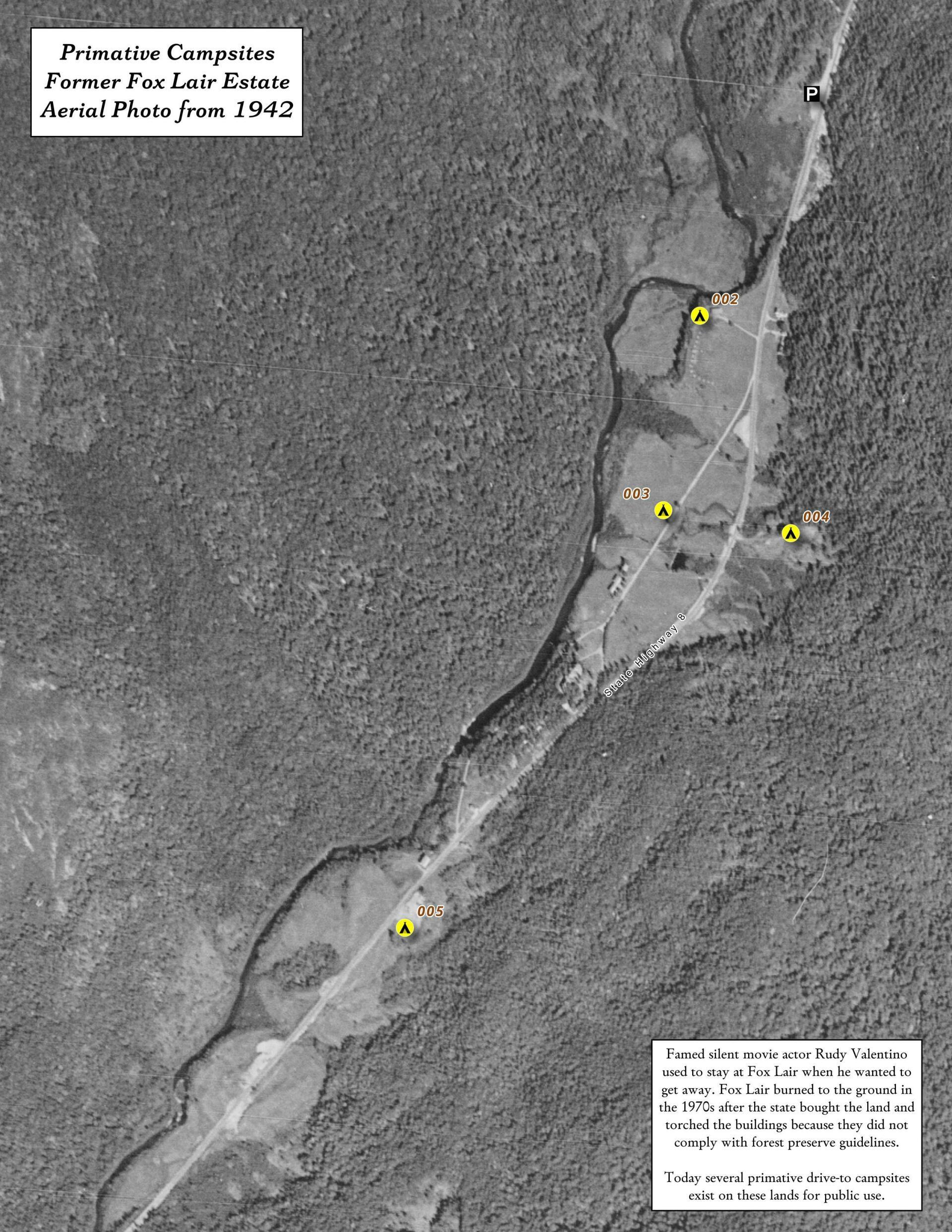
Fox Lair Campsites On Former Fox Lair Estate – Overlaid On Aerial Photo From 1942 🗺️
Download a High Resolution JPEG Image of the Fox Lair Campsites On Former Fox Lair Estate - Overlaid On Aerial Photo From 1942 or an Adobe Acrobat Printable PDF of the Thematic Fox Lair Campsites On Former Fox Lair Estate - Overlaid On Aerial Photo From 1942.
About Fox Lair Campsites On Former Fox Lair Estate - Overlaid On Aerial Photo From 1942 ....
I was curious about how the contemporary campsites at Fox Lair line up with the historic site so I did a quick overlay of the site with the DEC's campsite data.

More about East Branch Sacandaga River...
Stretching between Wevertown and Wells along NY 8, the East Branch of Sacandaga River offers a picturesque route hosting roadside campsites and trailheads to secluded spots. While proximity to a well-maintained state highway makes these campsites accessible during shoulder seasons and winter (with snow shovel), traffic noise can be a drawback. The river features noteworthy sites like Griffin Falls, Cod Pond, the captivating Stewart Creek, the ruins of Fox Lair Camp, the East Branch Trail leading to East Branch Falls, and scenic Eleventh Mountain. This scenic drive intertwines nature and exploration, inviting travelers to discover hidden gems along the East Branch of Sacandaga River.
Download the PDF Map Pack with All Maps from East Branch Sacandaga River.


