Mallet Pond State Forest
Download a High Resolution JPEG Image of the Mallet Pond State Forest or an Adobe Acrobat Printable PDF of the Mallet Pond State Forest.


Bookmark my free Interactive GPS Map for your phone:
https://andyarthur.org/ny
... shows your location as a blue dot in relationship to campsites, trails, state land. This online map requires cell service, won't work in remote country, so also bring a paper map.
Free Download of New & Historical USGS 1:24k Topograpic Maps
Interactive maps with backcountry and roadside camping: New York, Pennsylvania, West Virginia & Vermont. List of NYS DEC Lean-Tos and Firetowers.
Google Spreadsheet with Roadside, Primitive and Pay Campsites
More about Mallet Pond State Forest...
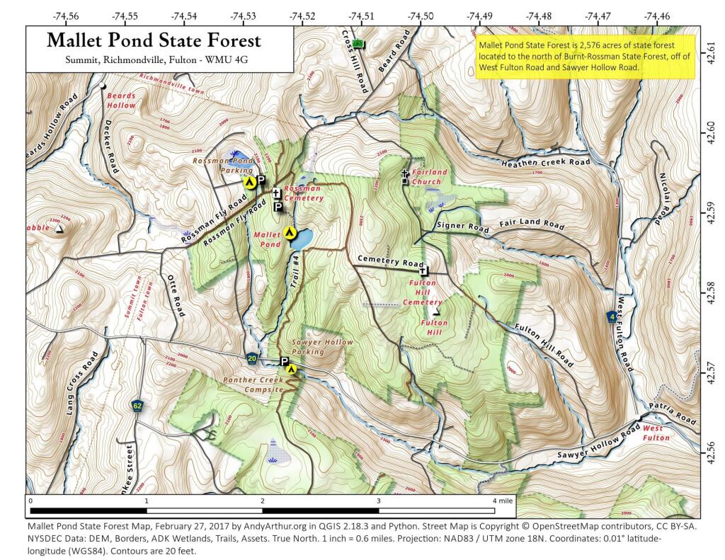
Mallet Pond State Forest is 2,567 acres of state land north of Burnt Rossman State Forest, outside of Fultonham. There are several informal campsites along the lakes that are popular during the summer months. Mallet Pond is most commonly fished for its trout. Special regulations apply. Some decent sized trout have been taken from this small pond. The pond is stocked annually with approximately 250 brown trout and 250 rainbow trout from 8-10" in length. Parking area at gated road off Rosseman Fly Road. Roughly a 0.3 mile walk from parking area to pond.
http://www.dec.ny.gov/outdoor/84886.html


