Hydrofracked Natural Gas Well, versus Empire Plaza
I knew some of the well pads were pretty big, but I was curious how they compared to the Empire State Plaza in size.
I knew some of the well pads were pretty big, but I was curious how they compared to the Empire State Plaza in size.

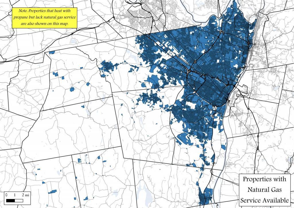
I thought it would be interesting to see how far out gas service goes across Albany County. It turns out that most urban and suburban properties in the county are serviced by gas lines.

This map shows 100 natural gas power plants -- co-gen and mid-market plants across New York State. The aerial photographs are from 2016-2020 an are fully-zoomable to 21 scale resolution.
Data Source: Energy Information Agency. https://www.eia.gov/maps/layer_info-m.php

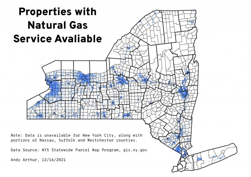
Especially in urban areas, natural gas remains the choice fuel for heating for new buildings, although that may be changing with climate concerns over the next few years.
Note: Data is unavailable for New York City, along with portions of Nassau, Suffolk and Westchester counties.
Data Source: NYS Statewide Parcel Map Program, gis.ny.gov