Piseco-Powley Road 📍

The 17-mile Piseco-Powley Road is a remote dirt route cutting through the Adirondack’s Ferris Lake Wild Forest. It features 22 primitive roadside campsites, including four spots at Powley Place where the road crosses the West Branch of the East Canada Creek.

Download the PDF Map Pack
🗺️ Maps 🖼️ Photos 📽️ Videos

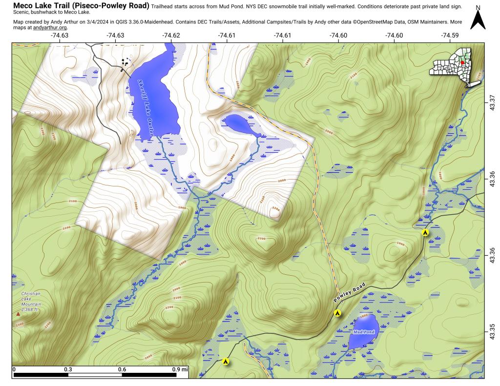
Meco Lake Trail (Piseco-Powley Road)

The Meco Lake Snowmobile Trail can be found near Mud Lake on Piseco-Powley Road. It is walkable in the summer months, and is easy to follow the 1.4 miles to the end of state land, however a somewhat harder to follow trail continues beyond that with views of Meco Lake about a 1/2 mile further. The private land is not posted, however there is a sign requesting you remain on the trail.

Meco Lake Trail (Piseco-Powley Road)

Map: Severence Hill Trail

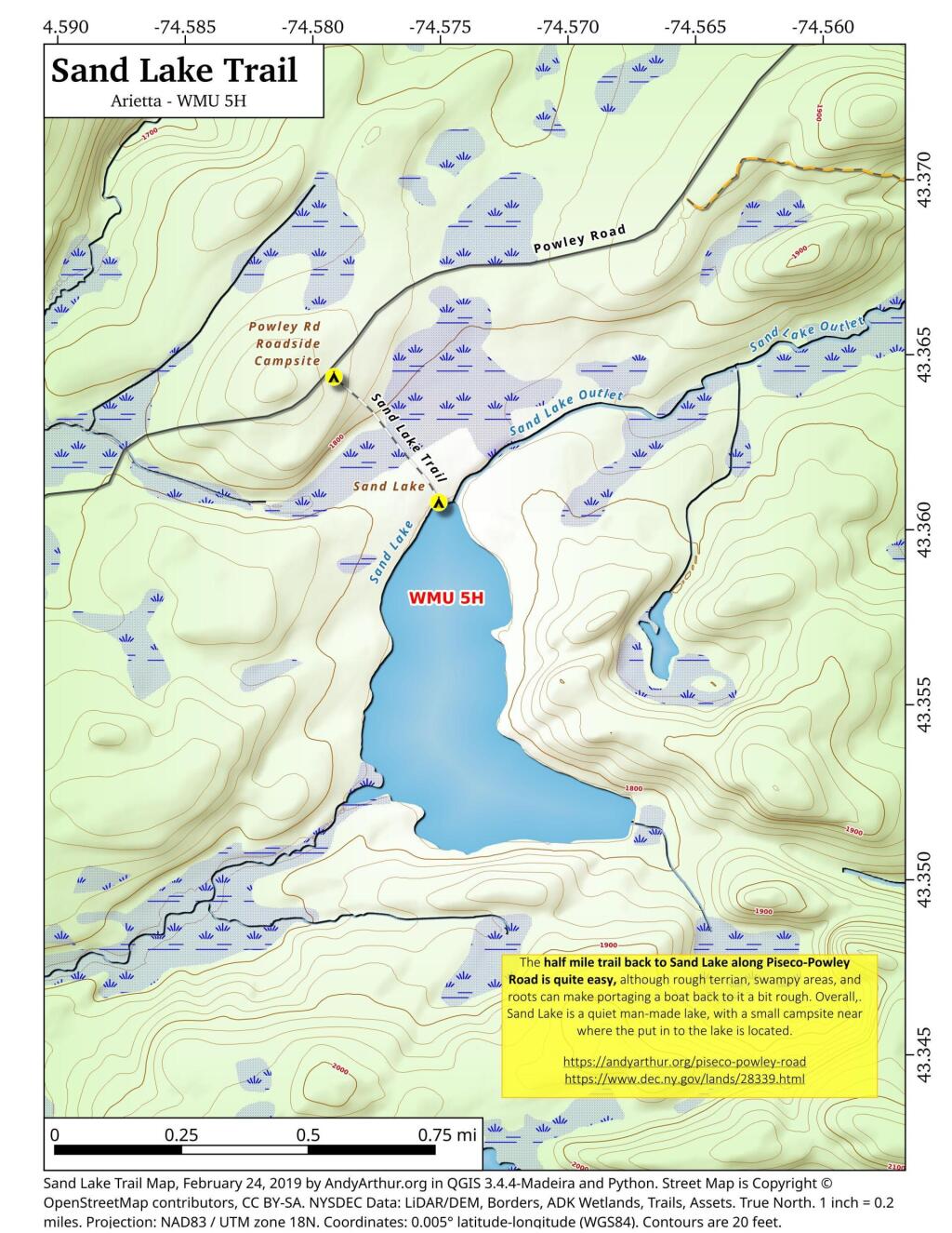
Sand Lake Trail

The Sand Lake Trail is about a half mile long but can be a somewhat difficult portage at the end due to the swampy, narrow trail. But it's a nice little wilderness lake, with a campsite, not too remote off of Piseco-Powley Road. There also is a designated roadside campsite at the trailhead.

 Sand Lake Trail

Map: Severence Hill Trail

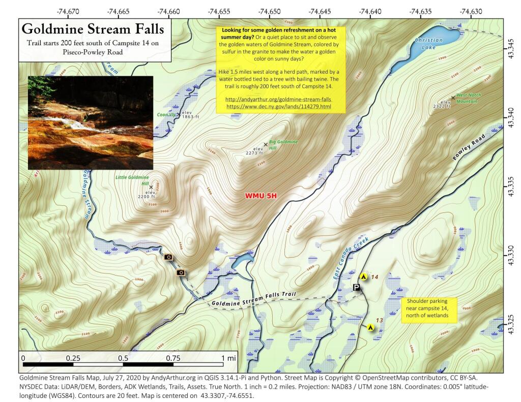
Goldmine Stream Falls

43.33072545558804,-74.6550531605912
Looking for some golden refreshment on a hot summer day? Or a quiet place to sit and observe the golden waters of Goldmine Stream, colored by sulfur in the granite to make the water a golden color on sunny days?

Hike 1.5 miles west along a herd path, marked by a water bottled tied to a tree with bailing twine. The trail is roughly 200 feet south of Campsite 14.

http://andyarthur.org/goldmine-stream-falls

https://www.dec.ny.gov/lands/114279.html

Goldmine Stream Falls

Map: Severence Hill Trail