Piseco-Powley Road 📍

The 17-mile Piseco-Powley Road is a remote dirt route cutting through the Adirondack’s Ferris Lake Wild Forest. It features 22 primitive roadside campsites, including four spots at Powley Place where the road crosses the West Branch of the East Canada Creek.

Download the PDF Map Pack
🗺️ Maps 🖼️ Photos 📽️ Videos

Big Alderbed Lake Trail

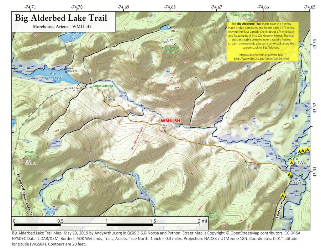
There is an old snowmobile trail/woods road by the Powley Place Bridge, that extends 2.5 miles west to Big Alderbed, that takes you to a wire crossing over the East Branch. The trail follows the East Branch for a short distance, then heads back into an interesting Old Growth Forest with a lot of big trails. To reach Big Alderbed -- which is largely drained wetland due to a failed dam -- you have to bushwhack along the stream to the mouth of the wetland.

 Big Alderbed Lake Trail

Terrain Map: Kingston and Catskill Mountains

Sand Lake

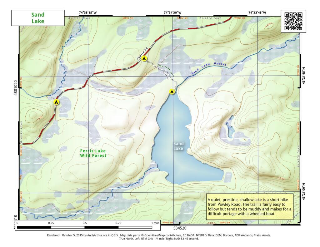
Sand Lake is a 1/3rd of a mile away from Piseco Powley Road. The trail is somewhat overgrown and marshy, so a paddle cart won't work for well for carrying a boat back here, but with another person you should be able to get back here.

 Sand Lake

Map: Chautauqua Lake Fish and Wildlife Mangement Areas
Thematic Map: Catskill Park Hillshade
SVGZ Graphic: NY Senate District 46 (Albany County)

Overview Map Piseco-Powley Road

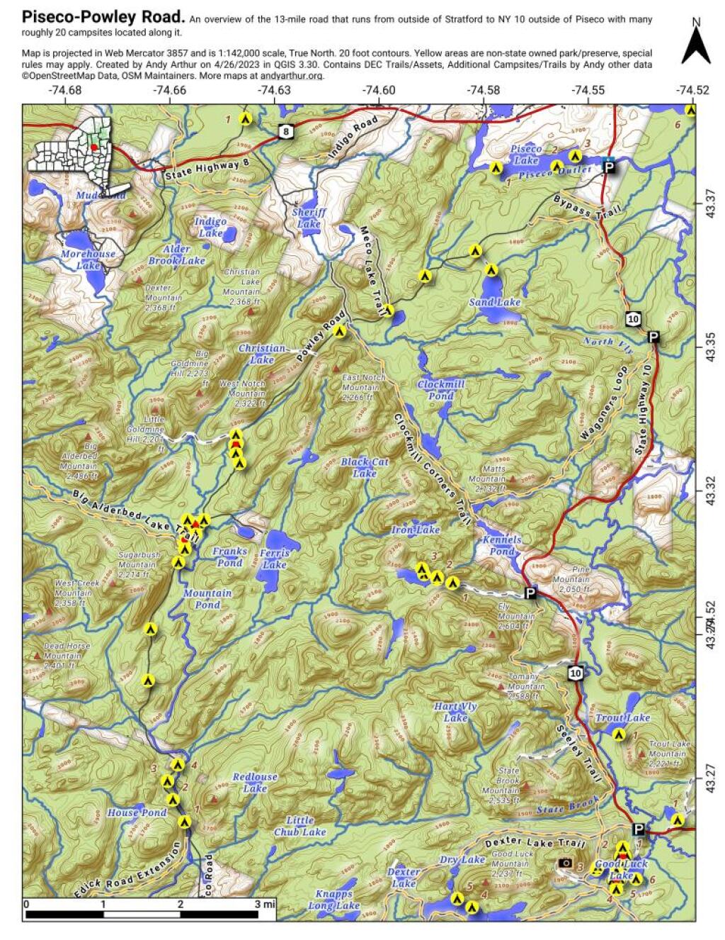
This Overview Map of Piseco-Powley Road shows the campsites along the road, along with major trails and destinations along the road.

Overview Map Piseco-Powley Road

Map: Severence Hill Trail