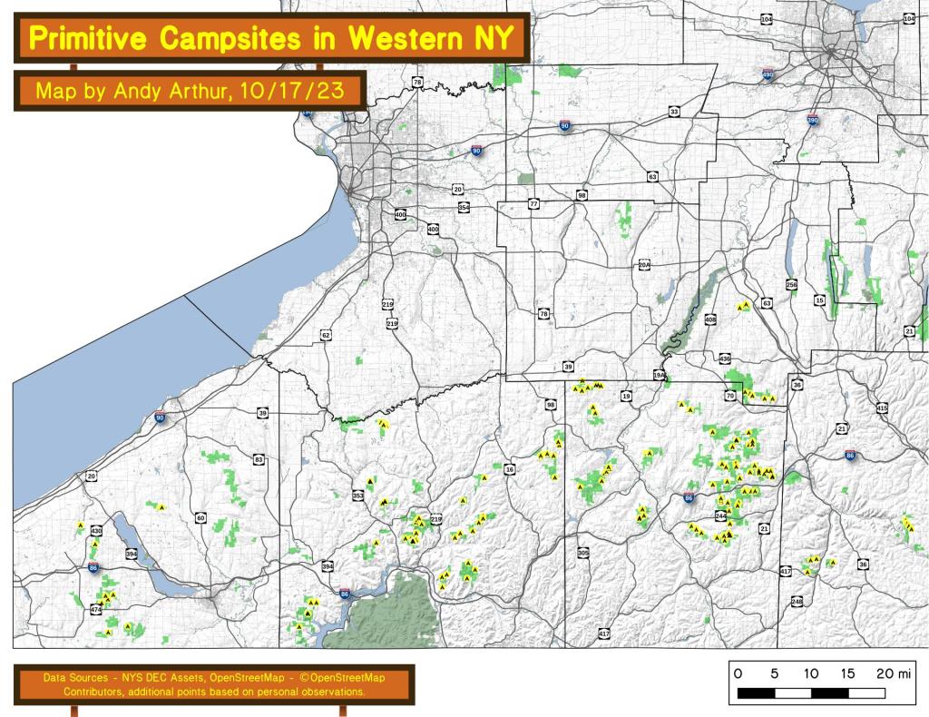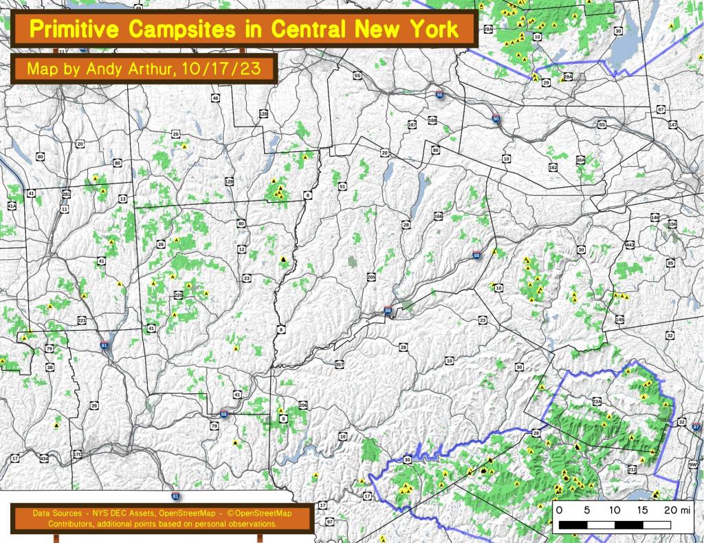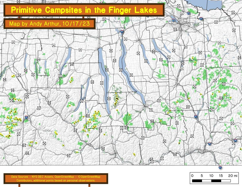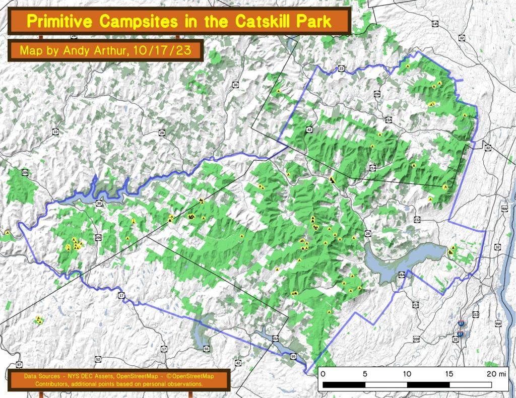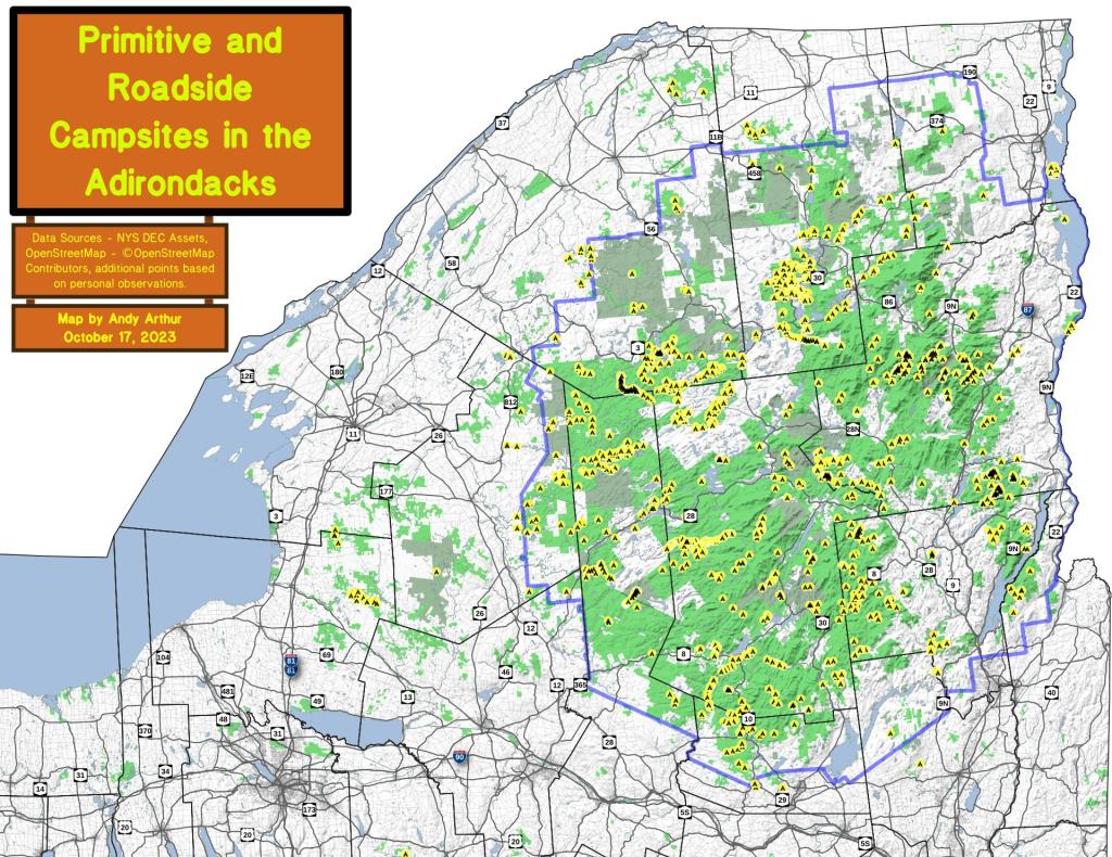
Free Primitive and Roadside Campsites in the Adirondacks, North Country, Tug Hill
An overview of free primitive and roadside campsites located throughout the Adirondacks, North Country and Tug Hill -- including Saint Lawrence County, Franklin County, Clinton County, Essex County, Hamilton County, Lewis County and Jefferson County. You can see more detailed locations by exploring this Interactive Google Map (KML) of the campsites across the state.