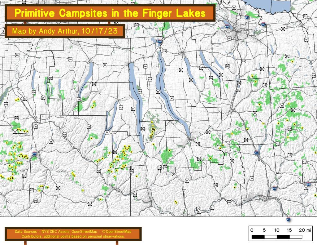
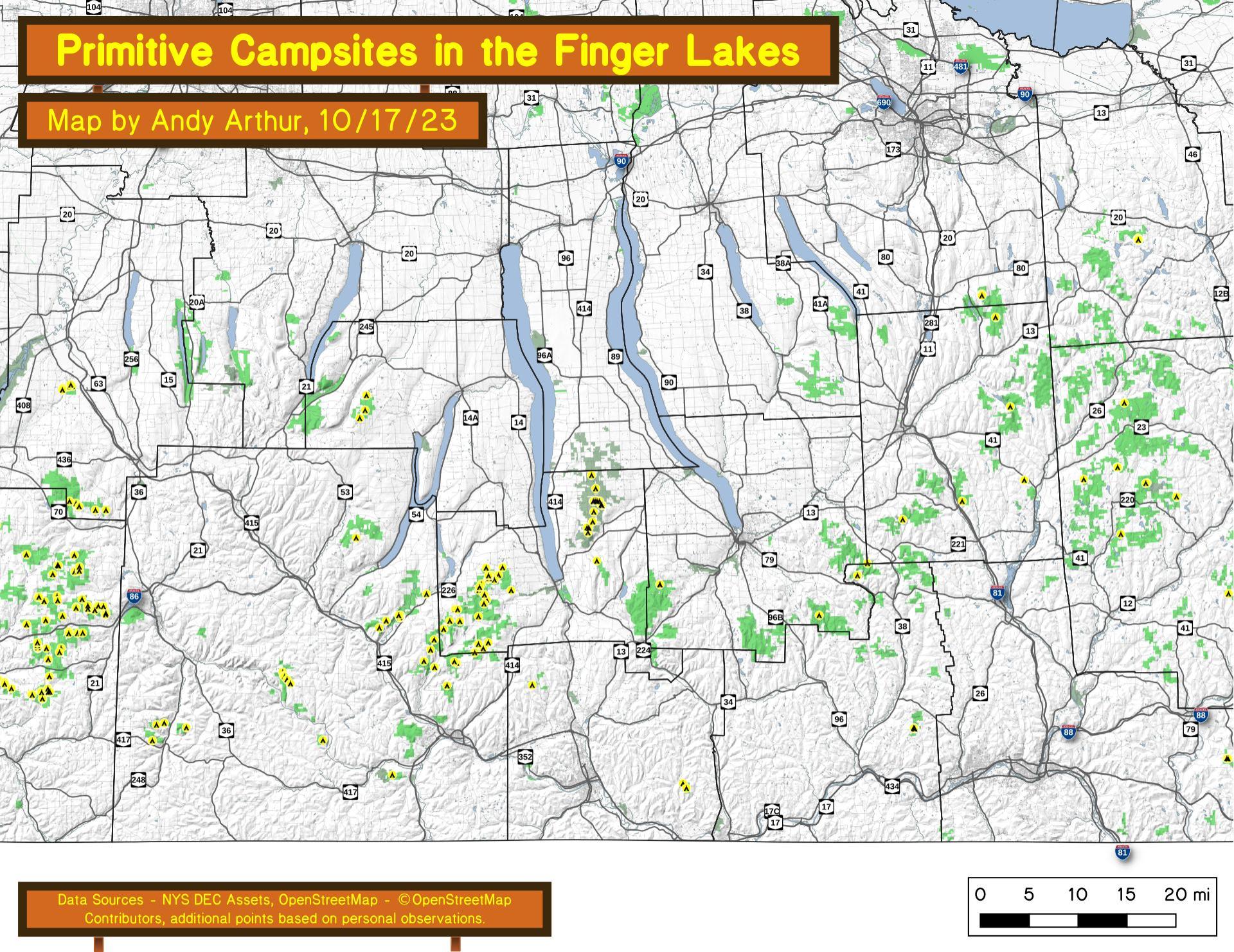
Free Primitive and Roadside Campsites in the Finger Lakes
Download a High Resolution JPEG Image of the Free Primitive and Roadside Campsites in the Finger Lakes or an Adobe Acrobat Printable PDF of the Free Primitive and Roadside Campsites in the Finger Lakes.
About Map: Free Primitive and Roadside Campsites in the Finger Lakes ....
An overview of free primitive and roadside campsites located throughout the Finger Lakes region of New York State including Chemung County, Tioga County, Tompkins County, Steuben County, and Schuyler County. Major areas include the Sugar Hill State Forest and Recreation Area and the Finger Lakes National Forest. You can see more detailed locations by exploring this Interactive Google Map (KML) of the campsites across the state.


Bookmark my free Interactive GPS Map for your phone:
https://andyarthur.org/ny
... shows your location as a blue dot in relationship to campsites, trails, state land. This online map requires cell service, won't work in remote country, so also bring a paper map.
Free Download of New & Historical USGS 1:24k Topograpic Maps
Interactive maps with backcountry and roadside camping: New York, Pennsylvania, West Virginia & Vermont. List of NYS DEC Lean-Tos and Firetowers.
Google Spreadsheet with Roadside, Primitive and Pay Campsites
More about NY State Camping Maps...
Maps of primitive or backcountry campsites and lean-tos in New York State.
Download the PDF Map Pack with All Maps from NY State Camping Maps.


")