Black River Wild Forest 📍

🗺️ Maps

Black River Valley

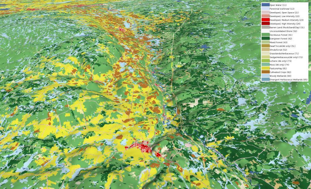
Looking at this 3D rendering of the Black River Valley, I never realized how nearly all the agriculture is on the west side of valley, climbing up into the Tug Hill Plateau. I am most of that has to do with the soils -- the east side is very sandy and infertile with a lot of timber stands. This picture starts around Boonville and heads north of Lowville, the town that rhythms with cow-ville for good reason.

Black River Valley

Map: Green Mountain National Forest North
Map: Lester Flow

Reeds Pond

Located at the intersection of Farr Road and North Lake Road, this lake is near the Black River, about 10 miles south of South Lake.

Map: Severence Hill Trail

Woodhull Lake

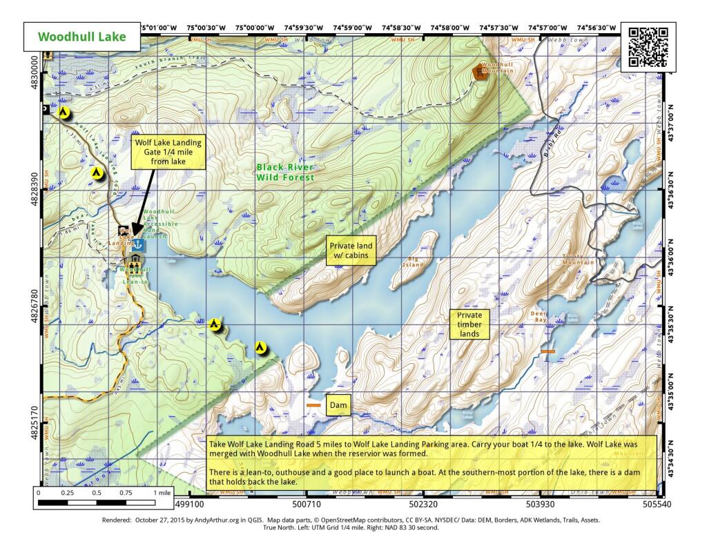
Take Wolf Lake Landing Road to the Wolf Lake Landing Parking area. Carry your boatd 1/4 mile to the lake. Wolf Lake was merged with Woodhull Lake when the reservior was formed. There is a lean-to, outhouse, and a good place to launch a hand-carried boat. AT the southern-most portion of the lake there is a a dam that holds back the lake. Part of the lake is lightly developed with cabins along the shoreline.

 Woodhull Lake

Map: Hoel Pond
Thematic Map: Percentage of Green Cars