
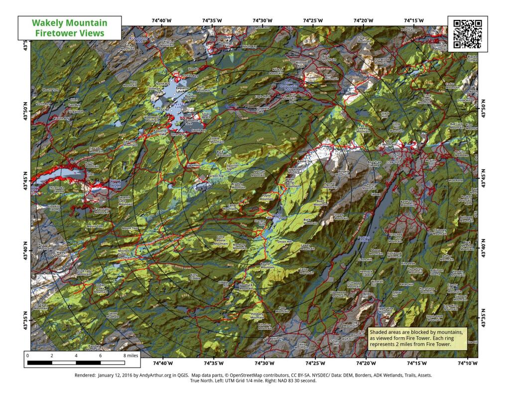
Wakely Mountain Firetower Views
This map gives an overview of mountains and lakes that are visible (and not visible) from Wakely Mountain Firetower. I'm new at doing visibility analysis so it's possible that I don't have the visibility completely correct, but it's an interesting experiment.
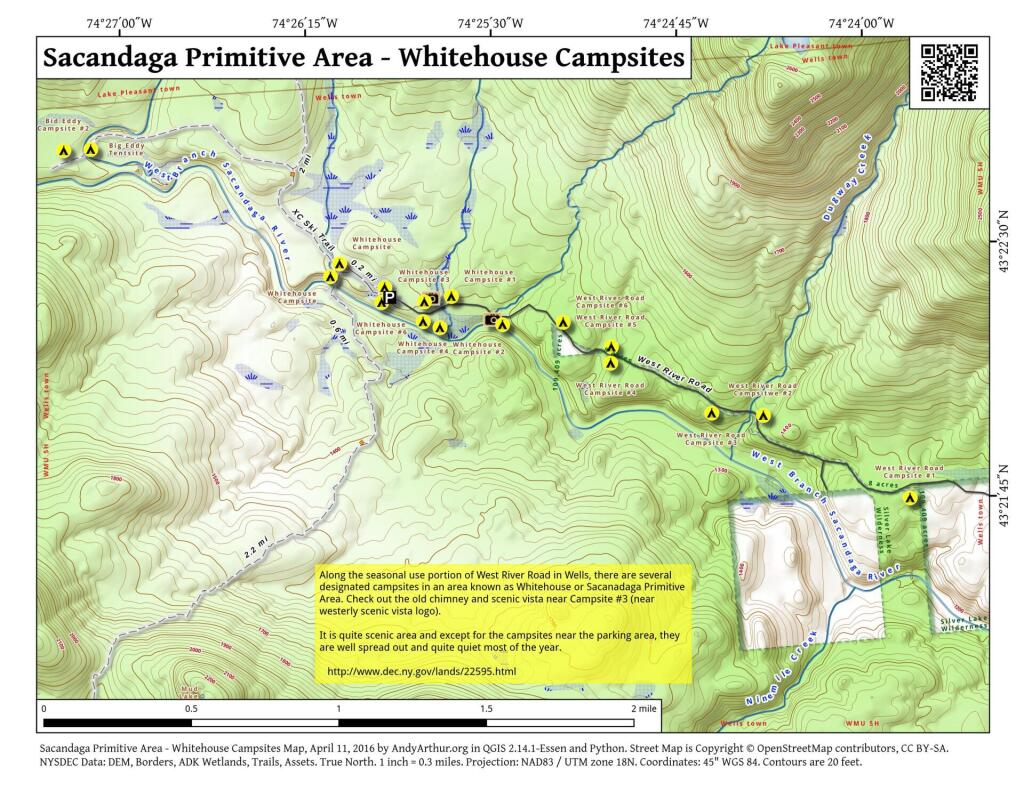
Sacandaga Primitive Area – Whitehouse Campsites
The DEC recently GPS'd the various designated campsites at Whitehouse area of the Sacanadaga Primitive Area along West River Road in Wells. This provides a pretty accurate map of the various campsite locations. West River Road isn't open to motor vehicles yet, but will open later in May once the frost is out of the ground and the dirt road isn't too soft.

Sprague Pond
Located a quarter mile north of Cedar River Road, about half way to Cedar River Flow at Moose River Plains, is the trail head for Sprague Pond. It's a short hike a quarter mile north of the road, along it's outlet creek to a modestly sized, swampy pond. Campsites along the pond are very informal, and lightly used.