Wakely Pond
Download a High Resolution JPEG Image of the Wakely Pond or an Adobe Acrobat Printable PDF of the Wakely Pond.

Bookmark my free Interactive GPS Map for your phone:
https://andyarthur.org/ny
... shows your location as a blue dot in relationship to campsites, trails, state land. This online map requires cell service, won't work in remote country, so also bring a paper map.
Free Download of New & Historical USGS 1:24k Topograpic Maps
Interactive maps with backcountry and roadside camping: New York, Pennsylvania, West Virginia & Vermont. List of NYS DEC Lean-Tos and Firetowers.
Google Spreadsheet with Roadside, Primitive and Pay Campsites
More about Wakely Pond...
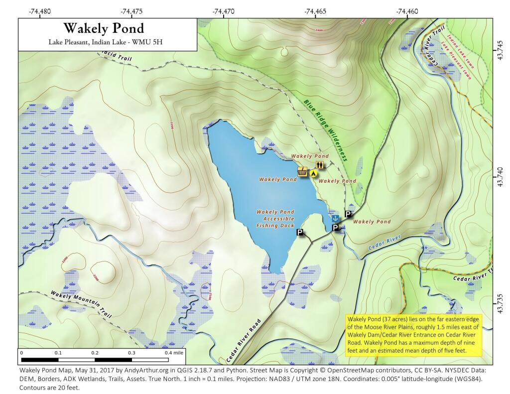
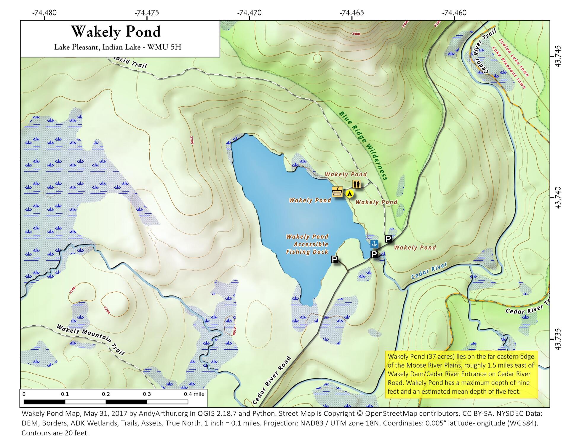
Wakely Pond (37 acres) lies on the far eastern edge of the Moose River Plains, roughly 1.5 miles east of Wakely Dam/Cedar River Entrance on Cedar River Road.
Wakely Pond has a maximum depth
of nine feet and an estimated mean depth of five feet. Much of the pond bottom is muck with some sand and limited areas of bedrock.


