Essex County πŸ“

Essex County is a county located in the U.S. state of New York. As of the 2010 census, the population was 39,370. Its county seat is Elizabethtown. Along with Hamilton County, Essex is entirely within the Adirondack Park.

Essex County is in the northeastern part of New York State, just west of Vermont along the eastern boundary of the State. The eastern boundary of Essex County is Lake Champlain, which serves as the New York – Vermont border at an elevation of just under 100 feet (30.5 m). The highest natural point in New York, Mount Marcy at 5,344 feet (1,629 m), is in the Town of Keene. The Ausable River forms a partial northern boundary for the county.

http://en.wikipedia.org/wiki/Essex_County,_NY

Download the PDF Map Pack
πŸ—ΊοΈ Maps πŸ–ΌοΈ Photos πŸ“½οΈ Videos

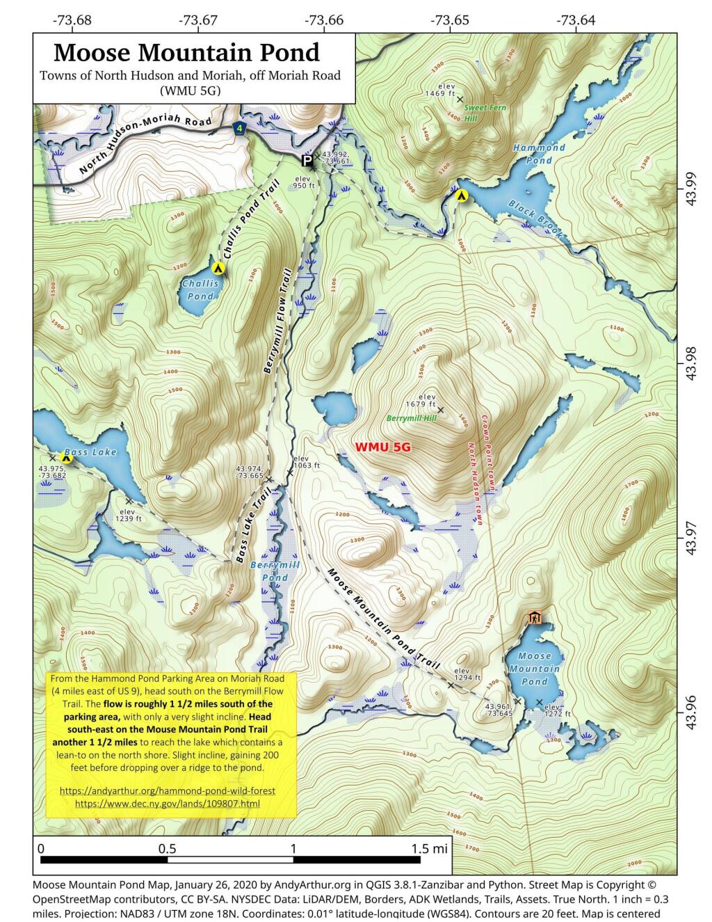
Moose Mountain Pond

From the Hammond Pond Parking Area on Moriah Road (4 miles east of US 9), head south on the Berrymill Flow Trail. The flow is roughly 1 1/2 miles south of the parking area, with only a very slight incline. Head south-east on the Mouse Mountain Pond Trail another 1 1/2 miles to reach the lake which contains a lean-to on the north shore. Slight incline, gaining 200 feet before dropping over a ridge to the pond.

https://andyarthur.org/hammond-pond
https://www.dec.ny.gov/lands/109807.html

 Moose Mountain Pond

SVGZ Graphic: Distance to a Dollar Store
Terrain Map: White Pines Along the Kiakout Are More then 100 Foot
Thematic Map: Most Common Heating Fuel in New York State
Thematic Map: Salmon River Reservior Campsites

Crane Pond

This updated map of Crane Pond in the Pharoah Lake Wilderness shows the location of the campsites along the lake.

 Crane Pond

Thematic Map: Most Popular Automobile Make