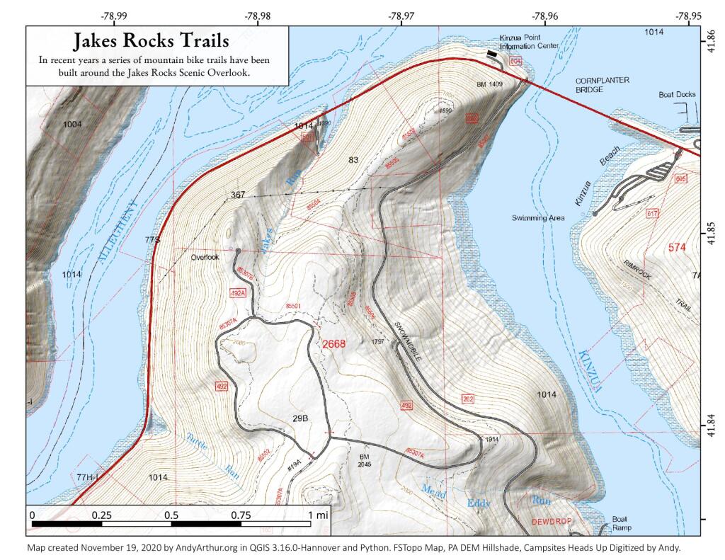
Jakes Rocks Trails
Download a High Resolution JPEG Image of the Jakes Rocks Trails or an Adobe Acrobat Printable PDF of the Jakes Rocks Trails.
About Map: Jakes Rocks Trails ....
In recent years several mountain bike trails have been built around the Jakes Rocks area. While you have to watch for bikers, especially on weekends, they are good heavy duty trails even during wet weather.


Bookmark my free Interactive GPS Map for your phone:
https://andyarthur.org/ny
... shows your location as a blue dot in relationship to campsites, trails, state land. This online map requires cell service, won't work in remote country, so also bring a paper map.
Free Download of New & Historical USGS 1:24k Topograpic Maps
Interactive maps with backcountry and roadside camping: New York, Pennsylvania, West Virginia & Vermont. List of NYS DEC Lean-Tos and Firetowers.
Google Spreadsheet with Roadside, Primitive and Pay Campsites
More about Jakes Rocks...
Scenic views of Jackson Bay (Allegheny Reservoir) and the Kinzua Dam are offered via hardened walking paths and from vehicles at vista points located on the exit road. Other facilities include: vault restrooms, picnic tables, grills and informational signing.
http://www.fs.usda.gov/recarea/allegheny/recreation/hunting/recarea/?recid=6092&actid=54
Download the PDF Map Pack with All Maps from Jakes Rocks.


