Adirondack Park Blowdown – November 1950
Day 3 - Polygons, #30DayMapChallenge, a look at the 1950 Adirondack Park Blowdown based on data from the Adirondack Park Agency. https://github.com/AndyArthur/30daymapchallenge/blob/main/day3polygon.R

Day 3 - Polygons, #30DayMapChallenge, a look at the 1950 Adirondack Park Blowdown based on data from the Adirondack Park Agency. https://github.com/AndyArthur/30daymapchallenge/blob/main/day3polygon.R


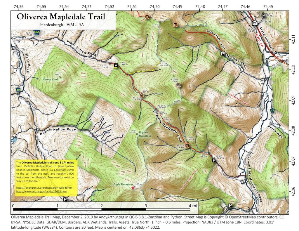
The Oliverea-Mapledale trail runs 3 1/4 miles from McKinley Hollow Road to Rider Hollow Road in Mapledale. There is a 1,400 foot climb to the col from the east, and roughly 1,000 feet down the otherside. Two lean-tos exist on way up to the col.
https://andyarthur.org/shandaken-wild-forest
http://www.dec.ny.gov/lands/22615.html